
LAST MONTH
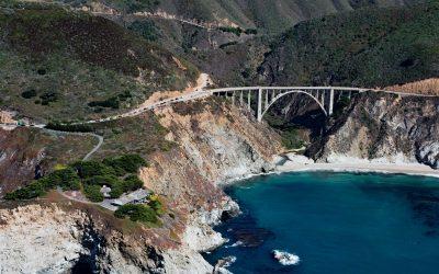
Bixby Creek, Big Sur
Bixby Creek starts at the confluence of Mill Creek and Turner Creek that flow from an elevation of 2,500 feet (762 m) on the west flank of Skinner Ridge for a total run of about 7 miles (11 km) through the Santa Lucia Mountains to the Big Sur coast, between Hurricane Point to the south and Division Knoll to the north, about 16 miles (26 km) south of Monterey and 9 miles (15 km) northwest of the community of Big Sur, California.

Main Bay, Prince William Sound
Main Bay is an estuary on the Kenai Peninsula fed by a watershed of 3,795 acres (1,536 ha) mostly draining from an unnamed lake at an elevation of 205 feet (62 m) on the northern flank of Eshamy Peak in Prince William Sound, between Port Nellie Juan to the west and Knight Island Passage to the east, about 81 miles (131 km) west of Cordova and 28 miles (45 km) southeast of Whittier, Alaska.
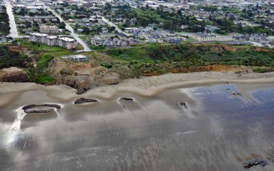
Nye Beach, Newport
Nye Beach is situated in Newport between Agate Beach to the north and Yaquina Beach to the south, and historically was demarcated at the north end by a rocky point with a sea stack known as Jump-Off Joe, about 22 miles (35 km) south of Lincoln City and 1.9 miles (3 km) north of Yaquina Bay, Oregon
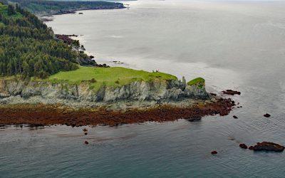
Point Pogibshi, Kachemak Bay
Point Pogibshi is a prominent flat-topped grassy headland with rocky sides about 50 feet (15 m) high on the southern shore of Kachemak Bay, about 20 miles (23 km) southwest of Homer, and 5 miles (8 km) north-northeast of Nanwalek, Alaska.
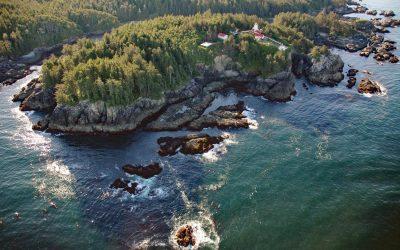
Cape Beale, Barkley Sound
Cape Beale is the site of a historic lighthouse marking the southern entrance to Barkley Sound on the west coast of Vancouver Island in Pacific Rim National Park Reserve, about 89 miles (143 km) west-northwest of Victoria and 4.7 miles (7.6 km) southwest of Bamfield, British Columbia.
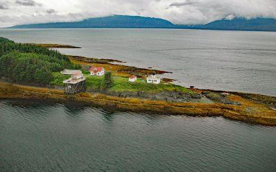
Point Retreat, Admiralty Island
Point Retreat is a headland with a historic lighthouse on the Mansfield Peninsula at the northern tip of Admiralty Island, between Lynn Canal to the west and Saginaw Channel of Stephens Passage to the east, about 60 miles (97 km) south-southeast of Haines and 20 miles (32 km) northwest of Juneau, Alaska.
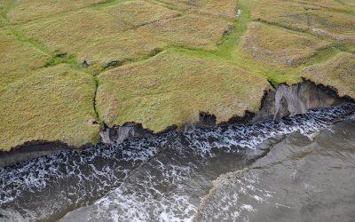
Drew Point, Smith Bay
Drew Point is located at the eastern entrance to Smith Bay on the Beaufort Sea and is formed by rapidly eroding permafrost and ice wedges at the edge of the Arctic Coastal Plain, about 81 miles (131 km) northwest of Nuiqsut and 70 miles (113 km) southeast of Utqiaġvik, Alaska.
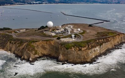
Pillar Point, Half Moon Bay
Pillar Point is a prominent headland forming the northwestern shore of Half Moon Bay and providing partial protection for Pillar Point Harbor, and the site of Pillar Point Air Force Station and a famous surf location called Mavericks, about 20 miles (32 km) south-southwest of San Francisco and 4 miles (6.5 km) northwest of the community of Half Moon Bay, California.

Hubbard Glacier, Disenchantment Bay
Hubbard Glacier originates from icefields at an elevation of around 11,000 feet (3,400 m) in the Centennial Range of the Saint Elias Mountains in Kluane National Park and Reserve and flows about 48 miles (77 km) to the Alaska border and then continues for another 28 miles (45 km) through Wrangell-Saint Elias National Park to its terminus in Disenchantment Bay, about 220 miles (355 km) east-southeast of Cordova and 32 miles (52 km) north-northeast of Yakutat, Alaska.
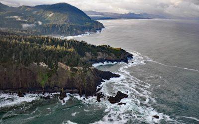
Cape Falcon, Oswald West State Park
Cape Falcon is a headland situated between Short Sand Beach in Smugglers Cove to the south and Cove Beach to the north, and is part of Oswald West State Park and adjacent to Cape Falcon Marine Reserve, about 23 miles (37 km) north-northwest of Tillamook and 9 miles (14.5 km) south of Cannon Beach, Oregon.
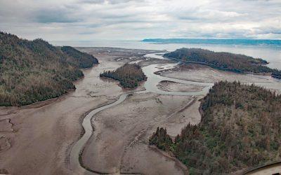
China Poot Creek, Kachemak Bay
China Poot Creek starts at an elevation of about 3,500 feet (1,067 m) on the western flank of the Kenai Mountains and flows for 5.6 miles (9 km) to China Poot Lake, also called Leisure Lake, at an elevation of 168 feet (51 m), and then for another 0.9 miles (1.5 km) to China Poot Bay on the southeastern shore of Kachemak Bay, about 19 miles (31 km) northeast of Seldovia and 13 miles (21 km) southeast of Homer, Alaska.
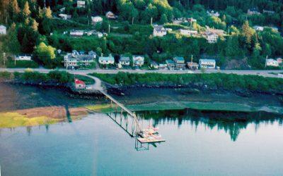
Daajing Giids, Graham Island
Daajing Giids was historically known as the village of Queen Charlotte and is situated on the northern shore of Skidegate Inlet on Graham Island in the Haida Gwaii archipelago, about 104 miles (167 km) southwest of Prince Rupert and 52 miles (84 km) south of Masset, British Columbia.