Lighthouses
Recent Articles
More Articles
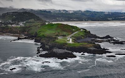
Yaquina Head, Agate Beach
Yaquina Head is a prominent basalt headland, adjacent to the community of Agate Beach, rising over 100 feet (30 m) in elevation and extending 0.75 miles (1.2 km) into the Pacific Ocean, about 9 miles (15 km) south of Depoe Bay and 3 miles (5 km) north-northwest of Newport, Oregon.
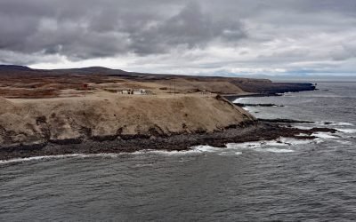
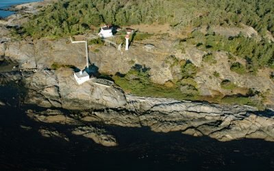
East Point, Saturna Island
East Point is the end of a long peninsula at the easternmost tip of Saturna Island in the Gulf Islands National Park Reserve, about 35 miles (56 km) south of Vancouver and 18 miles (29 km) northeast of Sidney, British Columbia.
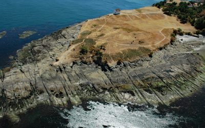
Point Conception, Gaviota Coast
Point Conception is located on the Gaviota Coast, at the western end of the Santa Barbara Channel, about 45 miles (72 km) west of Santa Barbara and 13 miles (21 km) south of Lompoc, California.
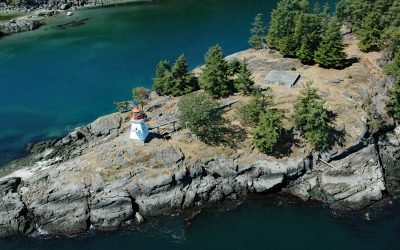
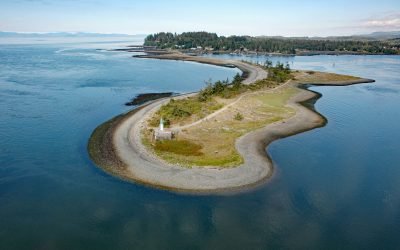
Portlock Point, Prevost Island
Portlock Point is part of a larger peninsula that forms the eastern extremity of Prevost Island and is part of the Gulf Islands National Park Reserve, about 33 miles (53 km) south-southwest of Vancouver and 13 miles (21 km) north-northeast of Sidney, British Columbia.
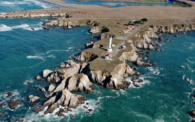
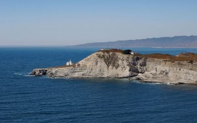
Point Arena, Mendocino Coast
Point Arena is a narrow headland about 0.5 miles (0.8 km) long with a historical lighthouse that marks a significant change in the orientation of the Mendocino Coast, about 34 miles (55 km) south of Fort Bragg and 4 miles (6.4 km) northwest of the community of Point Arena, California.
Cape Sarichef, Unimak Island
Cape Sarichef is at the southwestern end of Unimak Island, at the northwestern entrance to Unimak Pass on the Bering Sea coast, and on the northwest flank of Pogromni Volcano, about 80 miles (129 km) northeast of Dutch Harbor and 63 miles (101 km) west-southwest of False Pass, Alaska.
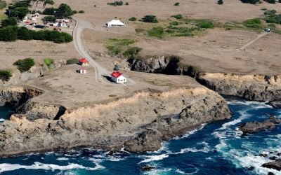
Point Cabrillo, Mendocino Coast
Point Cabrillo is a sandstone headland marked with a lighthouse on the Mendocino Coast between Point Arena and Cape Mendocino, about 6.7 miles (11 km) south of Fort Bragg and 1.3 miles (2 km) southwest of Caspar, California.
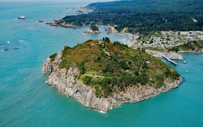
Trinidad Head, Trinidad Bay
Trinidad Head is a prominent headland joined to the mainland by a narrow isthmus adjacent to the town of Trinidad and protecting Trinidad Bay, about 48 miles (77 km) south of Crescent City and 18 miles (29 km) north of Eureka, California.
Discovery Island, Sea Bird Point
Discovery Island is part of a group of islands in Oak Bay off the southeastern tip of Vancouver Island at Sea Bird Point, about 17 miles (27 km) southeast of Sidney and 6.5 miles (10.5 km) east of downtown Victoria, British Columbia.
Whiffin Spit, Sooke Harbour
Whiffin Spit is a narrow sandspit that almost landlocks Sooke Harbour and Sooke Basin, about 17 miles (27 km) southwest of Victoria and 1.5 miles (2.4 km) southeast of Sooke, British Columbia.
About the background graphic
This ‘warming stripe’ graphic is a visual representation of the change in global temperature from 1850 (top) to 2019 (bottom). Each stripe represents the average global temperature for one year. The average temperature from 1971-2000 is set as the boundary between blue and red. The colour scale goes from -0.7°C to +0.7°C. The data are from the UK Met Office HadCRUT4.6 dataset.
Click here for more information about the #warmingstripes.