
Lighthouses
Recent Articles
More Articles
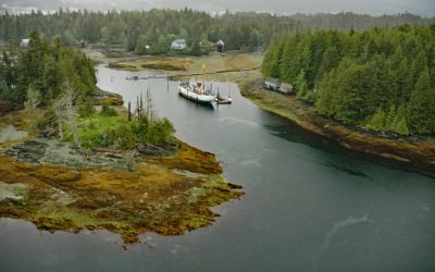
Umatilla Lightship, Pennock Island
WLV-196 Umatilla was the last lightship to mark Umatilla Reef off Washington state and in 2005 was moored on the north shore of Pennock Island in Southeast Alaska, about 2.75 miles (4.4 km) northwest of Saxman and 0.75 miles (1.2 km) southwest of Ketchikan, Alaska.
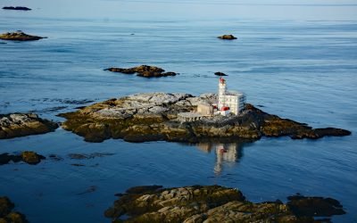
Triple Island, Brown Passage
Triple Island is the site of a large manned light station in Brown Passage, about 83 miles (134 km) south-southeast of Ketchikan and 22 miles (35 km) west-southwest of Prince Rupert, British Columbia.
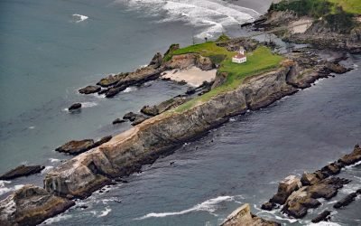
Chiefs Island, Cape Arago
Cape Arago Light is the third of a series of light towers built on Gregory Point and Chiefs Island just south of the entrance to Coos Bay, about 8 miles (13 km) west-southwest of Coos Bay and 3 miles (5 km) west of Charleston, Oregon.
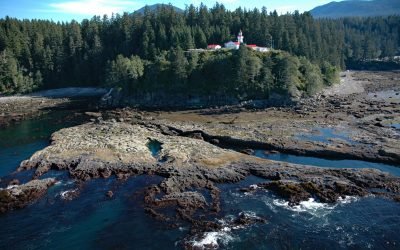
Carmanah Point, Pacific Rim National Park Reserve
Carmanah Point is the site of a historic light station in Pacific Rim National Park Reserve on the southwest coast of Vancouver Island that marks the entrance to the Strait of Juan de Fuca, about 65 miles (105 km) west-northwest of Victoria and 17 miles (27 km) northwest of Port Renfrew, British Columbia.
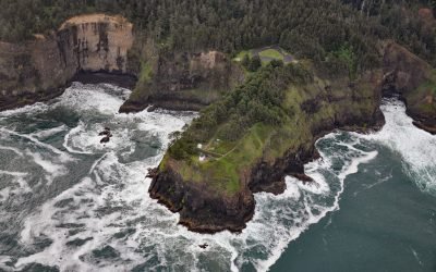
Cape Meares Lighthouse, Cape Meares
Cape Meares is the site of a historic lighthouse on a prominent headland that forms a high steep bluff on the south end of Tillamook Bay, about 48 miles (77 km) south of Astoria and 7 miles (11 km) west-northwest of Tillamook, Oregon.
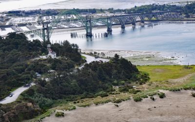
Yaquina Bay Light, Newport
Yaquina Bay Light is located on the north shore of the entrance to Yaquina Bay, about 40 miles (65 km) west of Corvallis and 1 mile (1.6 km) southwest of Newport, Oregon.

Mary Island, Revillagigedo Channel
Mary Island is the site of a historic lighthouse located between Felice Strait to the west and Revillagigedo Channel to the east, about 64 miles (103 km) north-northwest of Prince Rupert, British Columbia and 25 miles (40 km) southeast of Ketchikan, Alaska.

Friendly Cove, Nootka Island
Friendly Cove is an embayment on Nootka Island situated at the northern entrance to Nootka Sound, and is the site of a historic lighthouse and the Yuquot National Historic Site of Canada, about 72 miles (116 km) south-southeast of Port McNeill and 45 miles (72 km) northwest of Tofino, British Columbia.

Cape Spencer, Cross Sound
Cape Spencer is a prominent headland in Glacier Bay National Park and Preserve marking the northern entrance to Cross Sound adjacent to an area with numerous offshore islets, rocks, and islands, one of which, near the entrance to Dicks Arm, is the site of a historic lighthouse, about 45 miles (73 km) northwest of Hoonah and 37 miles (60 km) southwest of Gustavus, Alaska.

Cape Disappointment, Columbia River
Cape Disappointment is a prominent headland and navigational landmark with a historic lighthouse on the north side of the Columbia River, 12 miles (19 km) northwest of Astoria, and 2.2 miles (3.5 km) south of Ilwaco, Washington.
About the background graphic
This ‘warming stripe’ graphic is a visual representation of the change in global temperature from 1850 (top) to 2019 (bottom). Each stripe represents the average global temperature for one year. The average temperature from 1971-2000 is set as the boundary between blue and red. The colour scale goes from -0.7°C to +0.7°C. The data are from the UK Met Office HadCRUT4.6 dataset.
Click here for more information about the #warmingstripes.