
Parks
Recent Articles
More Articles

Beaver Point, Salt Spring Island
Beaver Point is a prominent headland in Ruckle Provincial Park on the southeastern shore of Salt Spring Island in the Southern Gulf Islands and at the northwestern end of Swanson Channel, about 8 miles (13 km) north-northeast of Sidney and 4 miles (6 km) east of Fulford Harbour, British Columbia.
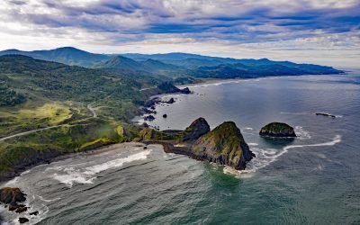
Sisters Rocks, Frankport
Sisters Rocks, historically known as Three Sisters Rocks, is a minor headland located between Mussel Creek to the north and Eucher Creek to the south, about 13 miles (21 km) north of Gold Beach and 11 miles (18 km) south-southeast of Port Orford, Oregon.
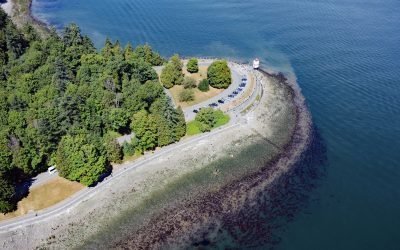
Brockton Point, Stanley Park
Brockton Point is a prominent peninsula in Stanley Park, located on the southern coast of Burrard Inlet, about 19 miles (30 km) north of Tsawwassen and 2.6 miles (4 km) southeast of West Vancouver, British Columbia.
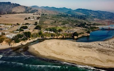
Ten Mile River, MacKerricher State Park
The Ten Mile River flows southwest for 7 miles (11 km) to the Pacific Ocean at the northern border of MacKerricher State Park, about 9 miles (15 km) north-northeast of the Noyo River at Fort Bragg and 5.7 miles (9.2 km) south of Westport, California.
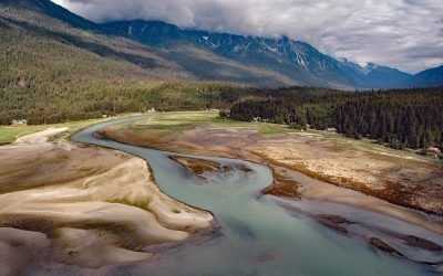
Chilkoot, Lutak Inlet
Chilkoot is a historical Tlingit village located on the Chilkoot River between Lutak Inlet to the south and Chilkoot Lake to the north, about 83 miles (134 km) north-northwest of Juneau and 12 miles (19 km) southwest of Skagway, Alaska.
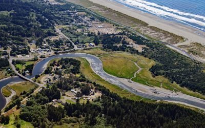
Copalis River, Copalis Beach
The Copalis River flows southwest for 22 miles (35 km) to the community of Copalis Beach, then another 2 miles (3.2 km) to the Pacific Ocean at Griffith-Priday State Park, about 21 miles (34 km) northwest of Hoquiam and 5 miles (8 km) south of Pacific Beach, Washington.
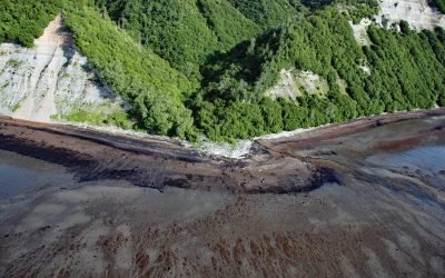
Cottonwood Creek, Kachemak Bay
Cottonwood Creek is a stream on the Kenai Peninsula in Kachemak Bay State Park that flows south for about 2 miles (3.2 km) to the northern shore of Kachemak Bay, about 13 miles (21 km) northeast of Homer and 6 miles (10 km) southwest of Voznesenka, Alaska.
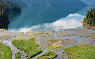
Foch Lagoon, Foch-Gilttoyees Provincial Park
Foch Lagoon is about 1 mile (1.6 km) wide and extends for 5 miles (8 km) northwest from the western shore of Douglas Channel in Foch-Gilttoyees Provincial Park and Protected Area, about 60 miles (97 km) southeast of Prince Rupert and 25 miles (40 km) southwest of Kitimat, British Columbia.
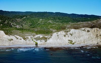
Alamere Falls, Point Reyes National Seashore
Alamere Falls is located in the Phillip Burton Wilderness of Point Reyes National Seashore, about 6 miles (10 km) south of Olema and 6.4 miles (10.3 km) northwest of Bolinas, California.
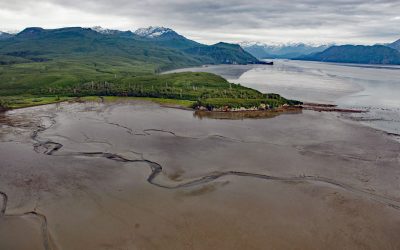
Fossil Point, Tuxedni Bay
Fossil Point is a prominent landmark in Lake Clark National Park and Preserve on the southern shore of Tuxedni Bay, at the north end of Tuxedni Channel and west of Chisik Island, about 56 miles (90 km) southwest of Kenai and 54 miles (87 km) northwest of Homer, Alaska.
About the background graphic
This ‘warming stripe’ graphic is a visual representation of the change in global temperature from 1850 (top) to 2019 (bottom). Each stripe represents the average global temperature for one year. The average temperature from 1971-2000 is set as the boundary between blue and red. The colour scale goes from -0.7°C to +0.7°C. The data are from the UK Met Office HadCRUT4.6 dataset.
Click here for more information about the #warmingstripes.