
Parks
Recent Articles
More Articles
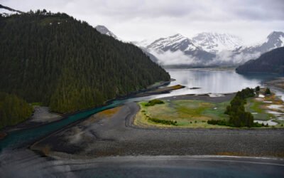
James Lagoon, McCarty Fjord
James Lagoon is a drowned cirque basin about 0.5 miles (0.8 km) wide, partially enclosed by the remains of a terminal moraine, on the western shore of McCarty Fjord in Kenai Fjords National Park, about 51 miles (82 km) southwest of Seward and 40 miles (64 km) east-southeast of Homer, Alaska.
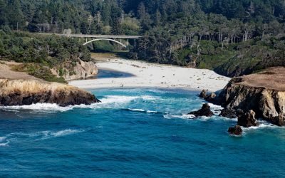
Jug Handle Cove, Ecological Staircase
Jug Handle Cove is a California State Natural Preserve made up of a series of ancient marine terraces, known as the Ecological Staircase, which exhibit different stages of ecological succession at the mouth of Jug Handle Creek, about 5 miles (8 km) south of Fort Bragg and 5 miles (8 km) north of Mendocino, California.
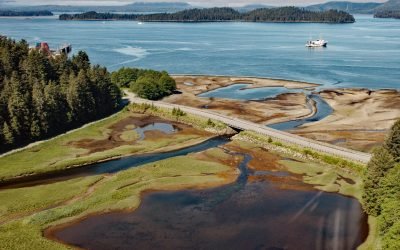
Old Sitka, Starrigavan Bay
Old Sitka is the site of a historical Russian settlement called Redoubt Saint Archangel Michael on the southern shore of Starrigavan Bay in Sitka Sound on the west coast of Baranof Island, about 232 miles (373 km) southeast of Yakutat and 5.5 miles (9 km) north of Sitka, Alaska.
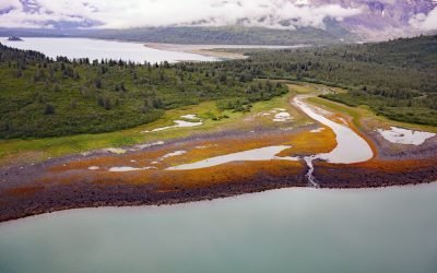
Scidmore Bay, Gilbert Peninsula
Scidmore Bay, enclosed by the Gilbert Peninsula to the east and the Fairweather Mountains to the west, lies in Glacier Bay National Park and Preserve, about 119 miles (192 km) southeast of Yakutat and 43 miles (69 km) northwest of Gustavus, Alaska.
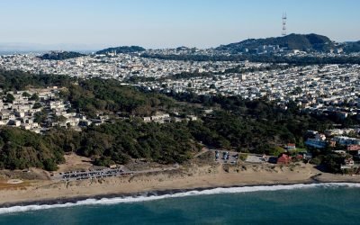
Lobos Creek, Baker Beach
Lobos Creek is a stream in the Presidio of San Francisco, draining urban runoff and underground springs and flowing intermittently west for 1 mile (1.6 km) from near Mountain Lake to the Pacific Ocean between Baker Beach and China Beach, about 5 miles (8 km) west of downtown San Francisco and at Sea Cliff, California.
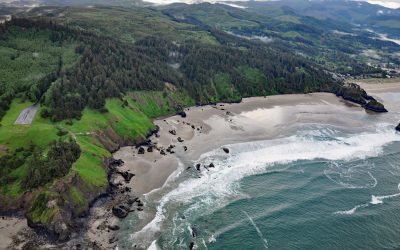
Crescent Beach, Ecola State Park
Crescent Beach lies between Ecola Point and Chapman Point in Ecola State Park, about 20 miles (32 km) south-southwest of Astoria and 2 miles (3.2 km) north-northwest of Cannon Beach, Oregon. It is accessible via a 1.5‑mile (2.4‑km) trail from Ecola Point.
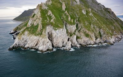
Sledge Island, Bering Sea
Sledge Island, 1.5 miles (2.4 km) across, lies in the Bering Sea, 5 miles (8 km) off the Seward Peninsula’s south coast, about 95 miles (153 km) southeast of Wales and 25 miles (40 km) west of Nome, Alaska.
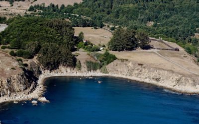
Fort Ross, Northwest Cape
Fort Ross, a historic Russian settlement and part of Fort Ross State Historic Park, lies on a small bight called Fort Ross Cove, south of Northwest Cape, about 24 miles (39 km) southeast of Gualala and 8 miles (13 km) northwest of Jenner, California.
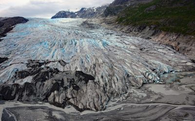
Reid Glacier, Glacier Bay National Park and Preserve
Reid Glacier flows north for 11 miles from the Brady Icefield to Reid Inlet in Glacier Bay National Park and Preserve, about 113 miles (182 km) southeast of Yakutat and 50 miles northwest of Gustavus, Alaska.
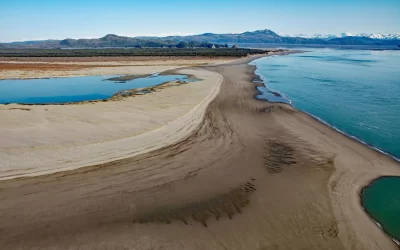
Strawberry Hill, Point Bentinck
Strawberry Hill is a series of uplifted beach ridges on Point Bentinck, at the eastern tip of Hinchinbrook Island and the southern entrance to Strawberry Channel, which separates the island from the mainland, about 53 miles (85 km) south of Valdez and 17 miles (27 km) southwest of Cordova, Alaska.
About the background graphic
This ‘warming stripe’ graphic is a visual representation of the change in global temperature from 1850 (top) to 2019 (bottom). Each stripe represents the average global temperature for one year. The average temperature from 1971-2000 is set as the boundary between blue and red. The colour scale goes from -0.7°C to +0.7°C. The data are from the UK Met Office HadCRUT4.6 dataset.
Click here for more information about the #warmingstripes.