
Parks
Recent Articles
More Articles
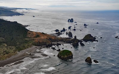
Crook Point, Oregon Islands National Wildlife Refuge
Crook Point is a prominent headland within the Oregon Islands National Wildlife Refuge that includes 1.4 miles (2.3 km) of shoreline with sandy beaches and areas of rocky intertidal, offshore rocks, islets, and subtidal reefs with kelp beds, about 15 miles (24 km) north-northwest of Brookings and 11 miles (18 km) south of Gold Beach, Oregon.
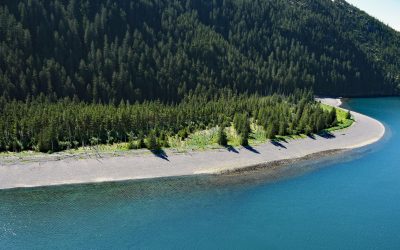
Verdant Cove, Kenai Fjords National Park
Verdant Cove is on the western shore of Aialik Bay in Kenai Fjords National Park at the northern entrance to Dora Passage, about 64 miles (103 km) east of Homer and 30 miles (48 km) south-southwest of Seward, Alaska.
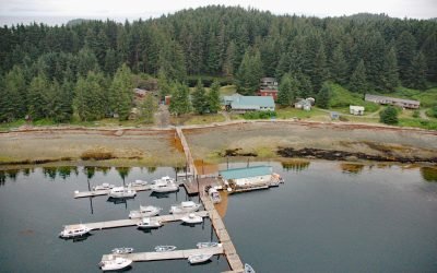
Whalers Cove, Killisnoo Island
Whalers Cove is a bight on the northeastern shore of Killisnoo Island located in Chatham Strait along the central west coast of Admiralty Island in the Alexander Archipelago of Southeast Alaska, about 42 miles (68 km) northeast of Sitka and 2.5 miles (4 km) south of Angoon, Alaska.
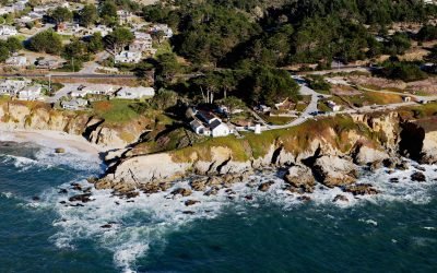
Point Montara Lighthouse, Montara
Point Montara Lighthouse is located in the coastal community of Montara, about 18 miles (29 km) south-southwest of San Francisco and 7 miles (11 km) northwest of Half Moon Bay, California.
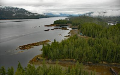
Thoms Place, Wrangell Island
Thoms Place is an embayment, and a widely distributed remote community, along Zimovia Strait on the southwest coast of Wrangell Island, about 62 miles (100 km) north-northwest of Ketchikan and 22 miles (35 km) south-southeast of Wrangell, Alaska.
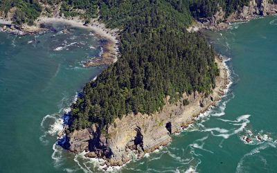
Hoh Head, Olympic National Park
Hoh Head is a sandstone headland situated 2.3 miles (3.7 km) northwest of the Hoh River in Olympic National Park, about 30 miles (48 km) north-northwest of Taholah and 12 miles (19 km) southeast of La Push, Washington.
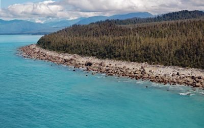
Cape Fairweather, Glacier Bay National Park and Preserve
Cape Fairweather is a point of land created by an ancient terminal moraine at the base of the Fairweather Glacier in Glacier Bay National Park and Preserve, about 131 miles (211 km) west-northwest of Juneau and 82 miles (132 km) southeast of Yakutat, Alaska.
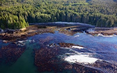
Botanical Beach, Juan de Fuca Provincial Park
Botanical Beach is located on San Juan Point in Botany Bay at the northern end of Juan de Fuca Provincial Park on the south coast of Vancouver Island, about 50 miles (80 km) west-northwest of Victoria and 2 miles (3 km) south-southwest of Port Renfrew, British Columbia.
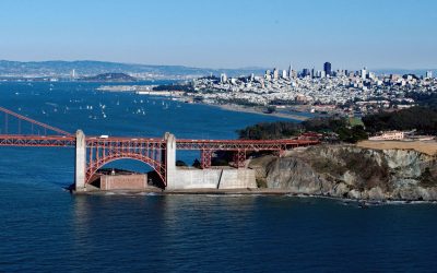
Fort Point, Golden Gate
Fort Point is a promontory where a historic masonry fortification, and later the southern approach of the Golden Gate Bridge, were constructed on the south side of the Golden Gate at the entrance to San Francisco Bay, about 4 miles (6 km) west-northwest of downtown San Francisco and 3 miles (5 km) south of Sausalito, California.
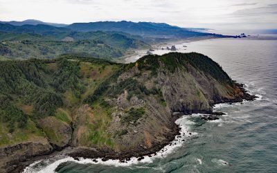
Cape Sebastian, Gold Beach
Cape Sebastian is a prominent headland with an elevation of about 640 feet (195 m) and is one of the 11 named capes along the Oregon coast, about 6.7 miles (10.8 km) south of Gold Beach and 3 miles (4.8 km) north of Pistol River, Oregon.
About the background graphic
This ‘warming stripe’ graphic is a visual representation of the change in global temperature from 1850 (top) to 2019 (bottom). Each stripe represents the average global temperature for one year. The average temperature from 1971-2000 is set as the boundary between blue and red. The colour scale goes from -0.7°C to +0.7°C. The data are from the UK Met Office HadCRUT4.6 dataset.
Click here for more information about the #warmingstripes.