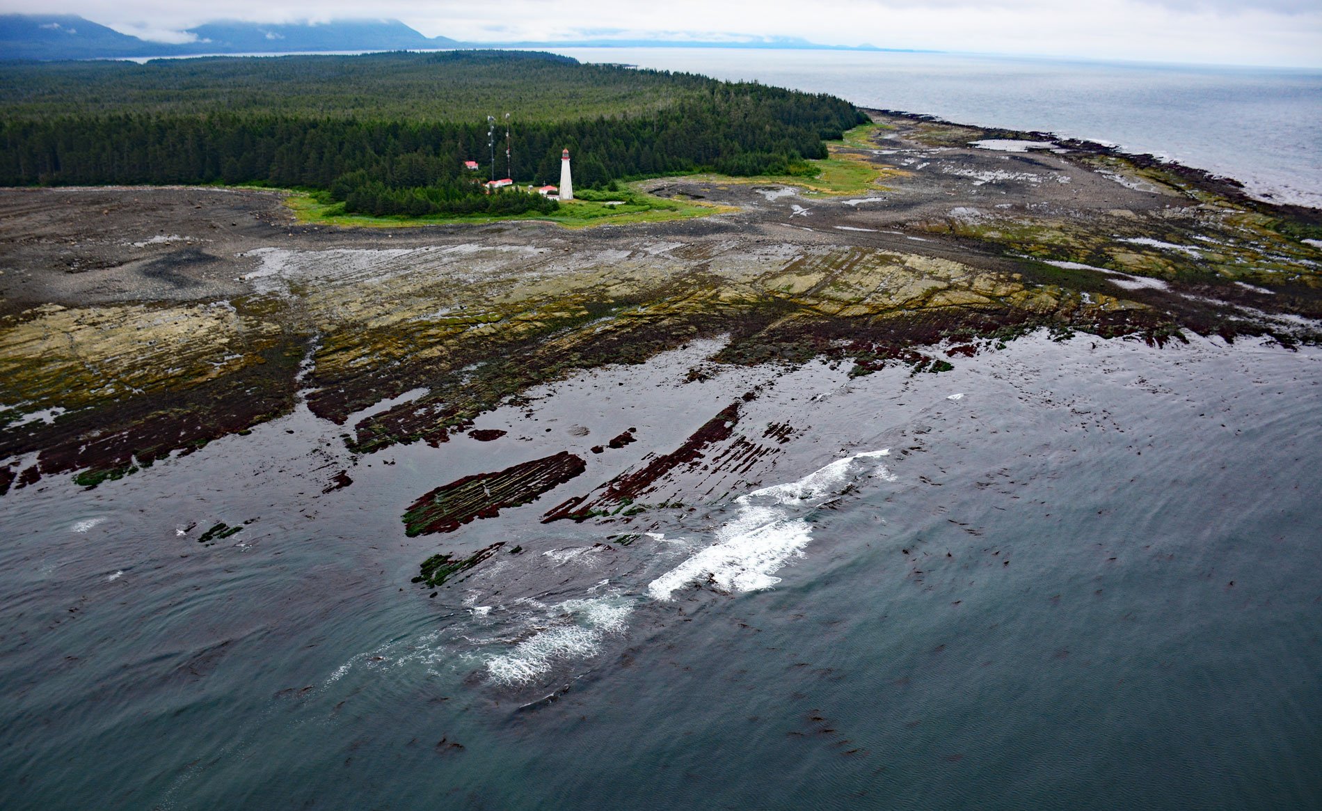
Estevan Point is the site of a historic lighthouse at the end of the Hesquiat Peninsula which forms the southern entrance to Nootka Sound on the west coast of Vancouver Island, about 35 miles (56 km) southwest of Gold River and 33 miles (53 km) northwest of Tofino, British Columbia. The point was named Punta San Esteban in 1774 by Spanish explorer Juan José Pérez Hernández to honor the day of Saint Stephen. The Hesquiat Peninsula forms the division between the Clayoquot Sound to the south and Nootka Sound to the north. The peninsula is named for the Hesquiaht tribe of the Nuu-chah-nulth peoples. Vancouver Island is formed mostly by the Wrangellia Terrane and is part of the Insular Belt of the Canadian Cordillera that comprise a number of accreted volcanic terranes consisting of Triassic meta-volcanic rocks and their plutonic counterparts. The Hesquiat Peninsula is formed by rocks representing the Carmanah Formation that developed during the Eocene and Oligocene, and consists mainly of siltstone and sandstone that overlie rocks of the Insular Belt and are now exposed along a narrow strip of land along the coast. The formation may have extended much farther eastward but was removed from the adjacent land-area by Late Cenozoic and Pleistocene erosion.
The Hesquiat Peninsula is part of the traditional territory of the Hesquiaht people that reside in Nootka Sound and Clayoquot Sound and speak the Nuu-chah-nulth language. The name ‘Nootka’ is the English derivation of Nuu-chah-nulth, and ‘Hesquiaht’ is from the word ‘heish-heish-a’, which means ‘to tear asunder with the teeth’, which refers to the technique of stripping herring roe away from eel grass. The Hesquiaht formerly consisted of several small, independent groups, each with their own village with cedar plank houses and a territory consisting of at least one salmon spawning stream. The Spanish explorer Perez Hernandez was the first white man on record to visit Nootka Sound in 1774. In 1778, Captain James Cook arrived during his third Pacific voyage. Following reports of Cook’s exploration, British traders began to use a harbor called Friendly Cove in Nootka Sound as a base for a promising trade in sea-otter pelts. However, the Spanish claimed sovereignty over the Pacific Ocean and the ensuing Nootka incident nearly led to war between Britain and Spain. The presence of Europeans also resulted in conflicts with the Hesquiaht people and on one occasion an Englishman named John R. Jewitt was taken captive and became a slave of chief Maquinna from 1803 t0 1805. He subsequently wrote a memoir of the experience, which has become an invaluable narrative of the contemporary indigenous lifestyle.
In the 19th century, the west coast of Vancouver Island had only two lighthouses at Carmanah and Cape Beale. Several high profile shipwrecks prompted the Canadian government to fund more navigational aids and in 1907, a light station at Estevan Point was approved. Thomas N. Tubman with a workforce of about ten men were charged with the construction of a light, fog alarm, and wireless telegraph station. Landing anywhere in its vicinity of the point is extremely difficult and dangerous, and all supplies had to be landed 5 miles (8 km) away. The workmen hacked a trail through the dense forest, bridging ravines and rocks, and laid track for a horse-drawn tramway. In November 1908, the combination of a high tide and a winter gale destroyed much of the tramway, and the men had to pack supplies on their backs and in wheelbarrows during the notorious winter rains. Despite these difficulties, the light station was completed in 1909 with a tower designed by William P. Anderson, one in a series of concrete buttressed octagonal structures 100 feet tall. In 1942, the lighthouse was attacked by the Japanese submarine I-26 under the command of Minoru Yokota. The submarine surface about 2 miles (3.2 km) offshore and fired 25–30 rounds of 5.5-inch (140 mm) shells, but the lighthouse station remained undamaged. Read more here and here. Explore more of Estevan Point and Hesquiat Peninsula here:

