
Parks
Recent Articles
More Articles
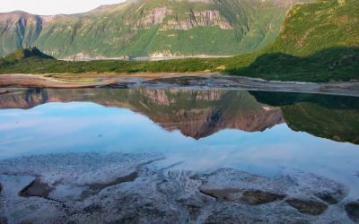
Kuliak Bay, Katmai National Park and Preserve
Kuliak Bay is about 4 miles (6.5 km) wide at the entrance on the western shore of Shelikof Strait and gradually tapers to the northwest for 5 miles (8 km) into Katmai National Park and Preserve on the Alaska Peninsula, about 92 miles (148 km) southeast of King Salmon and 74 miles (119 km) northwest of Kodiak, Alaska.

Margerie Glacier, Tarr Inlet
Margerie Glacier starts at an elevation of 9,860 feet (3,005 m) on the international border of the United States and Canada between Mount Root to the north and Mount Fairweather to the south and flows generally east for 21 miles (34 km) to tidewater at Tarr Inlet in Glacier Bay National Park and Preserve, about 101 miles (163 km) southeast of Yakutat and 66 miles (107 km) northwest of Gustavus, Alaska.
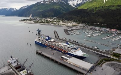
Seward, Resurrection Bay
Seward is a historic community at the base of Mount Marathon on the western shore of Resurrection Bay on the Kenai Peninsula and near the mouth of the Resurrection River, about 80 miles (129 km) west-northwest of Homer and 79 miles (127 km) south of Anchorage, Alaska.
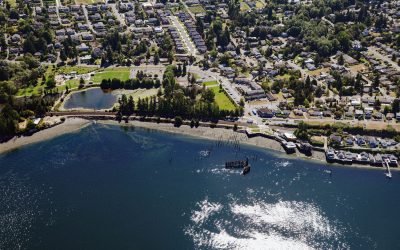
Titlow Beach, Tacoma Narrows
Titlow Beach is an urban neighborhood on the eastern shore of the Tacoma Narrows at the site of a historical fish camp used by the Puyallup and Nisqually tribes situated on a tidal wetland now called Titlow Lagoon, about 5.8 miles (9.4 km) south-southeast of Gig Harbor and 5.3 miles (8.5 km) west of downtown Tacoma, Washington.
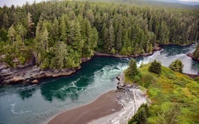
Whyac, Nitinat Narrows
Whyac is a historical Ditidaht First Nation village on the southern shore beside Nitinat Narrows, a tidal channel about 1.9 miles (3 km) long that connects Nitinat Lake to the Pacific Ocean on the north shore of the Strait of Juan de Fuca on Vancouver Island, about 22 miles (35 km) northwest of Port Renfrew and 17 miles (27 km) southeast of Bamfield, British Columbia.
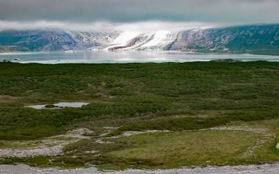
Fourpeaked Glacier, Shelikof Strait
Fourpeaked Glacier starts from the eastern flank of Fourpeaked Mountain with a summit elevation of 6771 feet (2,064 m) and flows generally east for 6 miles (10 km) to a proglacial lake about 2.5 miles (4 km) long that is drained by a river that flows another 0.8 miles (1.3 km) to Shelikof Strait in Katmai National Park and Preserve, about 90 miles (145 km) southwest of Homer and 77 miles (124 km) northwest of Kodiak, Alaska.

Fort Miley, Lands End
The Marine Exchange Lookout Station is on Fort Miley at Lands End in the Golden Gate National Recreation Area, about 6 miles (10 km) west of downtown San Francisco and 2.7 miles (4.4 km) southwest of the Presidio at the Golden Gate, California.
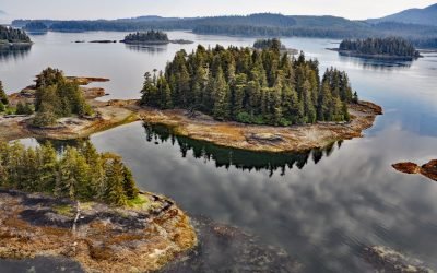
Christmas Island, Security Bay
Christmas Island is the largest of several small reefs and islets on the western coastline and near the entrance to Security Bay on Kuiu Island, about 45 miles (72 km) south of Angoon and 18 miles (29 km) southwest of Kake, Alaska.
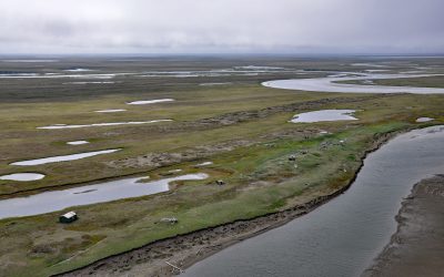
Cape Espenberg, Seward Peninsula
Espenberg is a historic Iñupiaq settlement and present-day fish camp at Cape Espenberg, a peninsula composed of a series of dune-covered beach ridges on the Chukchi Sea coast of the Seward Peninsula that extends eastward into Kotzebue Sound, about 63 miles (101 km) east-northeast of Shishmaref and 43 miles (69 km) southwest of Kotzebue, Alaska.
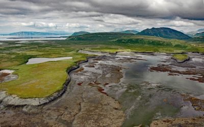
Chenik, Kamishak Bay
Chenik was a historical community at the mouth of Chenik Creek, between Chenik Lake to the west and Chenik Head to the east, on the west shore of Kamishak Bay, about 98 miles (158 km) northeast of King Salmon and 98 miles (158 km) southwest of Homer, Alaska.
About the background graphic
This ‘warming stripe’ graphic is a visual representation of the change in global temperature from 1850 (top) to 2019 (bottom). Each stripe represents the average global temperature for one year. The average temperature from 1971-2000 is set as the boundary between blue and red. The colour scale goes from -0.7°C to +0.7°C. The data are from the UK Met Office HadCRUT4.6 dataset.
Click here for more information about the #warmingstripes.