
Parks
Recent Articles
More Articles
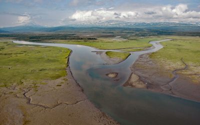
Kamishak River, Akumwarvik Bay
Kamishak River starts from an unnamed lake at an elevation of 2,700 feet (823 m) in a saddle between two peaks in the Aleutian Range and first flows southeast for 10 miles (16 km) and then north-northeast for 28 miles (45 km) through Katmai National Park and Preserve to Akumwarvik Bay, about 104 miles (168 km) southwest of Homer and 93 miles (150 km) east-northeast of King Salmon, Alaska.
About the background graphic
This ‘warming stripe’ graphic is a visual representation of the change in global temperature from 1850 (top) to 2019 (bottom). Each stripe represents the average global temperature for one year. The average temperature from 1971-2000 is set as the boundary between blue and red. The colour scale goes from -0.7°C to +0.7°C. The data are from the UK Met Office HadCRUT4.6 dataset.
Click here for more information about the #warmingstripes.