
Rivers
Recent Articles
More Articles
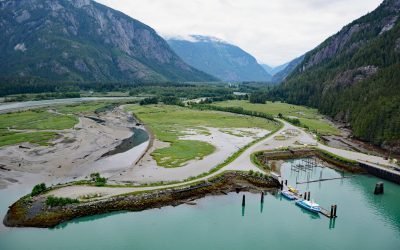
Kemano River, Gardner Canal
The Kemano River flows from the Kitimat Ranges to Kemano Bay on the northern shore of Gardner Canal, about 45 miles (72 km) south-southeast of Kitimat and 10 miles (16 km) southwest of Kemano, British Columbia.
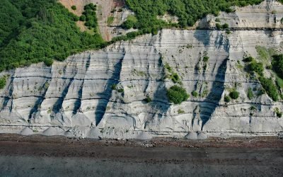
Falls Creek, Kachemak Bay
Falls Creek is located on the Kenai Peninsula, flowing generally south for 3.2 miles (5 km) to the northwestern shore of Kachemak Bay, approximately 17 miles (27 km) northeast of Homer and 2.5 miles (4 km) southwest of Kachemak Selo, Alaska.
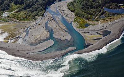
Elwha River, Angeles Point
The Elwha River starts from a perennial snowfield at an elevation of 4,763 feet (1,452 m) in the Olympic Mountains and flows generally north for 45 miles (72 km) to Angeles Point at Freshwater Bay on the southern shore of the Strait of Juan de Fuca, about 33 miles (53 km) east-southeast of Clallam Bay and 6 miles (10 km) west-northwest of Port Angeles, Washington.
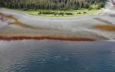
Barabara Point, Kachemak Bay
Barabara Point is on the Kenai Peninsula between McDonald Spit to the east and Seldovia Point to the west in Kachemak Bay, about 12 miles (19 km) south-southwest of Homer and 4 miles (6.5 km) northeast of Seldovia, Alaska.
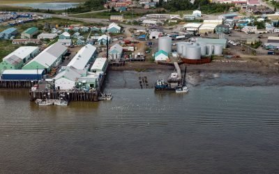
Dillingham, Nushagak Bay
Dillingham is a community on the south side of Snag Point at the confluence of the Wood and Nushagak Rivers, at the head of Nushagak Bay on the north coast of Bristol Bay, about 248 miles (400 km) west-southwest of Homer and 166 miles (270 km) southeast of Bethel, Alaska.
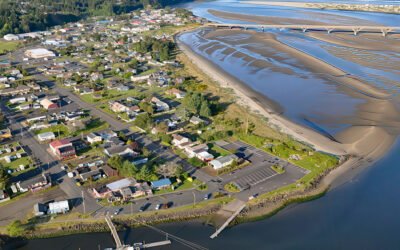
Waldport, Alsea Bay
Waldport is a community situated on the southern shore of Alsea Bay, an estuary of the Alsea River, about 15 miles (24 km) south of Newport and 8 miles (13 km) north of Yachats, Oregon.
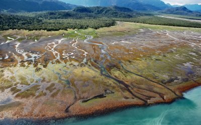
Humpy Creek, Kachemak Bay
Humpy Creek drains a watershed of 6,912 acres (2,797 ha) and flows generally northwest for about 4.5 miles (7 km) from Emerald Lake at an elevation of 1,138 feet (347 m) in the Kenai Mountains to the southeastern shore of Kachemak Bay, about 67 miles (108 km) southwest of Seward and 14 miles (22.5 km) east-northeast of Homer, Alaska.

Dismal Nitch, Columbia River
Dismal Nitch is a cove on the north shore of the lower Columbia River, historically significant as the last campsite of the Lewis and Clark Expedition before they sighted the Pacific Ocean, about 9 miles (15 km) southeast of Ilwaco, Washington and 4.5 miles (7 km) north-northwest of Astoria, Oregon.
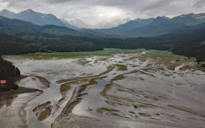
Seldovia River, Kenai Mountains
Seldovia River drains a watershed of 16,980 acres (6,872 ha) and flows generally northwest for 5 miles (8 km) from Seldovia Lake in the Kenai Mountains to Seldovia Bay on the south shore of Kachemak Bay and Lower Cook Inlet, about 18 miles (29 km) south-southwest of Homer and 3.6 miles (6 km) south-southeast of Seldovia, Alaska.
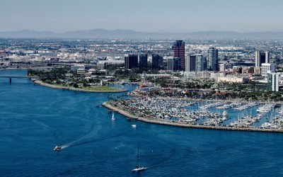
Los Angeles River, Long Beach
Los Angeles River starts at the confluence of Bell Creek and Arroyo Calabasas that drain from the Simi Hills and Santa Monica Mountains respectively, and flows generally southeast for 30 miles (48 km) through the San Fernando Valley and downtown Los Angeles and then south for 20 miles (32 km) to San Pedro Bay at Long Beach, California.
About the background graphic
This ‘warming stripe’ graphic is a visual representation of the change in global temperature from 1850 (top) to 2019 (bottom). Each stripe represents the average global temperature for one year. The average temperature from 1971-2000 is set as the boundary between blue and red. The colour scale goes from -0.7°C to +0.7°C. The data are from the UK Met Office HadCRUT4.6 dataset.
Click here for more information about the #warmingstripes.