
Rivers
Recent Articles
More Articles
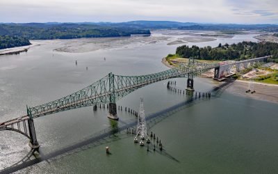
North Bend, Coos Bay
North Bend is one of several communities on Coos Bay, an estuary on the southern Oregon coast, about 22 miles (35 km) south of Reedsport and 3 miles (4.8 km) north of the city of Coos Bay, Oregon.
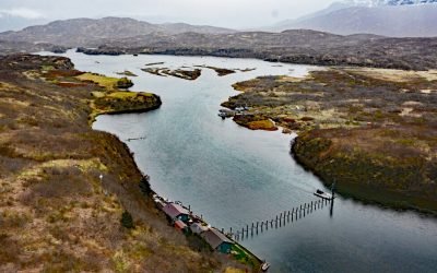
Chignik Fish Weir, Chignik River
Chignik River starts at Black Lake and flows south for about 8 miles to Chignik Lake, which is about 7 miles (11 km) long, and then the river continues flowing east for another 2 miles (3.2 km) to Chignik Lagoon, past the fish weir located about 12 miles (19 km) west-southwest of the community of Chignik and 2.3 miles (3.7 km) east-northeast of the community of Chignik Lake, Alaska.
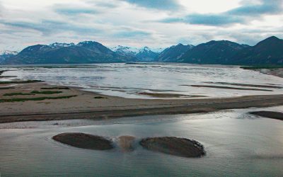
Katmai Bay, Katmai National Park and Preserve
Katmai Bay is about 9 miles (14.5 km) across, located at the mouth of the Katmai River on the Shelikof Strait coast of the Alaska Peninsula in Katmai National Park and Preserve, about 93 miles (150 km) west-northwest of Kodiak and 77 miles (124 km) southeast of King Salmon, Alaska.
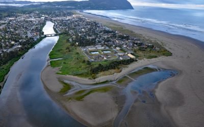
Necanicum River, Seaside
Necanicum River is approximately 21 miles (34 km) long draining a watershed of 84 square miles (21,756 ha), and forms the first estuary south of the Columbia River about 70 miles (113 km) northwest of Portland and 13 miles (21 km) southwest of Astoria at the coastal community of Seaside, Oregon.
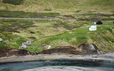
Karluk, Kodiak Island
Karluk is a historical fishing community situated on a barrier spit at the mouth of Karluk Lagoon on the west coast of Kodiak Island, about 301 miles (485 km) southwest of Anchorage and 88 miles (142 km) southwest of Kodiak, Alaska.
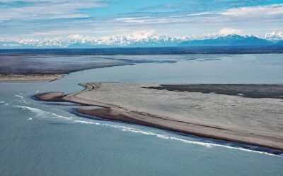
Dangerous River, Brabazon Mountains
Dangerous River starts at Harlequin Lake in the Brabazon Mountains of the Fairweather Range and flows southwest for 16 miles (26 km) to the Gulf of Alaska, about 102 miles (165 km) northwest of Gustavus and 50 miles (81 km) southeast of Yakutat, Alaska.
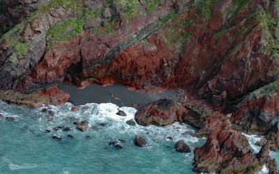
Red River, Kodiak Island
Red River is a stream on Kodiak Island that flows south for about 4.5 miles (7 km) to Shelikof Strait, 2 miles (3.2 km) east of Bumble Bay, and about 80 miles (129 km) southwest of Kodiak and 6 miles (10 km) northwest of Ayakulik, Alaska.

Kipnuk, Kuguklik River
Kipnuk is a Central Yup’ik village situated on a sharp bend of the Kuguklik River, 5 miles (8 km) upstream from the estuary in Kinak Bay on the Bering Sea, about 98 miles (158 km) southwest of Bethel and 18 miles (29 km) south-southeast of Chefornak, Alaska.

Will Rogers-Wiley Post Memorial, Walakpa Bay
Will Rogers-Wiley Post Memorial is at Walakpa Bay, a coastal inlet that extends 6 miles (10 km) east from the Chukchi Sea and is fed by a watershed of 56,487 acres (22,860 ha), about 76 miles (123 km) northeast of Wainwright and 11 miles (18 km) southwest of Utqiaġvik, Alaska.

Marys Slough, Unalakleet River
Marys Slough is a side channel about 5 miles (8 km) long at the mouth of the Unalakleet River formed by a barrier spit on Norton Sound that creates an extensive tidal wetland, about 46 miles (74 km) northeast of Saint Michael and 1.1 miles (1.8 km) south-southeast of Unalakleet, Alaska.
About the background graphic
This ‘warming stripe’ graphic is a visual representation of the change in global temperature from 1850 (top) to 2019 (bottom). Each stripe represents the average global temperature for one year. The average temperature from 1971-2000 is set as the boundary between blue and red. The colour scale goes from -0.7°C to +0.7°C. The data are from the UK Met Office HadCRUT4.6 dataset.
Click here for more information about the #warmingstripes.