Shipwrecks
Recent Articles
More Articles
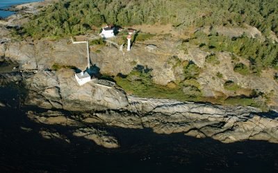
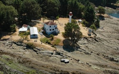
Discovery Island, Sea Bird Point
Discovery Island is part of a group of islands in Oak Bay off the southeastern tip of Vancouver Island at Sea Bird Point, about 17 miles (27 km) southeast of Sidney and 6.5 miles (10.5 km) east of downtown Victoria, British Columbia.
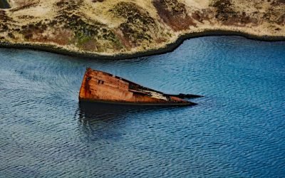
SS Islander, Green Cove
The remains of SS Islander and the salvage barge Griffson are in Green Cove on Stephens Passage, a waterway that separates the north shore of the Glass Peninsula on Admiralty Island from Douglas Island, about 86 miles (138 km) northeast of Sitka and 12 miles (19 km) southeast of Juneau, Alaska.
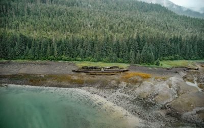
SS Portland, Katalla River
SS Portland is a shipwreck at the mouth of the Katalla River, near the abandoned oil prospecting community of Katalla, about 70 miles (113 km) west-northwest of Yakataga and 48 miles (77 km) southeast of Cordova, Alaska.
Aoyagi Maru, Lost Harbor
Aoyagi Maru is a Japanese flagged refrigerant ship that grounded on the south shore of Lost Harbor on Akun Island, about 135 miles (218 km) southwest of Cold Bay and 9 miles (14.5 km) northeast of Akutan, Alaska.
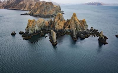
Cathedral Rocks, Makushin Bay
Cathedral Rocks is an island 0.3 miles (0.5 km) west of Cathedral Point on the northern shore of Makushin Bay, on the west coast of Unalaska Island in the Eastern Aleutians, about 98 miles (158 km) northwest of Nikolski and 18 miles (29 km) southwest of Dutch Harbor, Alaska.
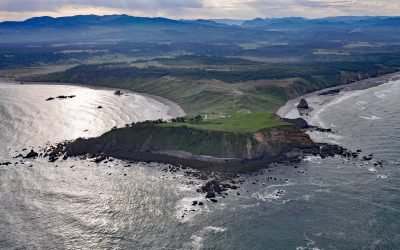
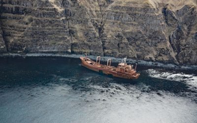
SS South Portland, Cape Blanco
SS South Portland is a historical shipwreck on Cape Blanco, a prominent headland that extends 1.5 miles (2.4 km) into the Pacific Ocean with cliffs 200 feet (61 m) high, about 205 miles (331 km) southwest of Portland and 7 miles (11 km) north-northwest of Port Orford, Oregon.
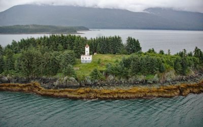
Sentinel Island, Lynn Canal
Sentinel Island is located along the eastern shore of Lynn Canal in the center of Favorite Channel near the northern entrance, about 51 miles (82 km) south-southeast of Haines and 25 miles (40 km) northwest of Juneau, Alaska.
SS Northwestern, Captains Bay
SS Northwestern is a historical shipwreck near the head of Captains Bay, the southern arm of Unalaska Bay, on the northeast coast of Unalaska Island , about 112 miles (181 km) northeast of Nikolski and 5 miles (8 km) southwest of the community of Unalaska, Alaska.
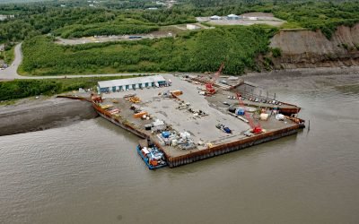
Arness Dock, Nikiski Bay
Arness Dock is in Nikiski Bay on the Kenai Peninsula, about 58 miles (94 km) southwest of Anchorage and 13 miles (21 km) north-northwest of Kenai, Alaska.
Active Pass, Gulf Islands
Active Pass is a narrow strait about 3.4 miles (5.5 km) long separating Mayne Island from Galiano Island in the southern Gulf Islands, about 16.4 miles (26.5 km) north-northeast of Sidney and 12.5 miles (20 km) southwest of Tsawwassen, British Columbia.
About the background graphic
This ‘warming stripe’ graphic is a visual representation of the change in global temperature from 1850 (top) to 2019 (bottom). Each stripe represents the average global temperature for one year. The average temperature from 1971-2000 is set as the boundary between blue and red. The colour scale goes from -0.7°C to +0.7°C. The data are from the UK Met Office HadCRUT4.6 dataset.
Click here for more information about the #warmingstripes.