THIS MONTH
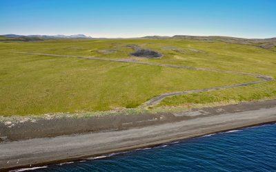
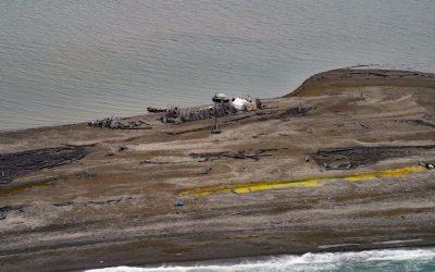
Chariot, Cape Thompson
Cape Thompson is a headland on the Chukchi Sea coast near the site of Project Chariot, about 41 miles (66 km) northwest of Kivalina and about 31 miles (50 km) southeast of Point Hope, Alaska.
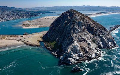
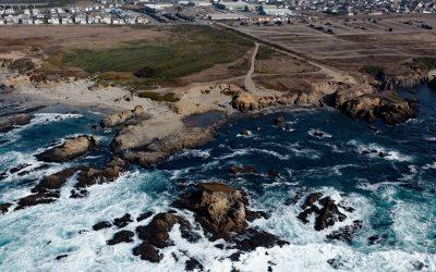
Morro Rock, Morro Bay
Morro Rock is a volcanic plug with an elevation of 576 feet (176 m), connected to the mainland by a causeway that forms the entrance channel to Morro Bay, about 102 miles (164 km) southeast of Monterey and 21 miles (34 km) northwest of Pismo Beach, California.
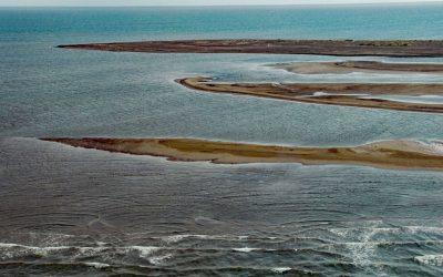
Point Franklin, Peard Bay
Point Franklin is the site of several whaling shipwrecks at the end of a barrier spit that extends 13 miles (21 km) northeast from the Arctic Coastal Plain, and together with the Seahorse Islands, separates Peard Bay from the Chukchi Sea, about 54 miles (87 km) southwest of Utqiaġvik and 33 miles (53 km) northeast of Wainwright, Alaska.
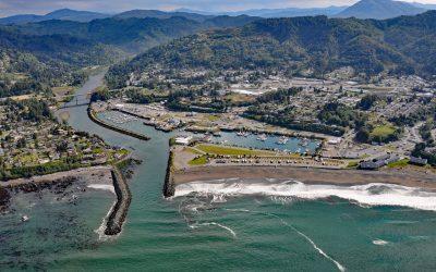
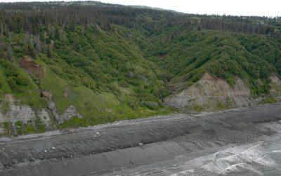
Brookings, Chetco River
Brookings is a community at the mouth of the Chetco River, which flows from the Southern Oregon Coast Range to the Pacific Ocean, about 21 miles (34 km) north-northwest of Crescent City, California and 26 miles (42 km) south-southeast of Gold Beach, Oregon.
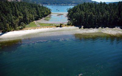
Montague Harbour, Galiano Island
Montague Harbour is a provincial marine park located on Trincomali Channel on the southern coast of Galiano Island, one of the Gulf Islands in the Strait of Georgia, about 32 miles (52 km) north of Victoria and 30 miles (48 km) south-southwest of Vancouver, British Columbia.
Diamond Creek, Kachemak Bay
Diamond Creek starts at an elevation of about 1,000 feet (305 m) on the southern Kenai Peninsula and drains a watershed of 3,424 acres (1,386 ha) while flowing generally west for about 5 miles (8 km) from Diamond Ridge to the northern shore of Kachemak Bay, about 10 miles (16 km) southeast of Anchor Point and 6 miles (10 km) west-northwest of Homer, Alaska.
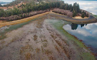
Gilmour Point, Montague Island
Gilmour Point is a headland that forms the northern shore of Port Chalmers on the northwest coast of Montague Island in Prince William Sound, and an area of extensive eelgrass beds, about 62 miles (100 km) southeast of Whittier and 54 miles (87 km) southwest of Cordova, Alaska.
Glass Beach, Noyo Headlands Park
Glass Beach is situated in the northern section of Noyo Headlands Park in the community of Fort Bragg, which is between Pudding Creek to the north and Noyo River to the south, about 95 miles (153 km) south-southeast of Eureka and 10 miles (16 km) north of Mendocino, California.
Gordon, Demarcation Point
Gordon is the site of a historical trading post near Demarcation Point, a 2.5 miles (4 km) long barrier spit separating Demarcation Bay to the south from the Beaufort Sea to the north, about 210 miles (338 km) northwest of Inuvik, Northwest Territories and 63 miles (102 km) southeast of Kaktovik, Alaska.
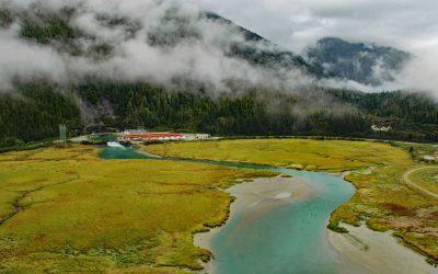
Speel Arm, Port Snettisham
Speel Arm extends generally northeast for 9 miles (14.5 km) from the head of Port Snettisham to the mouth of the Speel River, and is the site of a hydroelectric facility powered by water from Crater Lake and Long Lake, about 95 miles (153 km) northeast of Sitka and 30 miles (48 km) southeast of Juneau, Alaska.
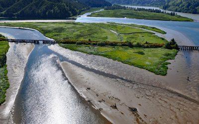
Blacks Island, Smith River
Blacks Island is situated at the confluence of the Smith River and the Umpqua River, on the historic spur line of the Southern Pacific Railroad connecting Eugene with Coos Bay, about 1.7 miles (2.7 km) southeast of Gardiner and 1 mile (1.6 km) northeast of Reedsport, Oregon.
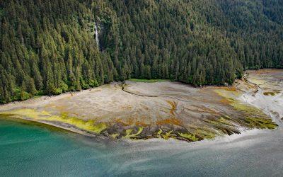
Tutka Bay, Kachemak Bay State Park
Tutka Bay is a deglaciated fjord that extends 8.5 miles (14 km) in Kachemak Bay State Park from Eldred Passage to the mouth of an unnamed river that flows generally west-northwest for 7 miles (11 km) from small remnants of the Southern Glacier, about 18 miles (29 km) southeast of Homer and 15 miles (24 km) east of Seldovia, Alaska.