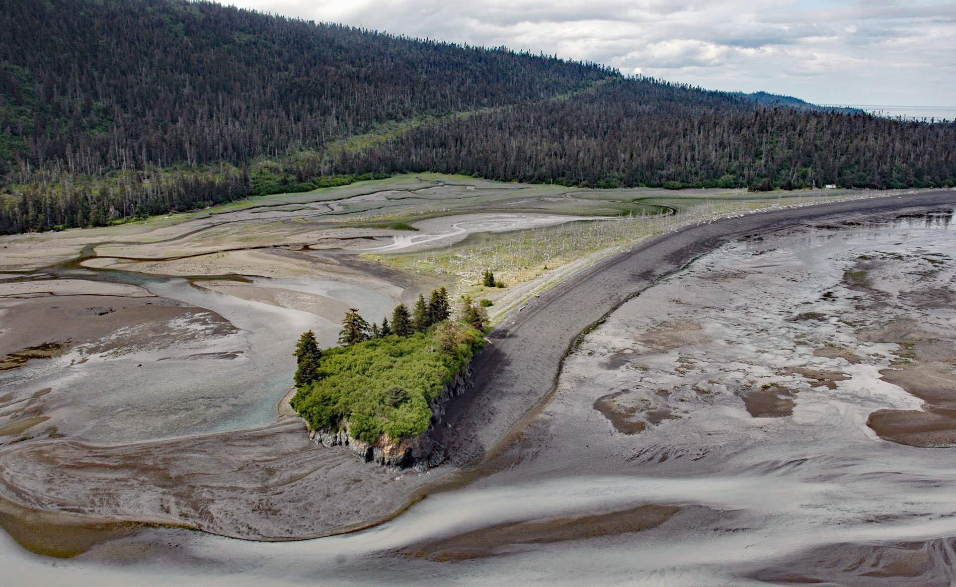
Mermaid Island is situated on a tidal flat called McKeon Flats formed by the Wosnesenski River as it flows into Neptune Bay, a bight about 1.5 miles (2.4 km) wide on the southeastern shore of Kachemak Bay on the Kenai Peninsula, about 13 miles (21 km) northeast of Seldovia and 8 miles (13 km) south-southeast of Homer, Alaska. The local name was first reported on charts in the 1940s by the U.S. Coast and Geodetic Survey. Mermaid Island is connected to the mainland by a recurved spit that was formed by prevailing wind-generated waves in Kachemak Bay. The mainland and the islands in McKeon Flats comprise rocks of the McHugh Complex, a tectonic mélange consisting largely of weakly metamorphosed siltstone, greywacke, arkose, and conglomerate that were deposited in a deep ocean trench during the Mississippian through the mid-Cretaceous periods, or about 350 to 100 million years ago. These rocks were accreted to the continental margin and uplifted during plate subduction. Repeated glacier advances during the Pleistocene eroded the bedrock to form the present-day configuration.
The islands in McKeon Flats and generally along the southern shore of Kachemak Bay include cliffs and rocky headlands that provide nesting habitat for numerous seabird colonies. Pigeon guillemots nest in approximately 30 small colonies of 2 to 15 nests each, and numerous solitary nests are also scattered along the shore. At least one colony is located in Neptune Bay. Pigeon guillemots and closely related black guillemots are unique among diving seabirds because they usually forage near the seafloor and within a few kilometers of the nest site. The pigeon guillemot mostly feeds on benthic prey found at the lowest level in a body of water close to the sea floor, but it also takes some prey from higher in the water column. It mainly eats fish and other aquatic animals. Fish taken include sculpins, sand lance, cod, and capelin. They also feed on invertebrates including shrimp and crabs, and even polychaete worms, gastropods, bivalves, and squid. Their preferred prey are small fish and the most abundant in Kachemak Bay are the Pacific sand lance, also called sand eels.
Pacific sand lance is a common schooling fish that feeds on zooplankton and is often abundant in coastal regions. They have a slender body and pointed snout, and do not have pelvic fins or swim bladders. Juvenile sand lance are perhaps the most abundant of all fish larvae and serve as a major food item for cod, salmon, whales, and other commercially important species. As adults, they are bottom-dwelling and live in burrows in sandy habitats to avoid tidal currents. They exhibit the rather unusual behavior of alternating between lying buried in the substrate and swimming pelagically in well-formed schools. They are typically associated with fine gravel and sandy substrates up to and including the intertidal zone, such as in Neptune Bay where they are an important food source for diving seabirds such as guillemots, puffins, auks, terns, and cormorants. Read more here and here. Explore more of Mermaid Island and Neptune Bay here:

