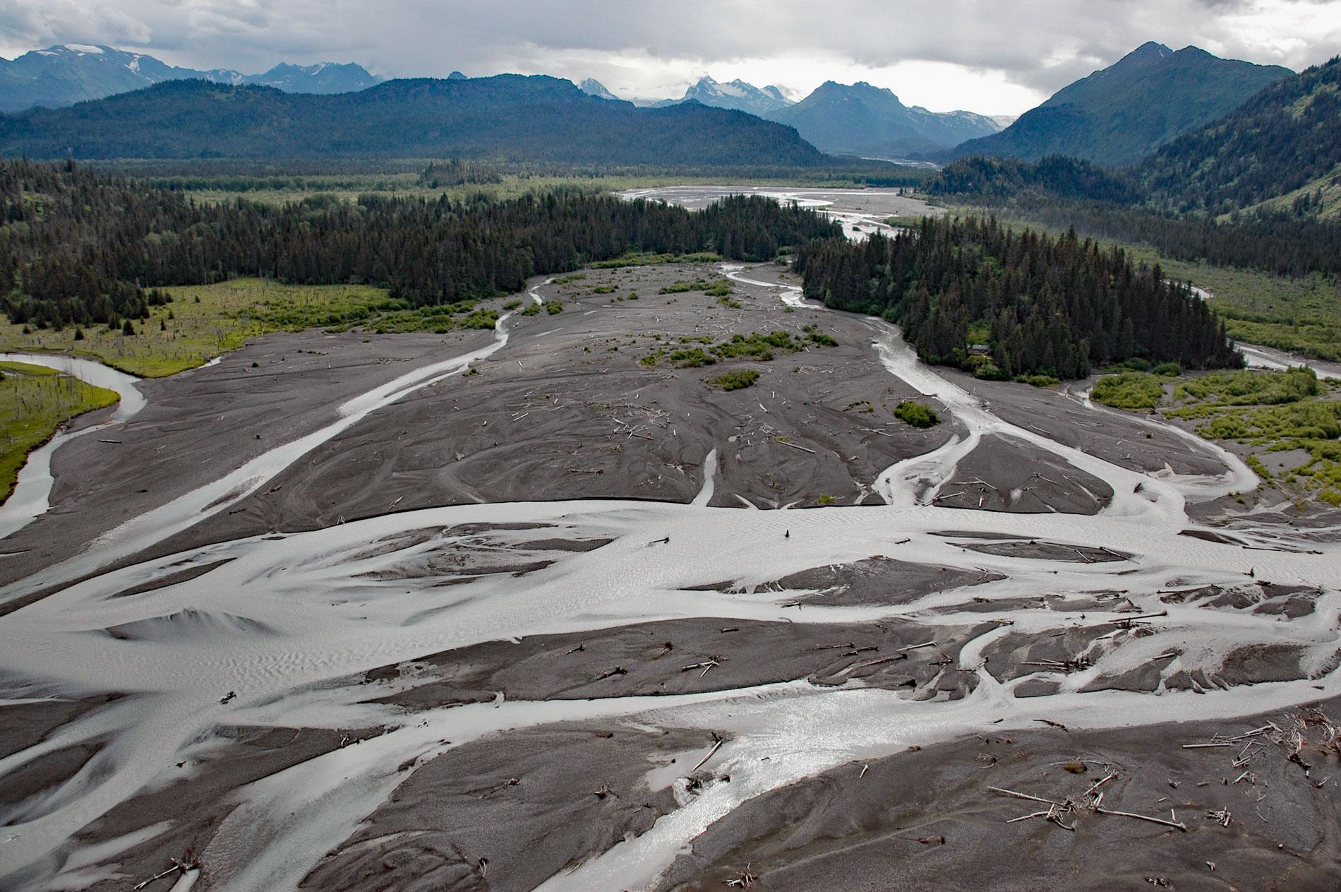
McKeon Flats is formed by the Wosnesenski River that flows into Neptune Bay on the south shore of Kachemak Bay on the Kenai Peninsula, about 14 miles (23 km) northeast of Seldovia and 9 miles (14.5 km) southeast of Homer, Alaska. McKeon Flats was first published on maps in the 1940s by the U.S. Geological Survey and the U.S. Coast and Geodetic Survey. The name is likely after Willaim J. McKeon who was born in Pennsylvania from Irish parents and married Annie Nanitak in Seldovia and had a cabin on the flats in the early 1900s. The Wosnesenski River is named after the glacier that starts in the Kenai Mountains at an elevation of 4,800 feet (1,463 m) and flows generally west for 6 miles (32 km) to a proglacial lake at 500 feet (152 m). The river drains the lake and flows generally west-northwest for 12 miles (19 km) to Neptune Bay. McKeon Flats comprise deltaic sediments including Holocene glacial outwash and alluvial deposits from the Wosnesenski River mostly consisting of gravel and sand eroded from the McHugh Complex greywacke that developed during the Cretaceous and is exposed as bedrock on both sides of the river valley.
The Wosnesenski Glacier is named after Russian explorer Ilya G. Voznesensky. The glacier carved a U-shaped valley during the Last Glacial Maximum and has since retreated into the Kenai Mountains. The steep-walled valley was subsequently inundated by rising sea level. However, the resulting embayment was very shallow and eventually filled with sediment creating McKeon Flats. In addition to sea level rise, Kachemak Bay and the west side of the southern Kenai Peninsula are part of a larger area that has experienced regional tectonic subsidence at least since the most recent deglaciation. Evidence of subsidence includes the classic submergent morphology of drowned valleys, as well as drowned shell middens. Parts of the coastline, such as the McKeon Flats, are presently building fan deltas in areas where the net rate of sedimentation is greater than the rate of submergence, although seaward portions of the deltas are periodically flooded because of regional subsidence. Nearly everywhere else in Kachemak Bay, with the notable except of Fox River Flats and the Homer Spit, the coastline consists of sea cliffs cut by wave erosion in bedrock, and sea stacks and sea caves attest to the dominance. of wave erosion over deposition.
In 1839, Ilya Gavrilovich Voznesenskyi was sent to Alaska by the Imperial Academy of Sciences of Saint Petersburg to make scientific collections. He spent the years of 1840-41 in California and from 1842 to 1849 was on Kodiak and in the Aleutian Islands and part of western Alaska where he explored, collected biological specimens and cultural artifacts. Voznesensky’s expedition continued for nine years and ten months. From this expedition he brought back 434 mammals, 2,859 birds, 179 fishes, 5 tortoises, 210 skeletons of mammals and birds, 1,052 ethnographic objects in 150 boxes, an herbarium on 2,000 sheets and a large geological-mineralogical collection. The expedition collected around 400 previously unknown species of plant and animals and established the world’s largest collection of ethnological artifacts of Russian America. Read more here and here. Explore more of McKeon Flats and Wosnesenski River here:

