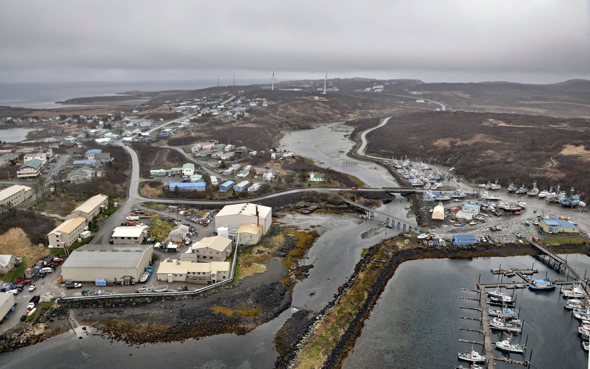
Sand Point is a community situated on Humboldt Harbor on the western shore of Popof Island, one of the Shumagin Islands in the Gulf of Alaska off the southern coast of the Alaska Peninsula, about 262 miles (422 km) northeast of Dutch Harbor and 65 miles (105 km) southwest of Perryville, Alaska. The village is named after a sandy point about 1.5 miles (2.4 km) south on Popof Strait which is now the site of Sand Point Airport. The Shumagin Islands were named after Nikita Shumagin, one of the sailors on Vitus Bering‘s 1741 expedition to North America who died of scurvy and was buried on Nagai Island. The island group is of volcanic origin and is made up of 15 primary islands and many smaller islets all within the Alaska Maritime National Wildlife Refuge. Popof Island was reputedly named after Russian-American Company promyshlenniki Silva and Ivan Popof who traded and hunted furs there in the 1760s. Humboldt Harbor was named in 1872 by William H. Dall for the U.S. Coast and Geodetic Survey schooner Humboldt which in turn was named for the geographer and scientist Alexander von Humboldt. The harbor and most of the island is formed by volcanic rocks that formed during the early Oligocene and late Eocene and consist mostly of erosion resistant lava flows, lahar deposits, ash-flow tuff, and tuff.
Unangan Aleut people have inhabited the western portion of the Alaska Peninsula for thousands of years. Qagaan Tayagungin is the tribal name of one of the major subdivisions of the Unangan Aleut people specifically referring to speakers of the Eastern Aleut dialect that inhabited the Alaska Peninsula, Shumagin Islands, and far eastern Aleutian Islands. Today this name is used primarily by Shumagin Aleuts. Prior to the arrival of Europeans, the population of Unangan Aleuts on the Alaska Peninsula and Shumagin Islands is estimated between 12,000 and 20,000 people. Following the arrival of Russian explorers and fur traders, the population declined by 80 or 90 percent as a result of disease, warfare, malnutrition, and forced labor as sea otter hunters. The present-day community of Sand Point was founded in 1898 as a cod fishing and trading station by a San Francisco fishing company. The original inhabitants included Scandinavian fishermen and Aleuts from surrounding villages. In the early 1900s, Sand Point served as a repair and supply center for gold mining operations including the Apollo Mine on nearby Unga Island. After both the mining and fur industries declined, the local economy turned to fish processing. In 1931, Alaska Pacific Salmon Company opened a salmon cannery on Humboldt Harbor, several miles from the original community of Sand Point. In 1936, the Saint Nicholas Chapel, a Russian Orthodox church, was built near the cannery.
Subsistence foods such as salmon, herring, halibut, cod, marine mammals, land mammals and birds have been important to residents of the Alaska Peninsula and Shumagin Islands for thousands of years. During the Russian colonial period, salmon remained a subsistence resource, but soon after the Alaska Purchase in 1867, the commercial exploitation of salmon and herring began. The earliest fisheries salted salmon and herring in barrels for storage and shipment. Halibut and groundfish fisheries began in the 1920s with the development of diesel engines that allowed fishing vessels to undertake longer trips. The groundfish fishery targeted a variety of species, including pollock, Pacific cod, sablefish, Atka mackerel, lingcod, and various rockfish and flatfish species. Today, Sand Point is home to the largest fishing fleet in the Aleutian Chain. A Trident Seafood plant processes a variety of bottom fish, pollock, salmon, grinds fish meal and provides fuel and repair services. Peter Pan Seafoods owns a storage and transfer station. Sand Point residents are actively engaged in federal and state fisheries for groundfish and crab, as well as state fisheries for salmon, halibut, and herring. Almost every household also participates in
subsistence hunting and fishing. Read more here and here. Explore more of Sand Point and Popof Island here:

