LAST MONTH
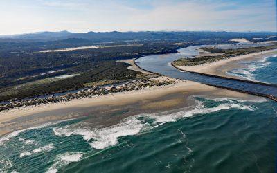
Siuslaw River, Florence
Siuslaw River starts at an elevation of 636 feet (194 m) in the Coast Range and flows generally west-northwest for 110 miles (177 km) to the Pacific Ocean at Florence, draining a watershed of 494,720 acres (200,206 ha), about 53 miles (85 km) west of Eugene and 43 miles (69 km) south of Newport, Oregon.
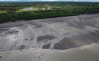
Corea Creek, Clam Gulch
Corea Creek drains a fen at an elevation of 200 feet (60 m) on the Kenai Peninsula and flows generally southwest for 2.4 miles (4 km) to the eastern shore of Cook Inlet and the site of a historic shipwreck, about 37 miles (60 km) north of Homer and 5 miles (8 km) south-southwest of Clam Gulch, Alaska.
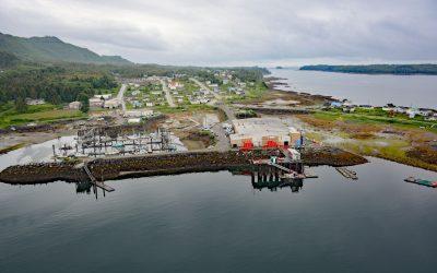
Lax Kw’alaams, Port Simpson
Lax Kw’alaams is a Tsimshian community on Port Simpson, an embayment on the eastern coast of Chatham Sound between Flewin Point to the north and Finlayson Island to the south, about 76 miles (123 km) southeast of Ketchikan, and 18 miles (29 km) north-northwest of Prince Rupert, British Columbia.
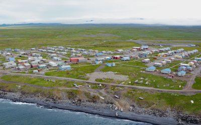
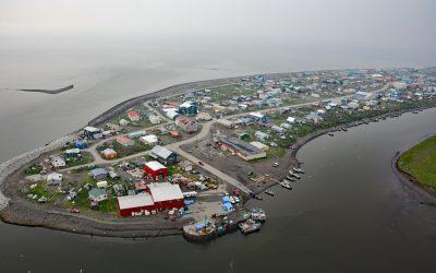
Savoonga, Saint Lawrence Island
Savoonga is a Siberian Yupik community situated on the north flank of the Kookooligit Mountains at Savoonga Point on the north coast of Saint Lawrence Island in the Bering Sea, about 164 miles (265 km) southwest of Nome and 39 miles (63 km) east of Gambell, Alaska.
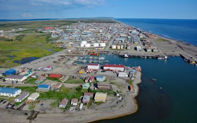
Nome, Norton Sound
Nome is a community at the mouth of the Snake River on the south coast of the Seward Peninsula on Norton Sound, about 289 miles (466 km) northwest of Bethel and 185 miles (298 km) southwest of Kotzebue, Alaska.

Año Nuevo Island, Año Nuevo State Park
Año Nuevo Island is the site of a historic light tower and fog signal on about 9 acres (3.6 ha) and separated from Point Año Nuevo by a shallow channel encompassed by Año Nuevo State Park, about 21 miles (34 km) northwest of Santa Cruz and 11 miles (18 km) south-southeast of Pescadero, California.

Safety Sound, Nome-Council Highway
Safety Sound is a lagoon along the Nome-Council Highway, formed by barrier beaches with elevations up to 14 feet (4.2 m), which extends 15 miles (24 km) along the north coast of Norton Sound between Cape Nome to the west and the Solomon River to the east, about 52 miles (84 km) west-southwest of Golovin and 20 miles (32 km) east of Nome, Alaska.
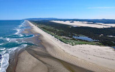
Siltcoos River, Oregon Coastal Dunes
Siltcoos River begins at the outlet of Siltcoos Lake and meanders generally west for 3 miles (4.8 km) through the Oregon Coastal Dunes to the Pacific Ocean, about 8 miles (13 km) south of Florence and 13 miles (21 km) north of Reedsport, Oregon.
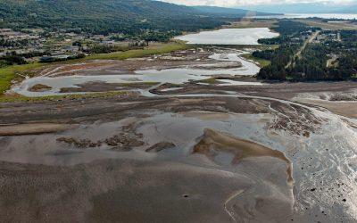
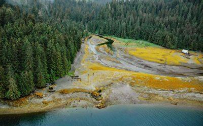
Beluga Slough, Bishops Beach
Beluga Slough is formed by Bishops Beach and is the tidal estuary of a historical stream called Palmer Creek that drained a watershed on the southern flank of Diamond Ridge on the northern shore of Kachemak Bay in the community of Homer, about 121 miles (195 km) southwest of Anchorage and 15 miles (24 km) north-northeast of Seldovia, Alaska.
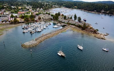
Ganges Harbour, Salt Spring Island
Ganges Harbour is an embayment on the eastern coast of Salt Spring Island that extends 5 miles northwest from Captain Passage, about 35 miles (57 km) southwest of Vancouver, and 15 miles (24 km) north-northwest of Sidney, British Columbia.
Unalakleet, Norton Sound
Unalakleet is an Iñupiaq-Yup’ik community built on an ancient beach ridge with an elevation of 7 feet (2 m) at the mouth of the Unalakleet River on the eastern coast of Norton Sound, about 145 miles (234 km) southeast of Nome, and 36 miles (58 km) south-southeast of Shaktoolik, Alaska.
Chomly, Cholmondeley Sound
Chomly is the site of a historic cannery and settlement situated on the south shore of West Arm Cholmondeley Sound on Prince of Wales Island, 28 miles (45 km) west-southwest of Ketchikan and 20 miles (32 km) east-northeast of Hydaburg, Alaska.