
Alaska
Recent Articles
More Articles

Makarius Bay, Amchitka Island
Makarius Bay is on the southeastern coast of Amchitka Island, the southernmost of the Rat Islands group in the Aleutian Islands of Southwest Alaska, bounded by the Bering Sea to the north and the Pacific Ocean to the south, about 2500 miles (4024 km) north-northwest of Honolulu and 182 miles (293 km) west-southwest of Adak, Alaska.

Dinglestadt Glacier, Kenai Fjords National Park
Dinglestadt Glacier has two land terminating lobes that straddle a watershed divide in the Kenai Mountains, with a minor lobe descending southeast for 4 miles (6 km) from an elevation of roughly 3300 feet (1006 m) to a tidal delta on the western shore of McCarty Glacier in Kenai Fjords National Park, about 44 miles (71 km) south-southwest of Seward and 42 miles (68 km) east of Homer, Alaska.

Boot Bay, Adak Island
Boot Bay is 3 miles (5 km) west of Kagalaska Strait on the south coast of Adak Island, the site of intensive military activity from 1942 to 1997, near the western extent of the Andreanof Islands group of the Aleutian Islands, about 443 miles (713 km) southwest of Unalaska and 11 miles (18 km) southeast of the community of Adak, Alaska.
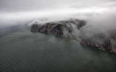
Alokut Point, Cape Lisburne
Alokut Point is a steep promontory with a summit elevation of 1015 feet (310 m) that represents an abrupt change in direction of the Cape Lisburne coastline and forms the northwest terminus of the Lisburne Hills, about 100 miles (160 km) southwest of Point Lay and 39 miles (63 km) north-northeast of Point Hope, Alaska.

McBride Glacier, Muir Inlet
McBride Glacier starts from a series of cirques at elevations near 5500 feet (1676 m) on the southern flank of the Takhinsha Mountains in Glacier Bay National Park and Preserve and flows generally south for roughly 10 miles (16 km) to McBride Inlet which connects to Muir Inlet, about 46 miles (74 km) north-northwest of Gustavus and 25 miles (40 km) southwest of Haines, Alaska.

Bering River, Controller Bay
Bering River starts from a series of ice-marginal lakes and streams draining from the Martin River, Steller, and Bering glaciers, and flows generally south-southwest for 18 miles ( km) to Controller Bay on the Gulf of Alaska, about 63 miles (102 km) west of Cape Yakutaga and 58 miles (94 km) southeast of Cordova, Alaska.

Rabbit Creek, Potter Marsh
Rabbit Creek starts at the outlet of Rabbit Lake, at the base of the west flank of North Yuyanq’ Ch’ex in the Chugach Mountains at an elevation of 3,082 feet (940 m), and flows generally west-northwest for 26 miles (42 km) draining a watershed of 9,152 acres (3,704 ha) to Potter Marsh where it merges with Little Rabbit Creek and discharges into Turnagain Arm, about 13 miles (21 km) northwest of Hope and 10 miles (16 km) south-southeast of downtown Anchorage, Alaska.

Kaigani Point, Long Island
Kaigani Point is at the southwest tip of Long Island between Kaigani Strait to the west and Cordova Bay to the east, about 100 miles (161 km) northwest of Prince Rupert and 56 miles (90 km) southwest of Ketchikan, Alaska.

Skookumchuck, Brownson Island
A skookumchuck is a tidal rapid that occurs at the mouth of an unnamed embayment that nearly bisects Brownson Island which is located on the west shore of Ernest Sound and separated from Etolin Island by Canoe Passage, about 47 miles (75 km) north-northwest of Ketchikan and 36 miles (58 km) south of Wrangell, Alaska.

Point Barrow, Elson Lagoon
Point Barrow is a spit that extends northeast from the mainland for 4 miles (6.4 km) into the Arctic Ocean forming Elson Lagoon to the southeast, about 150 miles (242 km) northwest of Nuiqsut and 9.8 miles (16 km) northeast of Utqiaġvik, Alaska.
About the background graphic
This ‘warming stripe’ graphic is a visual representation of the change in global temperature from 1850 (top) to 2019 (bottom). Each stripe represents the average global temperature for one year. The average temperature from 1971-2000 is set as the boundary between blue and red. The colour scale goes from -0.7°C to +0.7°C. The data are from the UK Met Office HadCRUT4.6 dataset.
Click here for more information about the #warmingstripes.