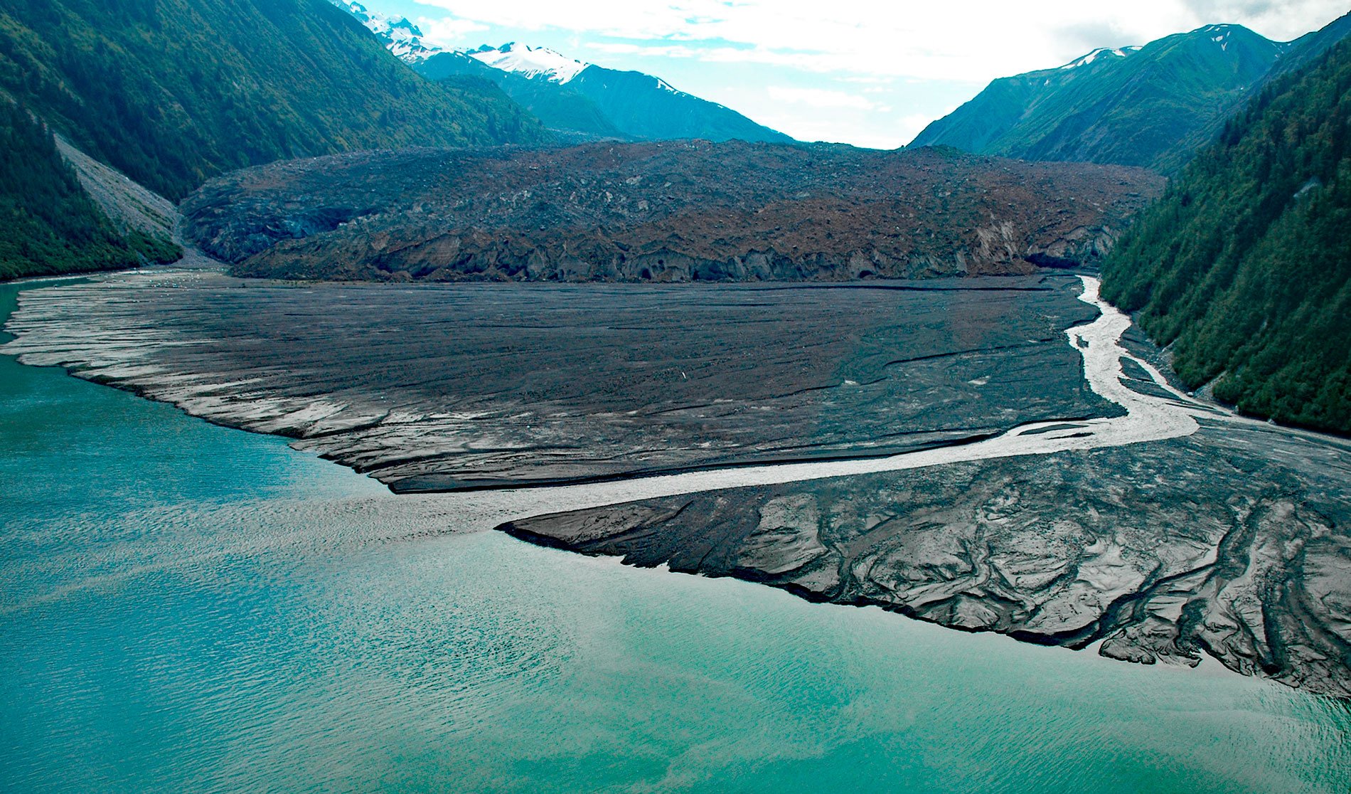
North Crillon Glacier starts from a cirque at an elevation near 6,200 feet (1,890 m) on the west flank of Mount Crillon in the Fairweather Range, and flows generally southwest for 9 miles (15 km) and then makes an abrupt turn to the north and continues for another 3 miles (5 km) to the head of Lituya Bay, about 100 miles (161 km) southeast of Yakutat and 65 miles (105 km) west-northwest of Gustavus, Alaska. Mount Crillon was named in 1786 by the French explorer Jean-François de Galaup, Comte de Lapérouse for Félix de Berton des Balbes de Crillon, the Duke of Crillon. The retreating and thinning glacier has exposed rocks at lower elevations correlated with the Valdez Group of the Southern Margin Composite terrane consisting of metasedimentary and volcanic rocks that developed during the Cretaceous. The bedrock at higher elevations consists of igneous intrusions that formed gabbro during the Miocene and Oligocene. The two arms at the head of Lituya Bay are aligned with the Fairweather Fault represented by a great trench that extends for many miles to the northwest and southeast along the southwest front of the Fairweather Range and the southern part of the Saint Elias Mountains.
Little is known about human settlement in Lituya Bay before the visit of Lapérouse in 1786 who is generally credited as the first European to discover the bay during a trip around the world with the vessels Boussole and Astrolabe. At that time, there were Tlingit people living in and near the bay, and the exploring party recorded observations on the native culture and the plant and animal life in the vicinity. Twenty-one of the crew were subsequently drowned when two of three small boats engaged in a survey of the bay entrance were swept into a tidal bore and wrecked. In 1788, the ship Three Saints entered the bay to claim the land for Russia and to induce the Tlingit to accept Russian rule. In 1796, the Russian ship Orel visited the bay to obtain sea otter furs. Russian censuses of the Tlingit population of Lituya Bay in 1835 was 200, and 590 in 1861. Following the Alaska Purchase, placer mining for gold in the sands along the ocean beach adjacent to the mouth of Lituya Bay was begun by the Americans in 1890 and continued intermittently at least until 1917. From 1917 to about 1940, James Huscroft lived on Cenotaph Island. The lack of permanent occupation of the bay may be related to the series of giant waves that have rushed out from the head of Lituya Bay, leaving sharp trim lines to mark the upper limit of total or near total destruction of the forest along the shores. The dates of 4 known and 1 inferred giant waves, and the maximum altitudes of their trim lines are as follows: July 9, 1958-1,720 feet; October 27, 1936-490 feet; 1899-about 200 feet; 1874-80 feet; and 1853 or 1854-395 feet.
The terminus of North Crillon Glacier was first sketched and sounded from a longboat by crewmen Monneon and Bennizet with Lapérouse. Their map shows the head of Lituya Bay as having a T-shape, with Crillon Inlet extending to the southeast, and Gilbert Inlet to the northwest, with a combined length of about 9 miles (15 km). In 1893, the Canadian Boundary Survey noted that the terminus of North Crillon Glacier had advanced 1.8 to 2.5 miles (3-4 km). From 1926 to 1961, soundings and aerial photos taken by the U.S. Coast and Geodetic Survey for navigation charts show an ice advance continuing for 32 years at an average near 50 to 60 feet (16-19 m) per year. In the summer of 1958 about 1,600 feet (488 m) or one-third of the total width of the front of North Crillon Glacier was tidal at the head of Crillon Inlet. The surface of the glacier near the front was mostly covered by rock debris and was relatively smooth with few crevasses. The outwash-delta is a characteristic feature of many tidal glaciers near equilibrium and averages over 260 feet (80 m) deep and covers about 124 acres (50 ha) at the present-day glacier terminus. The majority of the outwash plain developed in two spasms of accretion from 1933 to 1948, and from 1958 to 1961. Read more here and here. Explore more of North Crillon Glacier and Lituya Bay here:

