
Alaska
Recent Articles
More Articles
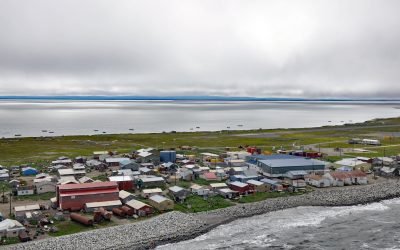
Shishmaref, Sarichef Island
Shishmaref is an Iñupiat community situated on Sarichef Island, a barrier island between Shishmaref Inlet to the south and the Chukchi Sea to the north, on the northern coast of the Seward Peninsula in the Bering Land Bridge National Preserve, about 105 miles (169 km) southwest of Kotzebue and 73 miles (117 km) northeast of Wales, Alaska.
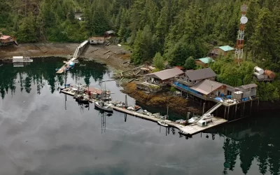
Port Protection, Wooden Wheel Cove
Port Protection is a community situated on Wooden Wheel Cove, at the northern tip of Prince of Wales Island in Tongass National Forest, about 140 miles (225 km) south-southwest of Juneau and 48 miles (77 km) west-northwest of Wrangell, Alaska.
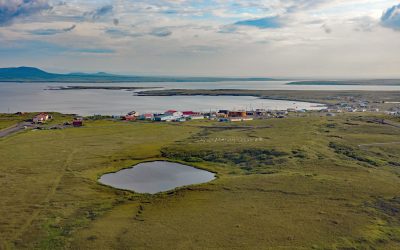
Saint Michael, Norton Sound
Saint Michael is a community situated on the eastern coast of Saint Michael Island, on Saint Michael Bay which is on the southern coast of Norton Sound, about 47 miles (76 km) southwest of Unalakleet and 8 miles (13 km) east-southeast of Stebbins, Alaska.
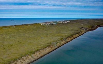
Wainwright, Kuk River
Wainwright is an Iñupiat community on the Chukchi Sea coastline situated on a barrier beach adjacent to Wainwright Inlet and the Kuk River, about 94 miles (151 km) northeast of Point Lay and 86 miles (138 km) southwest of Utqiaġvik, Alaska.
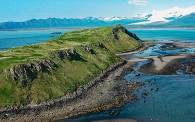
Ninagiak Island, Hallo Bay
Ninagiak Island is about 1.2 miles (2 km) long and 0.2 miles wide, located in Hallo Bay near the mouth of the Ninagiak River on the south coast of the Alaska Peninsula in Shelikof Strait, about 122 miles (197 km) southwest of Homer and 75 miles (121 km) northwest of Kodiak, Alaska.
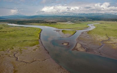
Kamishak River, Akumwarvik Bay
Kamishak River starts from an unnamed lake at an elevation of 2,700 feet (823 m) in a saddle between two peaks in the Aleutian Range and first flows southeast for 10 miles (16 km) and then north-northeast for 28 miles (45 km) through Katmai National Park and Preserve to Akumwarvik Bay, about 104 miles (168 km) southwest of Homer and 93 miles (150 km) east-northeast of King Salmon, Alaska.

Village Islands, Uganik Bay
Village Islands is a group of six large islands and many smaller islets that extend for 1.7 miles (2.7 km) along the western shore of Uganik Bay on the northwestern coast of Kodiak Island, about 147 miles (237 km) southwest of Homer and 42 miles (68 km) due west of Kodiak, Alaska.
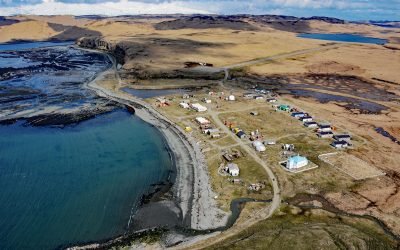
Nikolski, Umnak Island
Nikolski is a community located near the southwest end of Umnak Island, one of the Fox Islands in the eastern Aleutian Islands, about 910 miles (1,468 km) southwest of Anchorage and 116 miles (187 km) southwest of Dutch Harbor, Alaska.
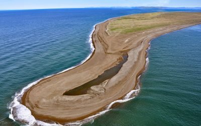
Tigara Peninsula, Chukchi Sea
Tigara Peninsula is a prominent point of land extending west for 13 miles (21 km) from the mouth of the Kukpuk River on the Cape Lisburne peninsula into the Chukchi Sea, about 320 miles (516 km) southwest of Utqiaġvik and 151 miles (244 km) northwest of Kotzebue, Alaska.
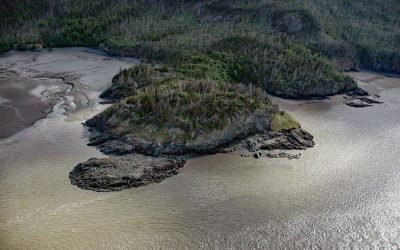
Gull Rock, Turnagain Arm
Gull Rock is a point of land on the south shore of Turnagain Arm on the Kenai Peninsula, about 18 miles (29 km) south-southeast of Anchorage and 6 miles (10 km) northwest of Hope, Alaska.
About the background graphic
This ‘warming stripe’ graphic is a visual representation of the change in global temperature from 1850 (top) to 2019 (bottom). Each stripe represents the average global temperature for one year. The average temperature from 1971-2000 is set as the boundary between blue and red. The colour scale goes from -0.7°C to +0.7°C. The data are from the UK Met Office HadCRUT4.6 dataset.
Click here for more information about the #warmingstripes.