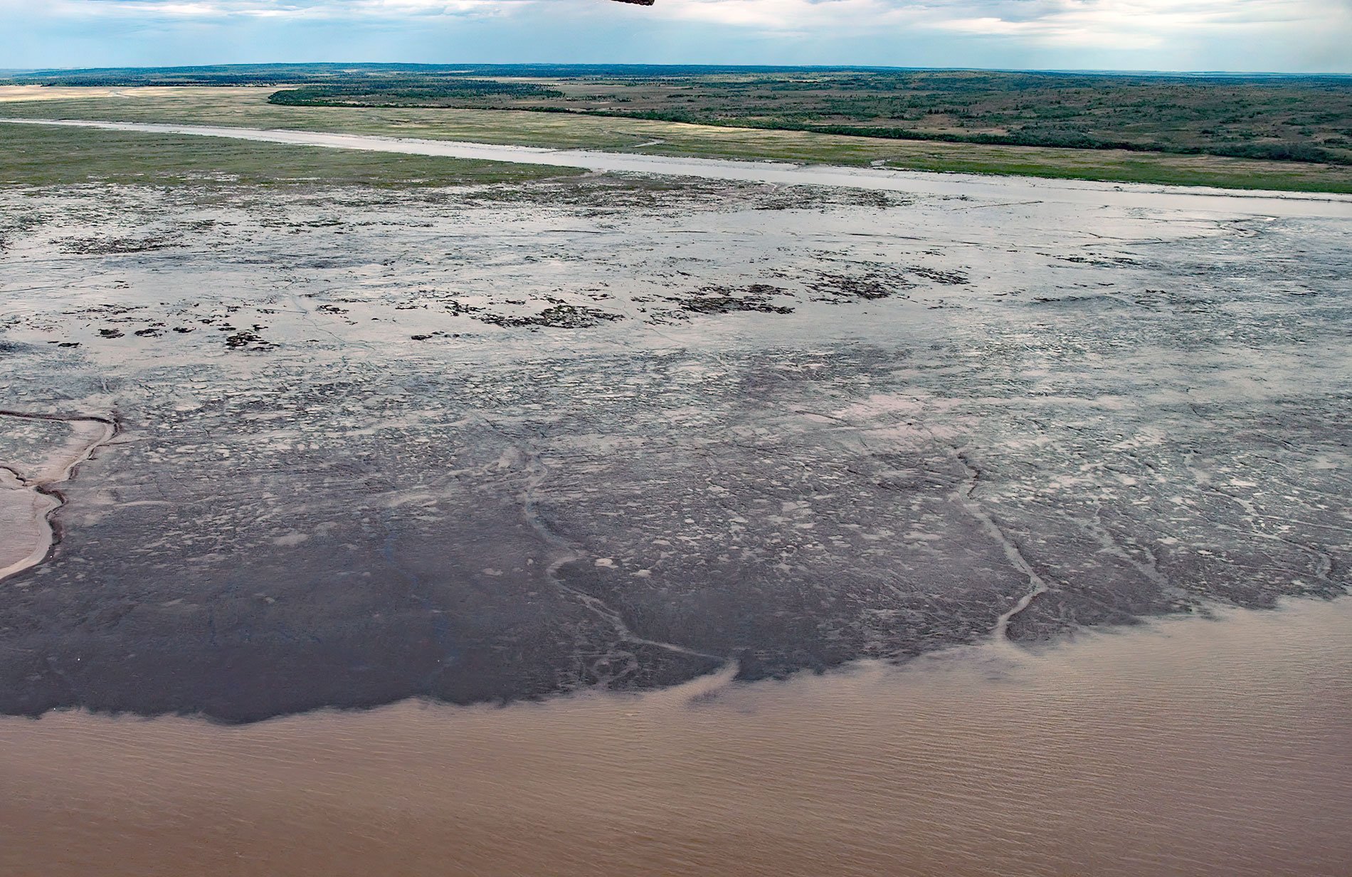
Rolph, or Ralph Slough is a tidal creek in an area of grass meadows and numerous unnamed sloughs that cut through vast mud flats on the left bank near the mouth of the Nushagak River at Nushagak Point, about 55 miles (89 km) west-northwest of Naknek and 6 miles (10 km) south of Dillingham, Alaska. Nushagak Point is a prominent bluff formed by glacial deposits remaining from the last Quaternary glaciation about 115,000 to 11,700 years ago. The mud flats to the north of the point, and surrounding Rolph Slough, have been steadily growing since at least the late 1800s. Rolph Slough is named after a historical cannery located at the head of the slough near the village of Kanulik and where the Moravian mission of Carmel once stood. The site was accessible by large ocean-going vessels but became isolated by mud flats and was eventually abandoned. Nushagak Point marks the transition between the Nushagak River to the north and Nushagak Bay to the south, and also the approximate northern boundary of the Nushagak District, a fisheries regulatory area. All five species of Pacific salmon pass through Nushagak Bay to spawn in the associated watersheds. Chinook salmon appear first, usually in late May or early June, followed by sockeye, the most abundant species in the Nushagak District, which peaks in early July and is the most important for subsistence and commercial uses. Chum salmon begin returning to the watersheds in late June and are usually caught incidentally with Chinook and sockeye. Significant numbers of pink salmon return to Nushagak Bay in even-numbered years during the latter part of July, but they are not usually targeted by commercial or subsistence fisheries. The last to arrive are the coho salmon in early August.
Yup’ik and Athabascan peoples inhabited permanent communities along the Nushagak River in the winter but relocated to inland hunting and trapping camps in the spring. When the salmon runs started in the summer, the people returned to the river to fish, and, in the fall, again relocated to inland hunting and trapping camps. The bluff at Nushagak Point was the site of a historical Yup’ik village called Tahlekuk. The site provided an excellent location for a settlement with a commanding view of the entire bay and anyone approaching, an abundance of fish and beluga whales, and drinking water from a small stream that flows down the bluff at the north end of the site. In 1818, the Russians constructed a trading post at the point called Aleksandrovski Redoubt. A Russian Orthodox mission was established there in 1837, by which time the community was known as Nushagak. The trading post became a place where different Alaska Native groups from the Kuskokwim River, the Alaska Peninsula, and Cook Inlet came to trade and live. The Alaska Purchase transferred the territory to the United States in 1867, and in 1881, the U.S. Army Signal Corps built a weather station at Nushagak. The establishment of a commercial salmon fishery in Bristol Bay in 1884 increased the opportunities to trade as well as opportunities for wage employment. In 1899, the Pacific Steam Whaling Company and the Alaska Fishermen’s Packing Company erected canneries directly in front of the settlement at Nushagak Point, and these facilities had a profound effect on the village.
As more Native people became involved in the commercial fishing industry, communities along the Nushagak River became more sedentary and less seasonally occupied with hunting and trapping. The economic opportunity of the commercial fishery increased the shift in seasonal patterns as more families began to stay at summer camps along the bay to fish for salmon and work for the commercial fishery. In 1916, Father Vasili Kashevarov, who, except for six years, had been the Russian Orthodox priest at Nushagak since 1896, died and was not replaced. The influenza epidemic of 1918-1919 caused severe mortality at Nushagak as it did at other villages in the region. In the 1920s and 1930s, Dillingham grew as the commercial center of the Nushagak fishery, and the two salmon canneries at Nushagak were abandoned. Between 1920 and 1940, the scattered fish camps and villages began to coalesce around the existing missionary churches, schools, stores, and canneries. By 1964, only two families maintained homes at Nushagak; however, fish camps persisted, and today many set-net cabins and subsistence camps are occupied during the summer salmon runs. Read more here and here. Explore more of Rolph Slough and Nushagak Point here:

