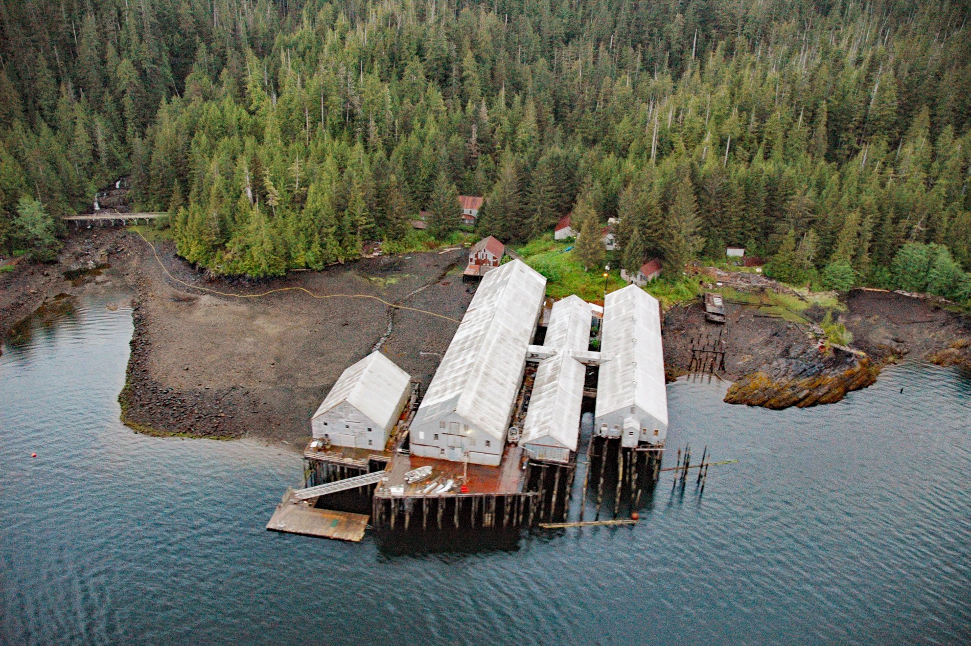
George Inlet is a deglaciated fjord that extends generally north into Revillagigedo Island for about 19 miles (31 km) from Revillagigedo Channel to Salt Lagoon, with a historical cannery situated on the western shore, about 87 miles (140 km) northwest of Prince Rupert and 9 miles (15 km) east-northeast of Ketchikan, Alaska. George Inlet was named in 1880 by the U.S. Coast and Geodetic Survey for Captain W.E. George, a local maritime pilot who reputedly sketched the first navigational chart of Revillagigedo Channel and Tongass Narrows. Revillagigedo Island is separated from the Alaska mainland to the east by Behm Canal, from Prince of Wales Island to the west by the Clarence Strait, and from Annette Island to the south by Revillagigedo Channel and Nichols Passage. The landscape of Revillagigedo Island is the result of complex interactions among tectonic terranes that accreted to the western margin of the North American Plate and were subsequently heavily glaciated. Most of the island consists of rocks in the Taku terrane, which is separated from the outermost Alexander terrane by a belt of rocks called the Gravina sequence. The Taku terrane consists of Late Paleozoic and Early Mesozoic metamorphosed basalt, marble, and argillite intruded by magma in the Cretaceous that formed granodiorite and quartz diorite. A fault zone that runs underneath the cannery in George Inlet separates these rocks from the Gravina sequence that is comprised of Late Jurassic and Early Cretaceous metavolcanic and metasedimentary strata that form a composite over 49,00 feet (15,000 m) thick and records intermittent arc volcanism along the eastern edge of the Alexander terrane. A massive gabbro pluton is situated just south of the cannery site. Another fault zone separates the Gravina sequence from the Alexander terrane which consists of Early Paleozoic metavolcanic and metasedimentary rocks intruded by diorite plutons. Subsequent erosion and deposition by continental and alpine glaciers during the Pleistocene between 2 million and 10,000 years ago and by alpine glaciation during Holocene time have modified the topography.
Revillagigedo Island is the traditional territory of the Tlingit people, and by the 19th century was divided between the Saanyaa Ḵwáan and Taantʼa Ḵwáan tribes or clans. The first European who documented sighting the island was Spanish explorer Jacinto Caamaño in 1792. The following year the island was named by British Captain George Vancouver for Juan Vicente de Güemes, 2nd Count of Revillagigedo, then viceroy of New Spain. Russian fur traders expanded their territory eastward and in 1802 established a fort near present-day Sitka, and in 1804, the Russian-America Company moved its headquarters from Kodiak to Sitka. By the mid-1850s, during the Crimean War, Russia was suffering various encroachments in their colonies and Alexander II, the Emperor of Russia, feared that England would seize Russian America. The combined effect was to sell the Russian America colonies to the United States in 1867. Cape Fox and Tongass villages had existed for several centuries in the lower portion of Southeast Alaska but life in those villages began to change in the 1800s when contact was made with traders and explorers. Cape Fox village had a population of 100 people and was located about 4 miles (6 km) south of Boca de Quadra Inlet, approximately 34 miles (55 km) southeast of Ketchikan. The village of Tongass had a population of 700 people and was located on Tongass Island about 56 miles (90 km) southeast of Ketchikan near the United States border with Canadia. In 1868, the United States established Fort Tongass and stationed a small military garrison to act as the customs port for the newly purchased territory. In 1894, residents of Cape Fox and Tongass villages chose to leave their ancestral homes and move into a newly created village called Saxman just south of Ketchikan in order to have access to a government school and to missionaries.
In 1878, the first salmon cannery in Alaska was built at the site of a fish saltery in Klawock, and over the following 50 years, salmon fishing and canning were the primary economic engine in Southeast Alaska. During the years 1878-1949, 134 canneries were built, 65 burned and were not rebuilt, five burned and were rebuilt, ten were moved to other sites, and some operations were consolidated until there were 37 operating plants in Southeast Alaska in 1949. The George Inlet Packing Company built a cannery in 1914 near Beaver Falls on George Inlet. The cannery was leased in 1926 and then purchased by Libby, McNeill & Libby in 1928. Libby, McNeill & Libby was a significant player in the Alaska seafood industry in the early 20th century. The brothers Arthur and Charles Libby and Archibald McNeill started the business in 1868 in Chicago and soon perfected the canning of meat, winning a gold medal at the 1878 Paris World’s Fair, called an Exposition Universelle at the time. The company entered the Alaska salmon canning business in 1912 with a cannery in Kenai and soon had canneries in all Alaska fishing districts. The Libby cannery in George Inlet operated until 1958. In 1959, Columbia River Packers Association and Wards Cove Packing combined to become Columbia Wards Fisheries and purchased all the Libby canneries in Alaska. The facilities at George Inlet were closed shortly thereafter. Cape Fox Corporation is the Alaska Native corporation for the Village of Saxman as a result of the Alaska Native Claims Settlement Act in 1971. In 1996, the George Inlet cannery reopened as a historic landmark owned and operated by Cape Fox Corporation with guided tours of the early cannery operations and equipment. Read more here and here. Explore more of Libby Cannery and George Inlet here:

