Beaches
Recent Articles
More Articles

SS Palo Alto, Seacliff Beach
SS Palo Alto is a shipwreck that now serves as an artificial reef for marine life at Seacliff State Beach on the northern coast of Monterey Bay, about 6.4 miles (10.3 km) east of Santa Cruz and 0.9 miles (1.5 km) southwest of Aptos, California.

New Carissa, North Spit
New Carissa was a freighter 639 feet (195 m) in length that grounded on North Spit in 1999, causing an oil spill about 5 miles (8 km) northwest of Coos Bay and 4 miles (6.5 km) west of the community of North Bend, Oregon.

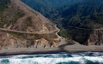
Red River, Lake Clark National Park and Preserve
Red River starts from the terminus of Red Glacier on the eastern flank of Mount Iliamna and flows southeast for 7 miles (11.3 km) through Lake Clark National Park and Preserve to the western shore of Cook Inlet, about 126 miles (203 km) southwest of Anchorage and 48 miles (77 km) northwest of Homer, Alaska.

USS Milwaukee, Samoa Beach
The USS Milwaukee was a U.S. Navy cruiser that in 1917 was overcome by wind and waves close to shore and was beached at the community of Samoa on the northern peninsula of Humboldt Bay, about 7 miles (11 km) southwest of Arcata and 1.5 miles (2.4 km) west of Eureka, California.
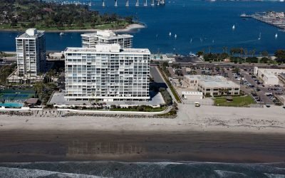
SS Monte Carlo, Coronado Shores
The shipwreck of the SS Monte Carlo is occasionally exposed by shifting sands during the winter on Coronado Shores, a wide sandy beach also known as South Beach, on Coronado Island about 4.5 miles (7.3 km) east of Point Loma and 3.4 miles (5.5 km) south of San Diego, California.
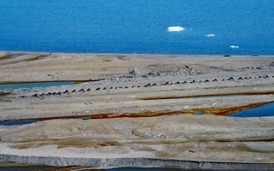
Cross Island, Beaufort Sea
Cross Island is an Arctic barrier island, about 2 miles (3.2 km) long, located between McClure Islands to the southeast and Midway Islands to the west on the Beaufort Sea coast, about 74 miles (119 km) northeast of Nuiqsut and 24 miles (40 km) north-northeast of Deadhorse, Alaska.

Pudding Creek, Fort Bragg
Pudding Creek is a small coastal watershed in Mendocino County that drains 18 square miles (4,662 ha) before entering the Pacific Ocean about 2.4 miles (3.9 km) southwest of Cleone and 1 mile (1.6 km) north of Fort Bragg, California.
Blues Beach, Chadbourne Gulch
Chadbourne Gulch is a small stream that flows to the Pacific Ocean at Blues Beach between Bell Point to the north and Bruhel Point to the south, about 12 miles (19 km) north of Fort Bragg and 1.8 miles (2.9 km) south of Westport, California.
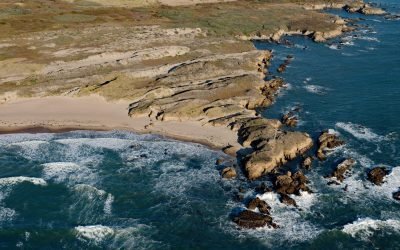
Franklin Point, Año Nuevo State Reserve
Franklin Point is located in the Año Nuevo State Reserve, 7.3 miles (12 km) south-southeast of Pescadero and 22 miles (35 km) northwest of Santa Cruz, California.

Minter, Henderson Bay
Minter is a community on the northwestern shore of Henderson Bay, at the head of Carr Inlet in South Puget Sound, about 24 miles (39 km) southwest of Seattle and 5.5 miles (9 km) northwest of Gig Harbor, Washington.
About the background graphic
This ‘warming stripe’ graphic is a visual representation of the change in global temperature from 1850 (top) to 2019 (bottom). Each stripe represents the average global temperature for one year. The average temperature from 1971-2000 is set as the boundary between blue and red. The colour scale goes from -0.7°C to +0.7°C. The data are from the UK Met Office HadCRUT4.6 dataset.
Click here for more information about the #warmingstripes.