Beaches
Recent Articles
More Articles
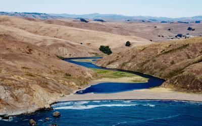
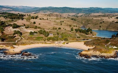
Estero de San Antonio, Bodega Bay
Estero de San Antonio is a small coastal lagoon formed by a sand bar that dams Stemple Creek, a stream that starts in the hills of Marin and Sonoma Counties and flows generally west to Bodega Bay near the mouth of Tomales Bay, 5.75 miles (9 km) southeast of the community of Bodega Bay and 1.5 mi (2.4 km) northwest of Dillon Beach, California.
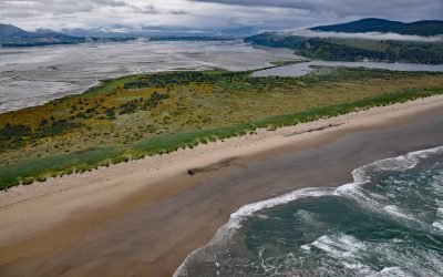
Bayocean, Tillamook Bay
Bayocean was a planned resort community founded in 1906 on a sand spit 4 miles, (6.5 km) long and 0.5 miles (0.8 km) wide, that separates Tillamook Bay from the Pacific Ocean, about 63 miles (102 km) west of Portland and 7 miles (11 km) northwest of Tillamook, Oregon.
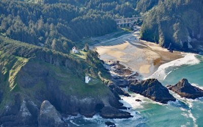
Heceta Head Lighthouse, Heceta Head
Heceta Head Lighthouse is at an elevation of 205 feet (62 m) on the Heceta headland, about 13 miles (21 km) north of Florence, and 13 miles (21 km) south of Yachats, Oregon.
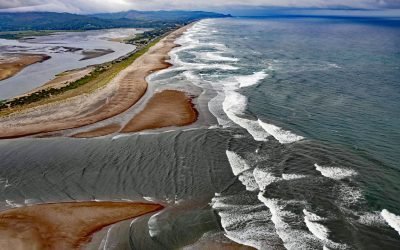
Salishan Spit, Lincoln City
Salishan Spit separates the Pacific Ocean from Siletz Bay and is located 2.5 miles (4 km) south of Lincoln City and 3 miles (4.8 km) north of Gleneden Beach, Oregon.
Arroyo de Los Frijoles, Bean Hollow State Park
Arroyo de Los Frijoles and Pebble Beach are in Bean Hollow State Park, located 17.5 miles (28.2 km) south of Half Moon Bay and 3 miles (4.8 km) south of Pescadero, California.
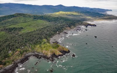
Hubbard Mound, Otter Point
The Hubbard Mound is a coastal headland and the location of a historical beach placer mining prospect near the community of Nesika Beach, 1 mile (1.6 km) north of Otter Point and about 6 miles (9.7 km) north of Gold Beach, Oregon.
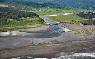
Pistol River, Pistol River State Scenic Viewpoint
Pistol River flows generally southwest for 21 miles (34 km) to the Pistol River State Scenic Viewpoint overlooking the Pacific Ocean near the community of Pistol River, about 17 miles (27 km) north-northwest of Brookings and 10 miles (16 km) south of Gold Beach, Oregon.
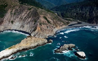
Cottoneva Creek, Rockport Bay
Cottoneva Creek originates at an elevation of approximately 1,300 feet (400 m) in the Coast Range and flows generally south-southwest for 7 miles (11 km) to Rockport Bay, about 11 miles (18 km) southwest of Leggett and 7 miles (11 km) north-northwest of Westport, California.
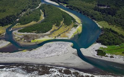
Queets River, Olympic National Park
The Queets River flows approximately 53 miles (85 km), mostly through Olympic National Park, to the Pacific Ocean, about 60 miles (96 km) southwest of Aberdeen and 5 miles (8 km) south of Kalaloch, Washington.
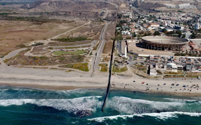
Border Field State Park, Playas de Tijuana
Border Field State Park is part of the Tijuana River National Estuarine Research Reserve, adjacent to the urban neighborhood of Playas de Tijuana, Mexico, located about 12 miles (19 km) south of San Diego, it lies within the city limits of Imperial Beach, California.
About the background graphic
This ‘warming stripe’ graphic is a visual representation of the change in global temperature from 1850 (top) to 2019 (bottom). Each stripe represents the average global temperature for one year. The average temperature from 1971-2000 is set as the boundary between blue and red. The colour scale goes from -0.7°C to +0.7°C. The data are from the UK Met Office HadCRUT4.6 dataset.
Click here for more information about the #warmingstripes.