Beaches
Recent Articles
More Articles
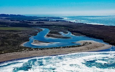
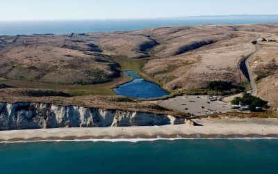
Garcia River, Manchester Beach
The Garcia River flows generally northwest for 44 miles (71 km) to Manchester Beach, north of Point Arena Lighthouse and at Manchester State Park, about 34 miles (55 km) south of Fort Bragg and 4 miles (6.4 km) northwest of the community of Point Arena, California.
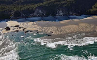
Hobbit Beach, Heceta Head
Hobbit Beach is a secluded strand located just north of Heceta Head, about 13 miles (21 km) north of Florence and 12.5 miles (20 km) south of Yachats, Oregon.
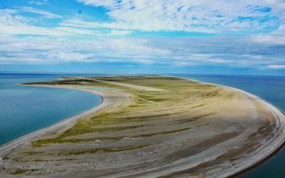
Point Spencer, Port Clarence
Point Spencer is the north end of a spit about 19 miles (31 km) long, between the Bering Sea and Port Clarence, on the Seward Peninsula, about 14 miles (23 km) west of Teller, Alaska.
Willows Beach, Oak Bay
Willows Beach is a beachfront neighborhood between Bowker Creek and Cattle Point at the head of Oak Bay in Victoria, British Columbia.
Drakes Beach, Point Reyes National Seashore
Drakes Beach is a remote stretch of sand located in Point Reyes National Seashore at the head of Drakes Bay and adjacent to the Point Reyes State Marine Reserve, about 12 miles (19 km) southwest of Inverness, California.
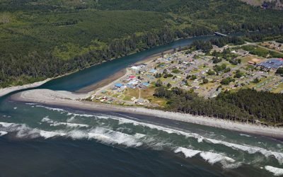
Taholah, Quinault River
Taholah is a community located at the mouth of the Quinault River on lands of the Quinault Indian Nation, about 9 miles (14 km) north of Moclips and 41 miles (66 km) north of Hoquiam on the Olympic Peninsula, Washington.
Mattole River, Lost Coast
The Mattole River flows approximately 62 miles (100 km) through the King Range to the Lost Coast at the Punta Gorda State Marine Reserve, about 10 miles (16 km) south of Cape Mendocino and 4 miles (6.4 km) west-southwest of Petrolia, California.
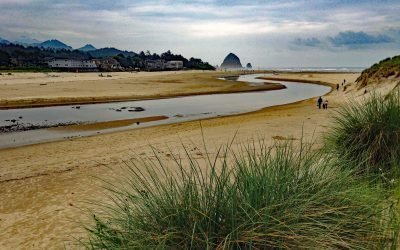
Ecola Creek, Cannon Beach
Ecola Creek flows into the Pacific Ocean at the northern edge of Cannon Beach, a small resort community approximately 30 miles (48 km) north of Tillamook and 8 miles (12 km) south of Seaside, Oregon.
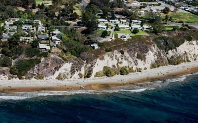
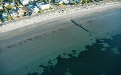
Santa Barbara Lighthouse, Santa Barbara
The Santa Barbara Lighthouse is located between the East Mesa and West Mesa neighborhoods, about 2 miles (3 km) west of Santa Barbara Harbor, in the City of Santa Barbara, California.
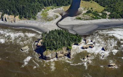
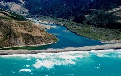
Tunnel Island, Raft River
The Raft River, a stream located entirely within the Quinault Indian Reservation on the Olympic Peninsula, flows into the Pacific Ocean at Tunnel Island, approximately 9 miles (14 km) north of Taholah, Washington.
About the background graphic
This ‘warming stripe’ graphic is a visual representation of the change in global temperature from 1850 (top) to 2019 (bottom). Each stripe represents the average global temperature for one year. The average temperature from 1971-2000 is set as the boundary between blue and red. The colour scale goes from -0.7°C to +0.7°C. The data are from the UK Met Office HadCRUT4.6 dataset.
Click here for more information about the #warmingstripes.