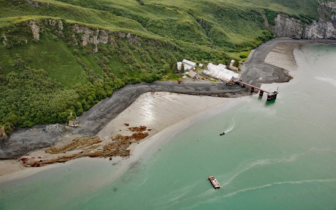
by CoastView | Dec 28, 2025 | 2025, Alaska, Biodiversity, Canneries, December 2025, Embayments, Historical, Islands, Natural History
Listen to the article here https://coastview.org/wp-content/uploads/2025/12/SnugHarbor.mp3 Snug Harbor is a historical cannery located along a bight on the west coast of Chisik Island, at the southern end of Tuxedni Channel, on the western shore of Cook Inlet, about...
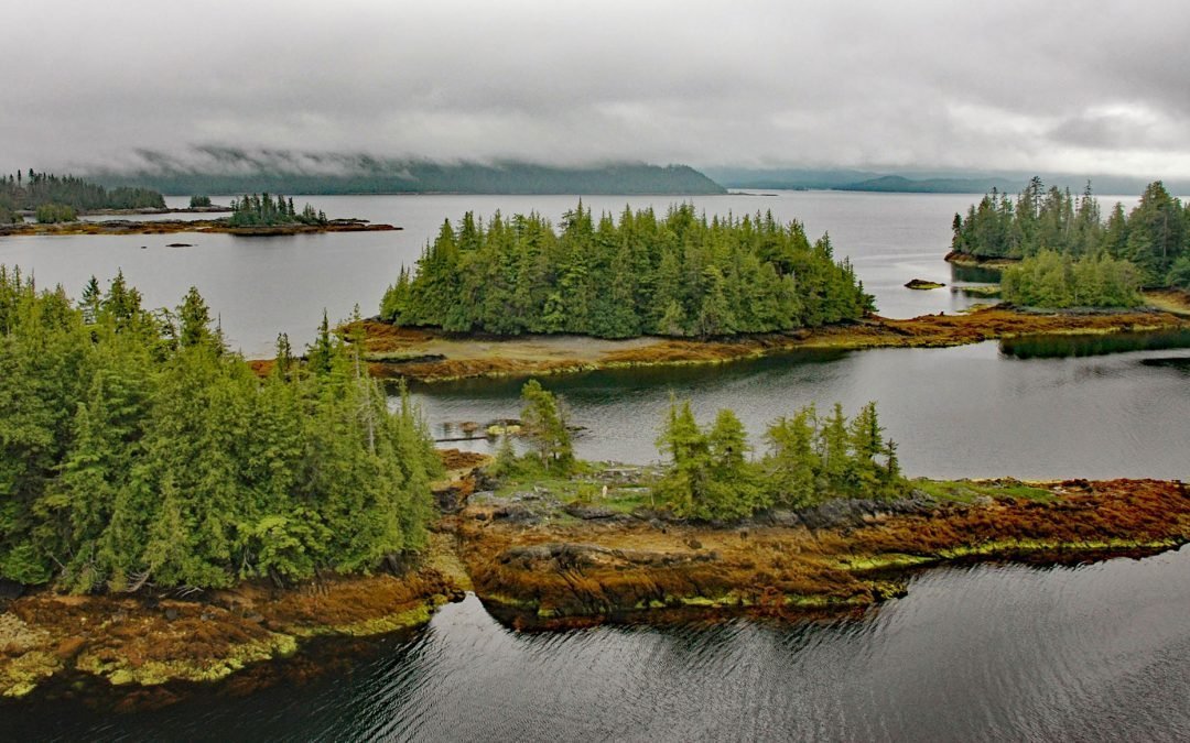
by CoastView | Dec 15, 2025 | 2025, Alaska, Biodiversity, Coastal Features, December 2025, Embayments, Islands
Listen to the article here https://coastview.org/wp-content/uploads/2025/12/CocoHarbor.mp3 Coco Harbor is an estuary that extends 3 miles west from Baldy Bay, off Tlevak Strait on the east coast of Dall Island, Alaska. Baldy Bay was first reported by Edmund F. Dickins...

by CoastView | Dec 11, 2025 | 2025, Alaska, Coastal Features, December 2025, Islands, Kachemak, Natural History
Listen to the article here https://coastview.org/wp-content/uploads/2025/12/HeskethIsland.mp3 Hesketh Island is approximately 1.2 miles (1.9 km) long and is situated on the southern shore of Kachemak Bay, about 9.5 miles (15 km) south of Homer and 8 miles (13 km)...

by CoastView | Dec 9, 2025 | 2025, Alaska, Coastal Features, December 2025, Islands, Land Use, Natural History
Listen to the article here https://coastview.org/wp-content/uploads/2025/12/Ugamak.mp3 Ugamak Island is approximately 5.2 miles (8.4 km) long and located in the Krenitzen Islands group, about 75 miles (121 km) northeast of Unalaska and 36 miles (58 km) east of Akutan,...
by CoastView | Dec 6, 2025 | 2025, Alaska, Biodiversity, Coastal Features, December 2025, Embayments, Historical, Islands, Land Use, Natural History
Listen to the article here https://coastview.org/wp-content/uploads/2025/12/PortCamden.mp3 Port Camden is an embayment on the northeast coast of Kuiu Island, approximately 36 miles (58 km) south-southwest of Petersburg and 61 miles (98 km) northwest of Wrangell,...
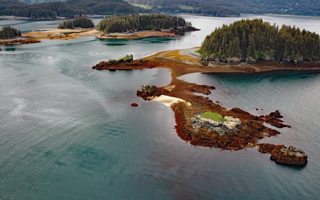
by CoastView | Dec 4, 2025 | 2025, Alaska, Biodiversity, Coastal Features, December 2025, Embayments, Islands, Kachemak, Natural History
Listen to the article here https://coastview.org/wp-content/uploads/2025/12/HerringIslands.mp3 The Herring Islands lie at the entrance to Tutka Bay on the southern shore of Kachemak Bay, about 11 miles (18 km) south of Homer and 8 miles (13 km) northeast of Seldovia,...