Communities
Recent Articles
More Articles
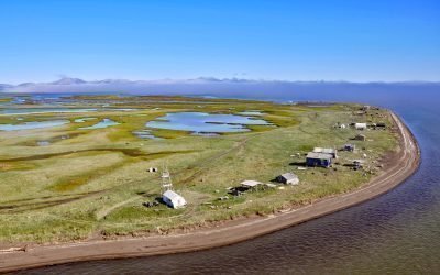
Sheshalik Spit, Kotzebue Sound
Sheshalik is a spit about 6 miles (10 km) long consisting of accretionary beach ridges with some lagoons situated in Cape Krusenstern National Monument on Kotzebue Sound, about 40 miles (64 km) south of Noatak and 10 miles (16 km) northwest of Kotzebue, Alaska.
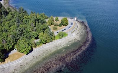
Brockton Point, Stanley Park
Brockton Point is a prominent peninsula in Stanley Park, located on the southern coast of Burrard Inlet, about 19 miles (30 km) north of Tsawwassen and 2.6 miles (4 km) southeast of West Vancouver, British Columbia.
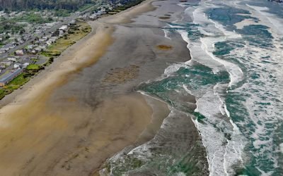
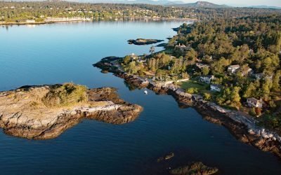
Twin Rocks, Rockaway Beach
Twin Rocks is a set of sea stacks situated about 0.5 miles (0.8 km) offshore and 1 mile (1.6 km) south-southwest of Rockaway Beach, a seaside community on a continuous strand that extends for 6 miles (10 km) from the mouth of the Nehalem River to the north and Tillamook Bay to the south, about 4 miles (6 km) south-southwest of Nedonna Beach and 2 miles (3.2 km) north-northwest of Barview, Oregon.
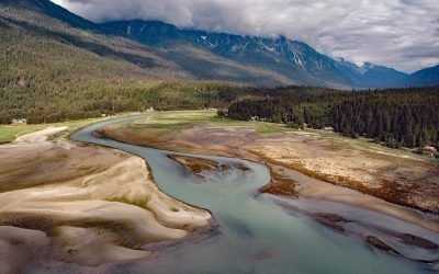
Oona River, Porcher Island
Oona River is a community situated at the mouth of the namesake river that drains a watershed on the southeastern shore of Porcher Island, approximately 25 miles (40 km) south of Prince Rupert and 13 miles (21 km) north-northeast of Kitkatla, British Columbia.
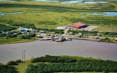
Alakanuk, Yukon River Delta
Alakanuk is a Yup’ik community located at the eastern entrance of Alakanuk Pass, a major distributary channel of the Yukon River, approximately 162 miles (261 km) northwest of Bethel and 8 miles (13 km) southwest of Emmonak, Alaska.

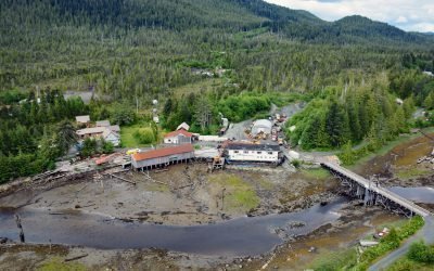
Lindenberger Cannery, Craig Island
The Lindenberger Packing Company is a historical salmon cannery on Craig Island, located in the present-day community of Craig, about 58 miles (93 km) west-northwest of Ketchikan and 6 miles (10 km) south-southwest of Klawock, Alaska.
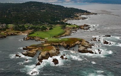
Cypress Point, Monterey Peninsula
Cypress Point is the westernmost headland on the Monterey Peninsula, about 4.5 miles (7.3 km) southwest of Monterey and 3.5 miles (5.5 km) northwest of Carmel, California.
Chilkoot, Lutak Inlet
Chilkoot is a historical Tlingit village located on the Chilkoot River between Lutak Inlet to the south and Chilkoot Lake to the north, about 83 miles (134 km) north-northwest of Juneau and 12 miles (19 km) southwest of Skagway, Alaska.
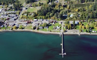
Allyn, Case Inlet
Allyn is a community at the mouth of Sherwood Creek on the western shore of Case Inlet in the North Bay region of South Puget Sound, about 21 miles (34 km) northwest of Tacoma and 17 miles (27 km) northeast of Shelton, Washington.
Flower Island, Ten Mile Point
Flower Island is a small, uninhabited islet located about 250 feet (80 m) offshore from the southern end of Ten Mile Point, roughly 15 miles (24 km) south-southeast of Sidney and 4 miles (6 km) east-northeast of Victoria, British Columbia.
About the background graphic
This ‘warming stripe’ graphic is a visual representation of the change in global temperature from 1850 (top) to 2019 (bottom). Each stripe represents the average global temperature for one year. The average temperature from 1971-2000 is set as the boundary between blue and red. The colour scale goes from -0.7°C to +0.7°C. The data are from the UK Met Office HadCRUT4.6 dataset.
Click here for more information about the #warmingstripes.