Communities
Recent Articles
More Articles

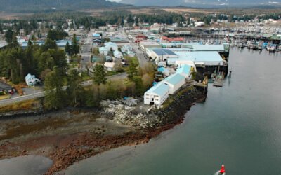
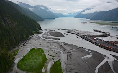
Wrangell, Wrangell Island
Wrangell is a community situated at the mouth of the Stikine River on the north coast of Wrangell Island in the Alexander Archipelago of Southeast Alaska, about 83 miles (134 km) north-northwest of Ketchikan and 33 miles (53 km) southeast of Petersburg, Alaska.
La Push, Quillayute River
La Push is the traditional community of the Quileute people situated at the mouth of the Quillayute River within the Quileute Indian Reservation and surrounded by the coastal strip of Olympic National Park, about 32 miles (51 km) south of Neah Bay and 12 miles (19 km) west-southwest of Forks, Washington.
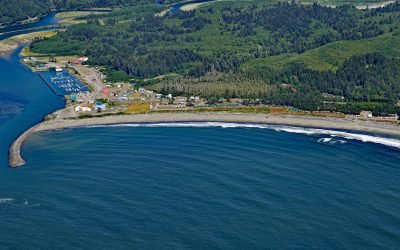
Petersburg, Mitkof Island
Petersburg is a community on the north end of Mitkof Island where the northern entrance to Wrangell Narrows meets Frederick Sound, about 116 miles (187 km) southeast of Juneau and 32 miles (52 km) northwest of Wrangell, Alaska.
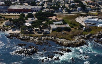
Hopkins Marine Station, Point Cabrillo
Hopkins Marine Station is a laboratory of Stanford University located on Point Cabrillo in Monterey Bay and adjacent to the Monterey Bay Aquarium in Pacific Grove, about 14 miles (23 km) south-southwest of Moss Landing and 1.5 miles (2.4 km) north-northwest of Monterey, California.
Anangula Island, Bering Sea
Anangula Island, also known as Ananiuliak Island, is situated in the Bering Sea and is one of the Fox Islands in the eastern Aleutian Islands, separated from Umnak Island by a channel about 0.93 miles (1.50 km) wide, about 116 miles (187 km) southwest of Dutch Harbor and 4.6 miles (7.4 km) north-northwest of Nikolski, Alaska.
Portland Canal, International Boundary
Portland Canal is a deglaciated fjord that extends south-southwest for 65 miles (105 km) from the community of Stewart in the north to the head of Portland Inlet in the south, forming part of the international boundary between Southeast Alaska and British Columbia, Canada.
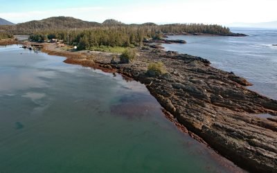
Port Alexander, Baranof Island
Port Alexander is an embayment and small community on the southern tip of Baranof Island in the Alexander Archipelago of Southeast Alaska, about 133 miles (214 km) northwest of Ketchikan and 62 miles (100 km) south-southeast of Sitka, Alaska.
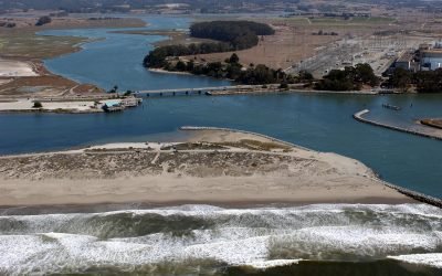
Elkhorn Slough, Moss Landing
Elkhorn Slough is an estuary about 7 miles (11 km) long that connects with Monterey Bay at the community of Moss Landing, about 17 miles (27 km) southeast of Santa Cruz and 16 miles (26 km) north-northeast of Monterey, California.
Kashega, Unalaska Island
Kashega is an abandoned Unangan Aleut village on the Bering Sea coast of Unalaska Island, situated on a spit between Brennan Lake and Kashega Bay, about 79 miles (127 km) northeast of Nikolski and 39 miles (63 km) southwest of Dutch Harbor, Alaska.
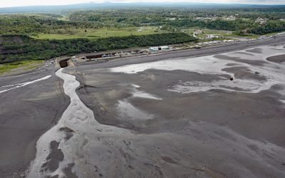
Ninilchik, Kenai Peninsula
Ninilchik is a community at Cape Ninilchik at the mouth of the Ninilchik River on the Kenai Peninsula, on the eastern shore of Cook Inlet, about 99 miles (160 km) southwest of Anchorage and 30 miles (48 km) north-northwest of Homer, Alaska.
About the background graphic
This ‘warming stripe’ graphic is a visual representation of the change in global temperature from 1850 (top) to 2019 (bottom). Each stripe represents the average global temperature for one year. The average temperature from 1971-2000 is set as the boundary between blue and red. The colour scale goes from -0.7°C to +0.7°C. The data are from the UK Met Office HadCRUT4.6 dataset.
Click here for more information about the #warmingstripes.