Communities
Recent Articles
More Articles

Minter, Henderson Bay
Minter is a community on the northwestern shore of Henderson Bay, at the head of Carr Inlet in South Puget Sound, about 24 miles (39 km) southwest of Seattle and 5.5 miles (9 km) northwest of Gig Harbor, Washington.
Bamfield, Barkley Sound
Bamfield is a community located on Barkley Sound on the west coast of Vancouver Island, 32 miles (52 km) southwest of Port Alberni and 20 miles (32 km) southeast of Ucluelet, British Columbia.

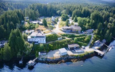
Funter Bay, Admiralty Island
Funter Bay is located on the west coast of the Mansfield Peninsula on Admiralty Island, approximately 32 miles (52 km) southeast of Gustavus and 14 miles (23 km) southwest of Juneau, Alaska.
Ocean Roar, Walker Creek
Ocean Roar is a small group of buildings at the mouth of Walker Creek, and formerly a community on the North Pacific Coast Railroad, about 2.3 miles (3.7 km) southwest of Tomales and 16 miles (26 km) west of Petaluma, California.

Depoe Bay, Depoe Creek
Depoe Bay is a community situated on a small natural embayment of the same name, forming the estuary for Depoe Creek, located about 11 miles (18 km) south-southwest of Lincoln City and 12 miles (19 km) north of Newport, Oregon.
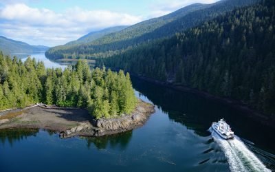
Tuck Narrows, Tuck Inlet
Tuck Narrows is located at the head of Tuck Inlet, about 6 miles (9.7 km) northeast of Prince Rupert, British Columbia.
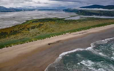
Bayocean, Tillamook Bay
Bayocean was a planned resort community founded in 1906 on a sand spit 4 miles, (6.5 km) long and 0.5 miles (0.8 km) wide, that separates Tillamook Bay from the Pacific Ocean, about 63 miles (102 km) west of Portland and 7 miles (11 km) northwest of Tillamook, Oregon.

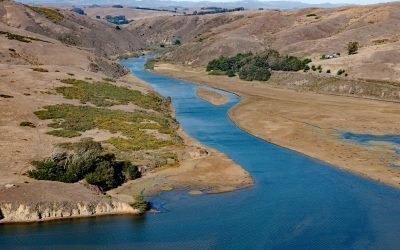
Pilot Point, Ugashik Bay
Pilot Point is a community on the eastern shore of Ugashik Bay, on the north coast of the Alaska Peninsula, 83 miles (134 km) south-southwest of King Salmon and 7 miles (11 km) northwest of Ugashik, Alaska.
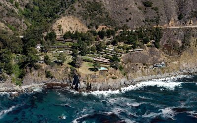
Esalen Institute, Slates Hot Springs
The Esalen Institute is located in Slates Hot Springs, a community on the Big Sur coast at an elevation of 118 feet (36 m), about 34 miles (55 km) southeast of Monterey, and 46 miles (74 km) northwest of San Simeon, California.
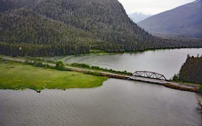
Skeena City, Khyex River
Skeena City is an abandoned community on the north shore of the Skeena River, at the mouth of the Khyex River, 22 miles (35 km) south-southeast of Prince Rupert, and 52 miles (84 km) southwest of Terrace, British Columbia.
About the background graphic
This ‘warming stripe’ graphic is a visual representation of the change in global temperature from 1850 (top) to 2019 (bottom). Each stripe represents the average global temperature for one year. The average temperature from 1971-2000 is set as the boundary between blue and red. The colour scale goes from -0.7°C to +0.7°C. The data are from the UK Met Office HadCRUT4.6 dataset.
Click here for more information about the #warmingstripes.