Historical Sites
Recent Articles
More Articles
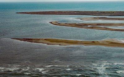
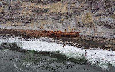
Point Franklin, Peard Bay
Point Franklin is the site of several whaling shipwrecks at the end of a barrier spit that extends 13 miles (21 km) northeast from the Arctic Coastal Plain, and together with the Seahorse Islands, separates Peard Bay from the Chukchi Sea, about 54 miles (87 km) southwest of Utqiaġvik and 33 miles (53 km) northeast of Wainwright, Alaska.
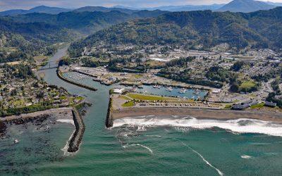
Brookings, Chetco River
Brookings is a community at the mouth of the Chetco River, which flows from the Southern Oregon Coast Range to the Pacific Ocean, about 21 miles (34 km) north-northwest of Crescent City, California and 26 miles (42 km) south-southeast of Gold Beach, Oregon.
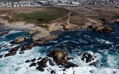
Glass Beach, Noyo Headlands Park
Glass Beach is situated in the northern section of Noyo Headlands Park in the community of Fort Bragg, which is between Pudding Creek to the north and Noyo River to the south, about 95 miles (153 km) south-southeast of Eureka and 10 miles (16 km) north of Mendocino, California.
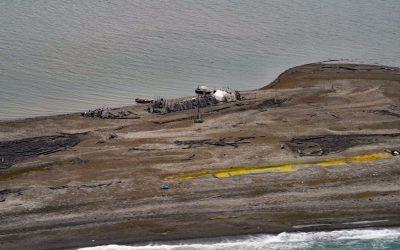
Gordon, Demarcation Point
Gordon is the site of a historical trading post near Demarcation Point, a 2.5 miles (4 km) long barrier spit separating Demarcation Bay to the south from the Beaufort Sea to the north, about 210 miles (338 km) northwest of Inuvik, Northwest Territories and 63 miles (102 km) southeast of Kaktovik, Alaska.
Cape Pankof, Ikatan Peninsula
Cape Pankof is a point of land situated at the eastern tip of the lkatan Peninsula on Unimak Island and the site of the shipwrecked SS Oduna, about 148 miles (239 km) northeast of Dutch Harbor and 18 miles (29 km) southeast of False Pass, Alaska.
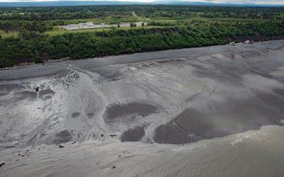
Corea Creek, Clam Gulch
Corea Creek drains a fen at an elevation of 200 feet (60 m) on the Kenai Peninsula and flows generally southwest for 2.4 miles (4 km) to the eastern shore of Cook Inlet and the site of a historic shipwreck, about 37 miles (60 km) north of Homer and 5 miles (8 km) south-southwest of Clam Gulch, Alaska.
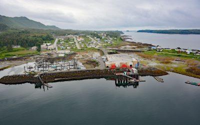
Lax Kw’alaams, Port Simpson
Lax Kw’alaams is a Tsimshian community on Port Simpson, an embayment on the eastern coast of Chatham Sound between Flewin Point to the north and Finlayson Island to the south, about 76 miles (123 km) southeast of Ketchikan, and 18 miles (29 km) north-northwest of Prince Rupert, British Columbia.
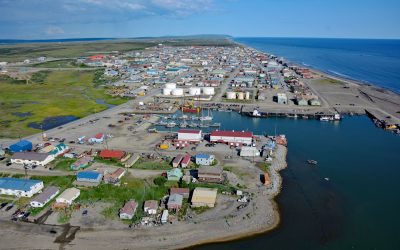
Nome, Norton Sound
Nome is a community at the mouth of the Snake River on the south coast of the Seward Peninsula on Norton Sound, about 289 miles (466 km) northwest of Bethel and 185 miles (298 km) southwest of Kotzebue, Alaska.

Año Nuevo Island, Año Nuevo State Park
Año Nuevo Island is the site of a historic light tower and fog signal on about 9 acres (3.6 ha) and separated from Point Año Nuevo by a shallow channel encompassed by Año Nuevo State Park, about 21 miles (34 km) northwest of Santa Cruz and 11 miles (18 km) south-southeast of Pescadero, California.

Safety Sound, Nome-Council Highway
Safety Sound is a lagoon along the Nome-Council Highway, formed by barrier beaches with elevations up to 14 feet (4.2 m), which extends 15 miles (24 km) along the north coast of Norton Sound between Cape Nome to the west and the Solomon River to the east, about 52 miles (84 km) west-southwest of Golovin and 20 miles (32 km) east of Nome, Alaska.
About the background graphic
This ‘warming stripe’ graphic is a visual representation of the change in global temperature from 1850 (top) to 2019 (bottom). Each stripe represents the average global temperature for one year. The average temperature from 1971-2000 is set as the boundary between blue and red. The colour scale goes from -0.7°C to +0.7°C. The data are from the UK Met Office HadCRUT4.6 dataset.
Click here for more information about the #warmingstripes.