Islands
Recent Articles
More Articles
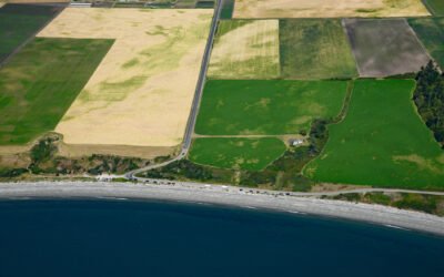
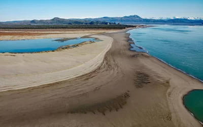
Ebey’s Landing, Whidbey Island
Ebey’s Landing is a beach on the southwest coast of Whidbey Island, on Admiralty Inlet in northern Puget Sound, about 45 miles (72 km) north-northwest of Seattle and 2 miles (3.2 km) south-southwest of Coupeville, Washington.
Takli Island, Amalik Bay
Takli Island is in Amalik Bay, between Cape Ilktugitak to the southwest and Cape Atushagvik to the northeast, along the Shelikof Strait coast of the Alaska Peninsula in Katmai National Park and Preserve, about 154 miles (248 kilometers) southwest of Homer and 81 miles (130 kilometers) west-northwest of Kodiak, Alaska.
Mount Westdahl, Unimak Island
Mount Westdahl, also known as Westdahl Peak, is a relatively young, glacier-capped volcano with a summit elevation of 5,118 feet (1,560 m) situated at the southwest end of Unimak Island in the eastern Aleutian Islands, about 527 miles (848 km) southwest of Kodiak and 87 miles (140 km) northeast of Dutch Harbor, Alaska.
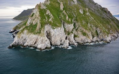
Sledge Island, Bering Sea
Sledge Island, 1.5 miles (2.4 km) across, lies in the Bering Sea, 5 miles (8 km) off the Seward Peninsula’s south coast, about 95 miles (153 km) southeast of Wales and 25 miles (40 km) west of Nome, Alaska.
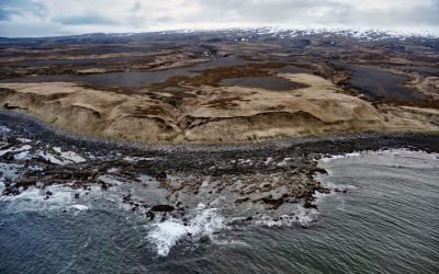
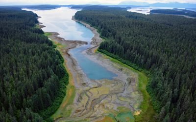
Strawberry Hill, Point Bentinck
Strawberry Hill is a series of uplifted beach ridges on Point Bentinck, at the eastern tip of Hinchinbrook Island and the southern entrance to Strawberry Channel, which separates the island from the mainland, about 53 miles (85 km) south of Valdez and 17 miles (27 km) southwest of Cordova, Alaska.
Point Baker, Sumner Strait
Point Baker is a cape on the south shore of Sumner Strait at the north end of Prince of Wales Island in Southeast Alaska, where a small community with the same name lines the shore of a narrow water passage, about 101 miles (163 km) northwest of Ketchikan and 49 miles (79 km) west of Wrangell, Alaska.
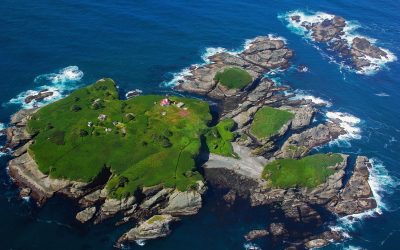
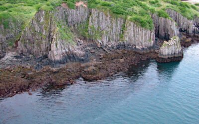
Tatoosh Island, Cape Flattery
Tatoosh Island is the largest of a small group of islands offshore from Cape Flattery and the site of a historic light station, situated on the Makah Reservation, about 34 miles (55 km) north of La Push and 6 miles (10 km) west-northwest of Neah Bay, Washington.
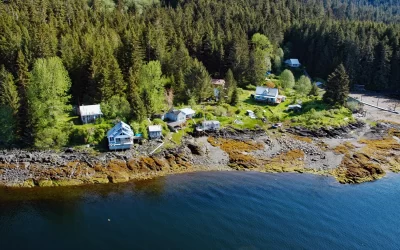
Hutchins Bay, Beardslee Islands
Hutchins Bay is on the eastern shore of Glacier Bay, partially surrounding the Beardslee Islands in Glacier Bay National Park and Preserve, about 155 miles (249 km) southeast of Yakutat and 8 miles (13 km) north of Gustavus, Alaska.
Metlakatla, Annette Island
Metlakatla is a Tsimshian community situated on Port Chester, an embayment on the west coast of Annette Island, about 75 miles (121 km) northwest of Prince Rupert and 16 miles (26 km) south-southeast of Ketchikan, Alaska.
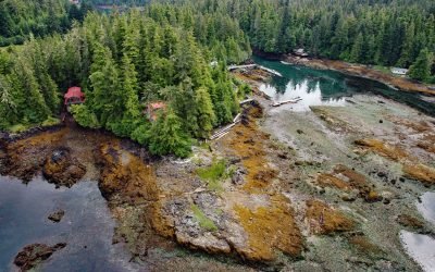
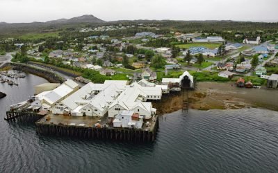
Loring, Naha Bay
Loring is a small community at the site of a historical salmon cannery on the west coast of Revillagigedo Island, at the head of Naha Bay and near the mouth of the Naha River, about 66 miles (106 km) south-southeast of Wrangell and 17 miles (27 km) north of Ketchikan, Alaska.
About the background graphic
This ‘warming stripe’ graphic is a visual representation of the change in global temperature from 1850 (top) to 2019 (bottom). Each stripe represents the average global temperature for one year. The average temperature from 1971-2000 is set as the boundary between blue and red. The colour scale goes from -0.7°C to +0.7°C. The data are from the UK Met Office HadCRUT4.6 dataset.
Click here for more information about the #warmingstripes.