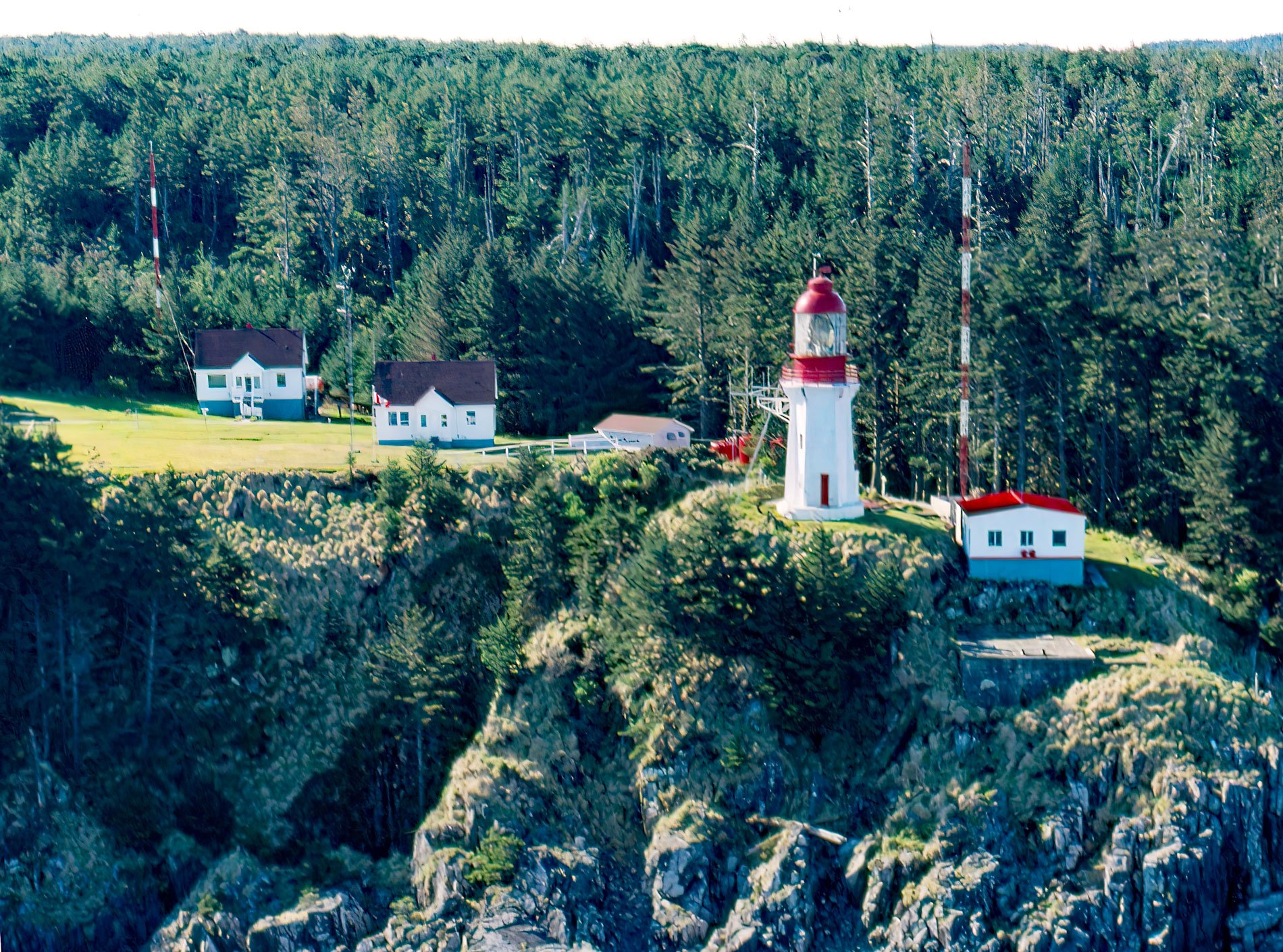
Langara is the northernmost island of the Haida Gwaii archipelago and the site of a historic light station that marks the southern boundary of Dixon Entrance, about 94 miles (151 km) southwest of Ketchikan, Alaska and 38 miles (61 km) west-northwest of Masset, British Columbia. The island was named in 1792 by Spanish Lieutenant Jacinto Caamano on the Aranzazu after the 18th century Spanish Naval officer Juan de Lángara. During the period that he was the head of the Spanish Navy as Minister of Marine, Spanish explorers were charting the coast of what is now British Columbia, and several land formations were named after him. The islands of Haida Gwaii are part of the Insular Belt and represent rocks of the Wrangellia terrane that extends from Alaska in the north to Oregon in the south and is believed to have collided with North America in Jurassic time. Langara Island and the northern tip of Graham Island are underlain by early Paleogene basaltic lavas and Oligocene sedimentary rocks covered with a thin veneer of till. The present-day landform was created by glacial ice from Alaska and the Canadian Cordillera that flowed through Dixon Entrance and over Langara Island in a westerly direction.
Haida Gwaii is the traditional territory of the Haida people who have inhabited the islands for thousands of years. The ancestors of the Haida probably did not become established until after the end of the last glacial maximum, and the earliest archaeological sites along the coast date from 10,000 to 6,500 years ago. Around 5,000 years ago, the coastal art and aesthetic styles associated with the Northwest Coast peoples were well established. By 3,000 years ago, the cultures were largely the same as those observed at the time of European contact. In 1774, the first encounter was recorded in the diaries of two Franciscan friars, Juan Crespi and Tomás de la Peña, when the Spanish navigator Juan Perez on the Santiago met a group of Haida off the northwest point of Langara Island. In 1787, Captain George Dixon sailed the Queen Charlotte into Cloak Bay on the west coast of Langara Island and within half an hour had traded for 300 furs with Haida from Dadens and a month later departed with 1,821 furs. During the peak of the maritime fur trade era, Chief Cuneah was the primary leader of Kiusta, the principal village adjacent to Langara Island, and had influence over the entire region of northern Haida Gwaii. In the late 1830s, a smallpox epidemic ravaged islands resulting in a greatly reduced population and trade became monopolized by a smaller number of chiefs that eventually gravitated to Masset where there were missionaries and schools.
The western terminus of the transcontinental Grand Trunk Pacific Railway at Prince Rupert resulted in increased marine traffic through Dixon Entrance and the need for a major landfall light to mark the most direct route from the Pacific Ocean. In 1912, work began on clearing five acres on Langara Island and the construction of a hexagonal tower 30 feet (9 m) high, a light keepers dwelling, and a tramway 2200 feet (670 m) long that would lead down to a boathouse situated on a sheltered bight. From 1918 to 1919, a salmon cannery operated in Henslung Cove at the southern end of Langara Island with floating stores and ice rooms. This fish camp was eventually operated by personnel of the North Island Trollers Association until it was amalgamated with the Prince Rupert Fisherman’s Cooperative Association in 1938. In 1929, an additional building was constructed at the light station to house machinery for a radio beacon, and an emergency telephone line was run from the light station at the north end of the island to Henslung Cove at the south end. During World War II, a radar station was established at the light station. On August 2, 1943, a Japanese submarine surfaced about 1300 feet (400 m) offshore which caused the encamped guard to prepare demolition charges. Today, the light station is still manned and Henslung Cove is the site of a luxury fishing resort. Read more here and here. Explore more of Langara Island and Haida Gwaii here:

