Islands
Recent Articles
More Articles
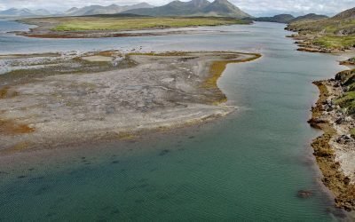
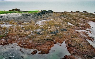
Alitak Lagoon, Tanner Head
Alitak Lagoon lies 1 mile (1.6 km) northeast of Cape Alitak on Tanner Head at the southern end of Kodiak Island, 93 miles (150 km) southwest of the community of Kodiak, Alaska.

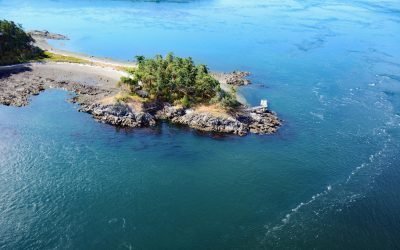
Christmas Island, Beecher Pass
Christmas Island, approximately 200 feet (61 m) across, is located between Beecher Pass and Duncan Canal, about 15 miles (24 km) southwest of Petersburg, Alaska.
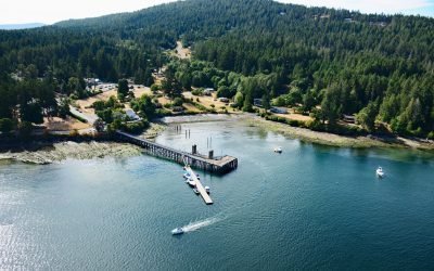
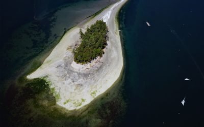
Miners Bay, Mayne Island
Miners Bay is located on Mayne Island, on the southeast side of Active Pass which separates Galiano and Mayne Islands, about 14.5 miles (23 km) north-northeast of Sidney, British Columbia.
Mermaid Island, Neptune Bay
Mermaid Island is located on McKeon Flats, a tidal flat formed by the Wosnesenski River as it flows into Neptune Bay, about 13 miles (21 km) northeast of Seldovia and 8 miles (13 km) south-southeast of Homer, Alaska.
D’Arcy Island, Southern Gulf Islands
D’Arcy Island, part of the Southern Gulf Islands in Haro Strait, covers approximately 205 acres (83 hectares), about 30 miles (48 km) west of Anacortes and 10 miles (16 km) north-northeast of Victoria, British Columbia.
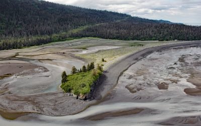
Shakun Islets, Swikshak Bay
Shakun Islets is a group of grass-covered islands and submerged reefs extending 1.8 miles (2.9 km) north to south at the entrance of Swikshak Bay in Shelikof Strait, about 108 miles (174 km) southwest of Homer and 57 miles (92 km) northwest of Kodiak, Alaska.
HMCS Mackenzie, Cornet Island
HMCS Mackenzie was a destroyer scuttled in Haro Strait, between Cornet and Gooch Islands in the Southern Gulf Islands, approximately 18 miles (29 km) north-northeast of Victoria and 5 miles (8 km) east-northeast of Sidney, British Columbia.
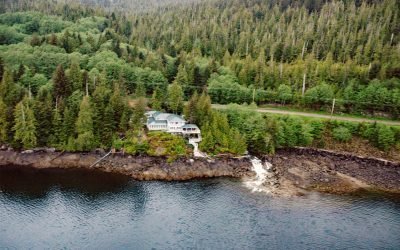
Whitman Creek, Revillagigedo Island
Whitman Creek is on the southeast coast of Revillagigedo Island, about 14 miles (23 km) north of Metlakatla and 7 miles (11 km) east-southeast of Ketchikan, Alaska.
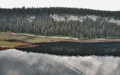
Fossil Bluffs, Kuiu Island
Fossil Bluffs is on the northeast shore of Halleck Harbor near the northern entrance of Saginaw Bay on Kuiu Island, about 42 miles (68 km) southeast of Sitka and 17 miles (27 km) southwest of Kake, Alaska.
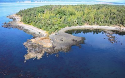
Cutts Island, Carr Inlet
Cutts Island is a state park located about 0.5 miles (0.8 km) off the eastern shore of Carr Inlet in South Puget Sound, approximately 12 miles (19 km) northwest of Tacoma and 5 miles (8 km) west of Gig Harbor, Washington.
About the background graphic
This ‘warming stripe’ graphic is a visual representation of the change in global temperature from 1850 (top) to 2019 (bottom). Each stripe represents the average global temperature for one year. The average temperature from 1971-2000 is set as the boundary between blue and red. The colour scale goes from -0.7°C to +0.7°C. The data are from the UK Met Office HadCRUT4.6 dataset.
Click here for more information about the #warmingstripes.