
LAST MONTH
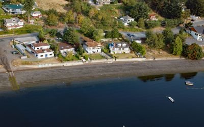
Maple Bay, Sansum Narrows
Maple Bay is a community located on Sansum Narrows, a narrow inlet in the Salish Sea that separates Vancouver Island from Salt Spring Island, about 29 miles (47 km) northwest of Victoria and 28 miles (45 km) southeast of Nanaimo, British Columbia.
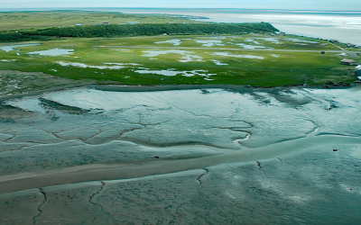
Clark’s Point, Nushagak Bay
Clark’s Point is the site of a historic community and salmon cannery located on the eastern shore of Nushagak Bay at the mouth of Clark Slough, about 57 miles (92 km) west-northwest of Naknek and 14 miles (23 km) south-southwest of Dillingham, Alaska.
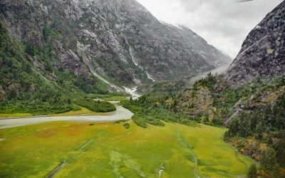
North Dawes Glacier, Endicott Arm
North Dawes Glacier starts from the Stikine Icefield at an elevation of about 5,200 feet (1,585 m) on the western flank of Sheppard Peak and flows generally southwest for 15 miles (24 km) to a proglacial lake at an elevation of 1000 feet (305 m) which is 2 miles (3.2 km) long and drained by a stream 1.3 miles (2.1 km) long at the head of an inlet extending north from Endicott Arm, about 74 miles (119 km) southeast of Juneau and 51 miles (82 km) north of Petersburg, Alaska.

Salmon Creek, Sonoma Coast State Park
Salmon Creek starts at an elevation of 570 feet (174 m) and flows generally southwest for 19 miles (31 km) draining a watershed of 22,487 acres (9,100 ha) between the Northern Coast Ranges and the Pacific Ocean at Salmon Creek Beach in Sonoma Coast State Park, about 20 miles (32 km) southwest of Santa Rosa and 2 miles (3.2 km) northwest of Bodega Bay, California.

Yahtse Glacier, Icy Bay
Yahtse Glacier starts from the south flank of Mount Miller in Barkley Ridge at an elevation of 8,200 feet (2,500 m) and flows generally southeast for 40 miles (65 km) through Wrangell-Saint Elias National Park and Preserve to a tidewater terminus between Guyot Hills to the west and Karr Hills to the east in Icy Bay, about 152 miles (245 km) east-southeast of Cordova and 71 miles (115 km) northwest of Yakutat, Alaska.
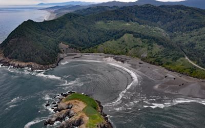
Hunters Cove, Cape Sebastian
Hunters Cove is on the south side of Cape Sebastian, a prominent headland in Cape Sebastian State Scenic Corridor, about 20 miles (32 km) north-northwest of Brooking and 6.3 miles (10 km) south of Gold Beach, Oregon.
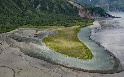
Diamond Point, Iliamna Bay
Diamond Point is a prominent headland situated between Iliamna Bay to the east and Cottonwood Bay to the south, about 126 miles (203 km) northeast of King Salmon and 75 miles (121 km) west of Homer, Alaska.
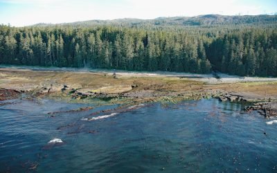
Michigan Creek, Pacific Rim National Park Reserve
Michigan Creek starts at an elevation of 1400 feet (427 m) and flows generally south for 4 miles (6.4 km) through the coast mountains on Vancouver Island and enters the Pacific Ocean in the Pacific Rim National Park Reserve 1 mile (1.6 km) east of the Pachena Point Light Station, about 81 miles (130 km) west-northwest of Victoria and 8.5 miles (14 km) southeast of Bamfield, British Columbia.