
LAST MONTH
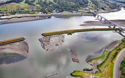
Mary D. Hume, Rogue River
Mary D. Hume sank in 1984 on the south bank of the Rogue River during a restoration effort to convert the vessel to a museum ship for the Curry County Historical Society and now rests on the bottom in shallow water with a portion of the hull and superstructure exposed at low tide near Gold Beach, Oregon.
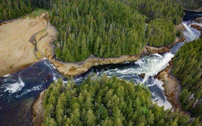
Salt Lagoon, Porcher Inlet
Salt Lagoon is situated at the southwestern base of the Spiller Range on Porcher Island and is connected by a tidal channel 1.8 miles (2.9 km) long to Porcher Inlet that extends 11 miles (81 km) from the south and nearly bisects the island, about 15 miles (24 km) north-northeast of Kitkatla and 5 miles (8 km) northwest of Oona River, British Columbia.
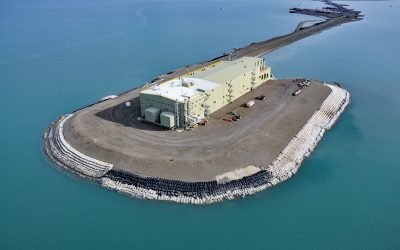
West Dock Causeway, Prudhoe Bay
West Dock Causeway was constructed in the Beaufort Sea between Gwydyr Bay to the west and Prudhoe Bay to the east in support of oil exploration and to access a seawater treatment facility 2.5 miles (4.3 km) north from the mainland, about 59 miles (95 km) northeast of Nuiqsut and 15 miles (24 km) north of Deadhorse, Alaska.

Guyot Glacier, Icy Bay
Guyot Glacier starts from an elevation of about 6,700 feet (2,042 m) on the eastern flank of Yaga Peak in the Robinson Mountains and flows generally east-southeast for 34 miles (55 km) to its terminus just south of the Guyot Hills on the western shore of Icy Bay in Wrangell-Saint Elias National Park and Preserve, about 146 miles (235 km) east-southeast of Cordova and 76 miles (123 km) northwest of Yakutat, Alaska.
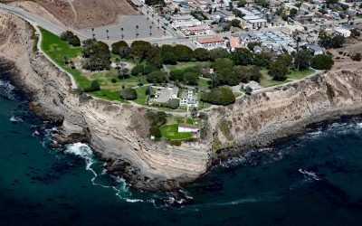
Point Fermin, San Pedro
Point Fermin is the site of a historic lighthouse at the southernmost tip of the Palos Verdes Peninsula in the city of San Pedro, about 25 miles (40 km) southeast of Santa Monica and 7 miles (11 km) southwest of Long Beach, California.

Sumdum Glacier, Powers Creek
Sumdum Glacier starts on the south flank of Mount Sumdum with a summit elevation of 6,666 feet (2,032 m) and flows southwest to a hanging terminus at 2,100 feet (640 m) and the start of Powers Creek that flows 2 miles (3.2 km) to the eastern shore of Endicott Arm, about 89 miles (144 km) northeast of Sitka and 50 miles (81 km) southeast of Juneau, Alaska.
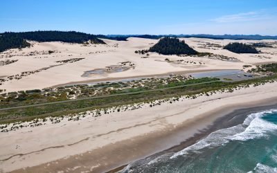
Umpqua Beach, Oregon Dunes National Recreation Area
Umpqua Beach is an off-highway vehicle staging area south of the Umpqua River mouth in the Oregon Dunes National Recreation Area that extends for about 35 miles (56 km) along the coast from the Siuslaw River at Florence in the north to the Coos River at North Bend, Oregon.
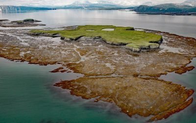
Nordyke Island, Kamishak Bay
Nordyke Island is about 35 feet (11 m) high, flat topped and grass covered, and located in Kamishak Bay, about 115 miles (186 km) northwest of Kodiak and 96 miles (155 km) southwest of Homer, Alaska.
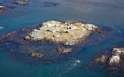
Race Rocks, Strait of Juan de Fuca
Race Rocks is a group of nine islets including North Rock, West Race, Great Race, and Rosedale Rock located about 1 mile (1.6 km) off Cape Calver on the southern tip of Vancouver Island in the Strait of Juan de Fuca, about 12 miles (19 km) southwest of Victoria and 11 miles (18 km) southeast of Sooke, British Columbia.
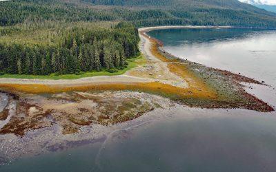
Sumdum, Endicott Arm
Sumdum is a historical Tlingit village of the S’awdaan Kwáan located north of Powers Creek at the northern end of Endicott Arm where it meets Holkham Bay in Tracy Arm-Fords Terror Wilderness, about 70 miles (113 km) north-northwest of Petersburg and 49 miles (79 km) southeast of Juneau, Alaska.
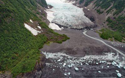
Tigertail Glacier, Nassau Fjord
Tigertail Glacier starts at an elevation of about 2,850 feet (869 m) in the Sargent Icefield on the Kenai Peninsula and flows generally northeast for 3.3 miles (5.3 km) and terminates 0.2 miles (0.3 km) from the western shore of Nassau Fjord, which is a northern arm of Icy Bay in western Prince William Sound, about 36 miles (58 km) east-northeast of Seward and 36 miles (58 km) south-southeast of Whittier, Alaska.
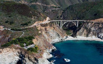
Bixby Creek, Big Sur
Bixby Creek starts at the confluence of Mill Creek and Turner Creek that flow from an elevation of 2,500 feet (762 m) on the west flank of Skinner Ridge for a total run of about 7 miles (11 km) through the Santa Lucia Mountains to the Big Sur coast, between Hurricane Point to the south and Division Knoll to the north, about 16 miles (26 km) south of Monterey and 9 miles (15 km) northwest of the community of Big Sur, California.