
Mines
Recent Articles
More Articles

Portage Head, Makah Bay
Portage Head is a prominent headland south of Cape Flattery on the Olympic Peninsula that separates Makah Bay Beach from Shi Shi Beach, about 58 miles (94 km) west-northwest of Port Angeles and 6 miles (10 km) southwest of Neah Bay, Washington.

Vindicator Mine, Popof Island
Vindicator is a historical beach placer mine in the Alaska Peninsula Mining District situated on the western shore of Popof Island between Sand Point to the north and Red Cove to the south, about 260 miles (419 km) northeast of Dutch Harbor and 67 miles (108 km) southwest of Perryville, Alaska.

Lone Ranch Beach, Cape Ferrelo
Lone Ranch Beach is a sand and gravel deposit at Cape Ferrelo situated between Lone Ranch Creek to the north and Ram Creek to the south in Samuel H. Boardman State Scenic Corridor, about 22 miles (35 km) south of Gold Beach and 5 miles (8 km) northwest of Brookings, Oregon.

Blubber Bay, Texada Island
Blubber Bay is a community and an embayment on the northern tip of Texada Island, between the Strait of Georgia to the west and Malaspina Strait to the east, and the site of a historical shore whaling station and present-day limestone mine, about 76 miles (122 km) northwest of Vancouver and 5 miles (8 km) southwest of Powell River, British Columbia.
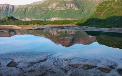
Kuliak Bay, Katmai National Park and Preserve
Kuliak Bay is about 4 miles (6.5 km) wide at the entrance on the western shore of Shelikof Strait and gradually tapers to the northwest for 5 miles (8 km) into Katmai National Park and Preserve on the Alaska Peninsula, about 92 miles (148 km) southeast of King Salmon and 74 miles (119 km) northwest of Kodiak, Alaska.

Valdez, Mineral Creek
Valdez is a community situated on the outwash fan of Mineral Creek on the north shore and near the head of Port Valdez in northeastern Prince William Sound, about 82 miles (132 km) east-northeast of Whittier and 46 miles (74 km) north-northwest of Cordova, Alaska.

Calder, Shakan Strait
Calder is a mining camp for a historic marble quarry and present-day limestone mine situated at the mouth of Marble Creek on Shakan Strait near the entrance to El Capitan Passage on Prince of Wales Island, about 92 miles (148 km) northwest of Ketchikan and 12 miles (19 km) south-southeast of Port Protection, Alaska.

Deering, Kotzebue Sound
Deering is a community situated on a barrier spit at the mouth of the Inmachuk River on Kotzebue Sound on the northern coast of the Seward Peninsula between Cape Deceit to the west and Ninemile Point to the east, about 155 miles (250 km) east-northeast of Point Hope and 57 miles (92 km) south of Kotzebue, Alaska.
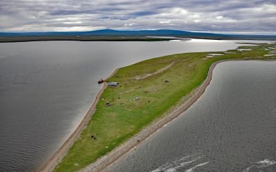
Kiwalik, Spafarief Bay
Kiwalik is a historical Iñupiat hunting and fishing camp, that became a major logistical base for mining activities in the Candle area, situated on a spit between Kawalik Lagoon to the south and Spafarief Bay to the north on the northeast coast of the Seward Peninsula, about 148 miles (238 km) northeast of Nome and 64 miles (103 km) south-southeast of Kotzebue, Alaska.
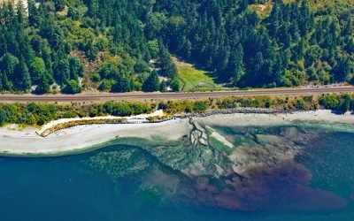
Fort Nisqually, Sequalitchew Creek
Fort Nisqually was a historical trading post established by the Hudson’s Bay Company in 1833 on Sequalitchew Creek, 1.3 miles (2.1 km) east of South Puget Sound at an elevation of 220 feet (67 m), about 14 miles (22.5 km) southwest of Tacoma and 2 miles (3.2 km) northwest of Dupont, Washington.
About the background graphic
This ‘warming stripe’ graphic is a visual representation of the change in global temperature from 1850 (top) to 2019 (bottom). Each stripe represents the average global temperature for one year. The average temperature from 1971-2000 is set as the boundary between blue and red. The colour scale goes from -0.7°C to +0.7°C. The data are from the UK Met Office HadCRUT4.6 dataset.
Click here for more information about the #warmingstripes.