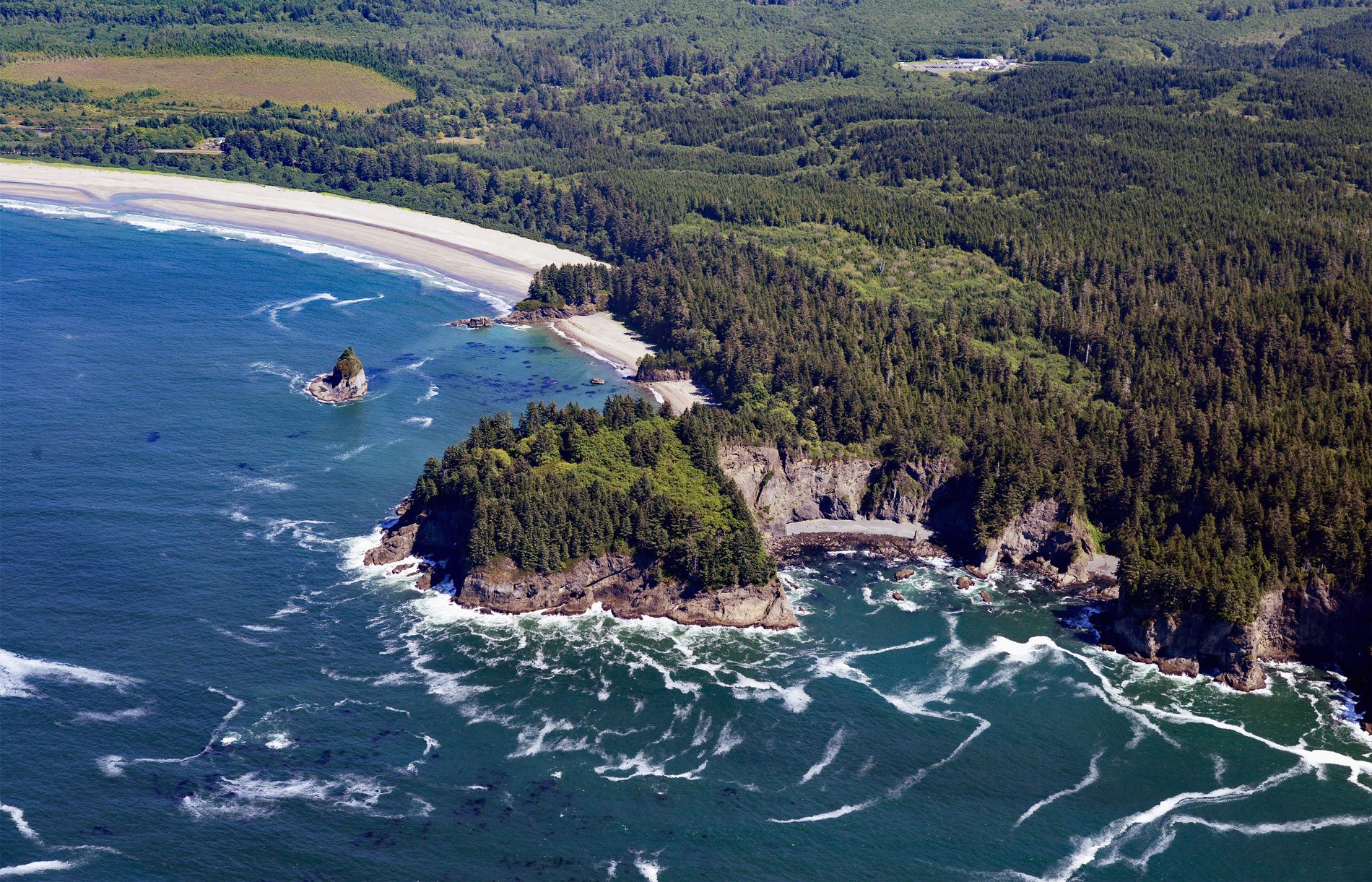
Portage Head is a prominent headland south of Cape Flattery on the Olympic Peninsula that separates Makah Bay Beach from Shi Shi Beach, about 58 miles (94 km) west-northwest of Port Angeles and 6 miles (10 km) southwest of Neah Bay, Washington. The headland is on the Makah Indian Reservation and is likely named for the portage trail that historically linked the ancient village of Ozette with Makah Bay, and today provides access from the north to the coastal strip of Olympic National Park. In 1855, the Makah people ceded all their lands to the United States except a small reservation on Cape Flattery, and today most of the Makah live on the reservation in Neah Bay. Non-tribal members visiting the reservation are required to purchase a pass to use the trail that connects to Shi Shi Beach in Olympic National Park.
In 1894, there was a brief period of gold prospecting on the Olympic coast and beach prospects were staked for 60 to 70 miles (98 to 113 km) south of Cape Flattery. The productive localities were soon found to be along 20 miles (32 km) of the coast between Portage Head and Cape Johnson near the Quillayute River. Early maps of the coastline depict numerous mining locations and sluice boxes along the ocean beaches from Shi Shi Beach southward for several miles during the 1890s and early 1900s. The most productive site was Shi Shi Beach where beach placers were formed by the oscillation of ocean waves reworking beach sands and gravels and concentrating the heavy minerals. Platinum and gold were found in a layer of heavy sand and gravel, concentrated by the waves at the base of the sea cliff. The beach was covered with a layer of fine gravel and sand from 1 to 3 feet (0.3 to 0.9 m) thick, and was strewn with cobbles at the base of the cliff. The metal-bearing part of the deposit was a thin layer of fine heavy sand composed chiefly of pink garnet and black grains of ilmenite and magnetite. During storms, the gravel and sand were shifted back and forth and the gold and platinum settled into joints and seams of the underlying bedrock.
Eight gold placers were worked prior to 1953 when the coastal strip was added to the Olympic National Park. At Shi Shi Beach, the Lovelace placer was prospected in the 1900s by W.W. Lovelace who may have homesteaded in the area in the early 1890s. Together with the adjacent southerly Ozette Beach placer, $15,000 in gold was produced before 1904. Further to the south and directly west of Ozette Lake near Sand Point, the Little Wink and Morgan placers were developed by S.D. Morgan in 1940. Near the Yellow Banks placer, J.D. Morrow developed an area that produced $1,678 in gold. The adjoining Yellow Banks placer was intensively worked by the Japanese in 1932. Near the mouth of Cedar Creek southwest of the south end of Ozette Lake, the Cedar Creek or Starbuck placer was owned and presumably worked by J.M. Starbuck in the 1910s. Prior to 1917, $5,000 of gold and 5 ounces of platinum were reportedly extracted from the sand. Approximately four miles south of Cedar Creek at Cape Johnson, the Johnson Point Placer yielded $2.00 to $10.00 per day soon after the turn of the century. Read more here and here. Explore more of Portage Head and Makah Bay here:

