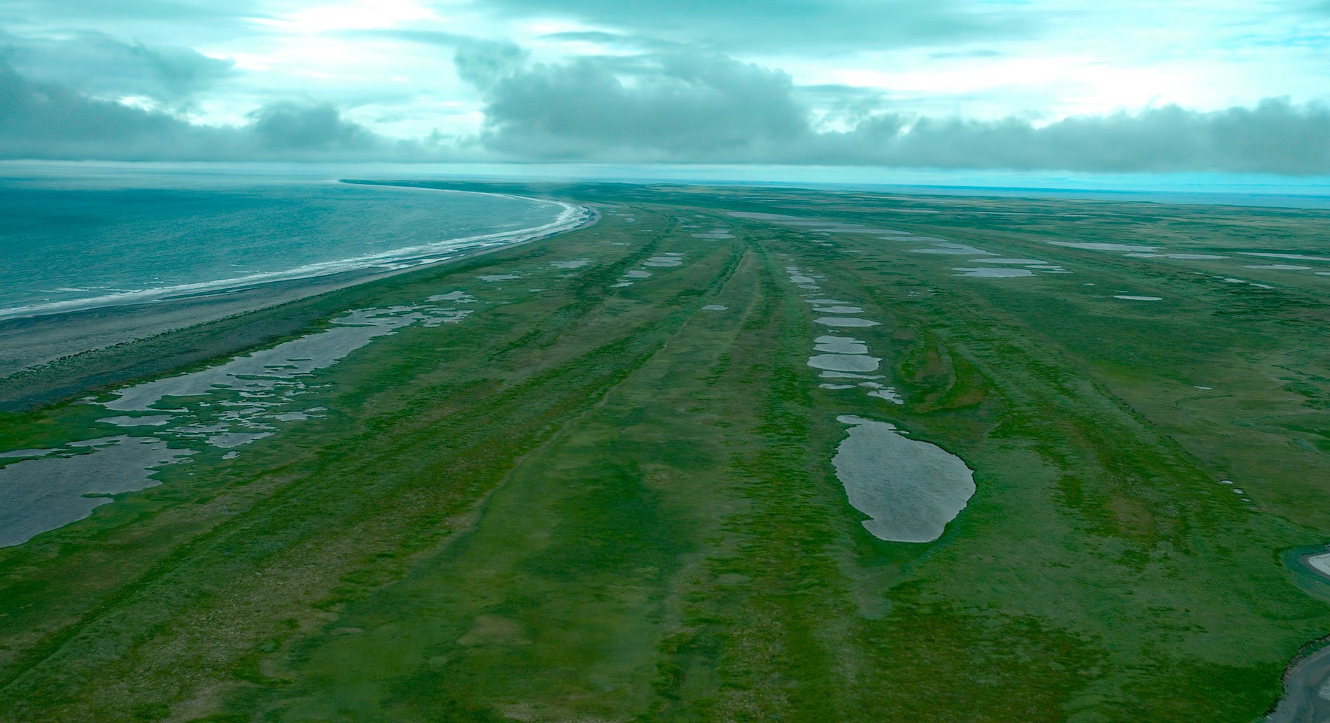
Tugidak Island is the westernmost of the Trinity Island Group, which includes Sitkinak Island, and is part of the Kodiak Archipelago situated off the southern tip of Kodiak Island in the Gulf of Alaska, about 145 miles (233 km) east of Chignik and 124 miles (200 km) south-southwest of Kodiak, Alaska. The name ‘Tugidak’ is a transliteration by Lieutenant Gavril Sarychev of the Unangan Aleut name that, according to R.H. Geoghegan, means ‘moon’ or ‘mouth’, likely referring to the large lagoon at the northeastern tip of the island. The Trinity Islands were originally named ‘Trinidad Island’ by Dionisio Alcalá Galiano in 1802, but the name was published as ‘Trinity Island’ by Captain James Cook in 1785. At that time, Sitkinak Island was considered to be two islands making the group of three, but the passage between east and west Sitkinak has since filled in with sand and is now a tidal lagoon. The eastern part of Tugidak Island is formed by surficial glacial moraine and most of the spit that encompasses the large bay was formed by longshore drift creating a series of beach ridges. The western part of the island is underlain by sandstone and siltstone with interbedded volcanic lava representing the Tugidak Formation. The sedimentary rocks have an abundance of marine fossils of Pliocene age with more than 80 species identified.
Tugidak Island is mostly low undulating terrain of wet tundra, grasslands, and marshes creating by an intricate maze of lakes and ponds. Neighboring islands historically had permanent human settlements, but there is no evidence on Tugidak Island; although, there are middens and house pits on the north and east sides of the island suggesting seasonal inhabitants. With an abundance of sea otters, harbor seals, waterfowl, salmon streams, and shellfish, the island must have been an attractive place to spend the summer. In 1790, Sarychev provided the first written record of Tugidak inhabitants when his ship the Glory of Russia was approached at anchor by several islanders in double-seated baidarkas. In the late 18th and early 19th centuries, parties of Alutiiq hunters under the control of a few Russian promyshlenniki or creoles would fan out from the main settlements on Kodiak Island and some gathered on Tugidak Island to hunt for sea otters and other fur bearing animals before continuing to the northern Gulf of Alaska coast. The waters around Tugidak are notoriously hazardous, with shoals and uncharted rocks extending far from shore. At least four shipwrecks are documented, including Lizzie Williams that struck a shoal in 1889, James A. Borland struck a reef extending from the island in 1896, and the cannery steamer Pavlof that struck an uncharted rock and wrecked in 1916.
Tugidak Island was established as a Critical Habitat Area by the State of Alaska in 1998 and is managed by the Alaska Department of Fish and Game as a wildlife conservation area. The lagoon at the northeastern end of the island is historically renowned as one of the largest harbor seal pupping and haul out areas in the world, with an estimated peak population of 20,500 seals and estimated peak annual pup production of 4,500 in the mid-1960s. For as yet undetermined reasons, this harbor seal population declined by about 92 percent between 1976 and 1992 when only 2,000 seals hauled out in the lagoon. The island also attracts some of the greatest diversity of bird life known to nest on and visit any one island in the Gulf of Alaska. Wetland habitats throughout the island provide nesting habitat for waterfowl, shorebirds, tundra swans, and loons; and support nesting concentrations of swans, mallards, pintails, gadwalls, green-winged teals, and wigeons. Black brants and white-fronted geese concentrate by the thousands on the lagoon during the fall migration to rest and feed on the rich eelgrass beds and marine life that abounds. Arctic terns, cormorants and several thousand glaucous-winged and mew gulls also nest on the island. Read more here and here. Explore more of Tugidak Island and Trinity Island Group here:

