Rivers
Recent Articles
More Articles
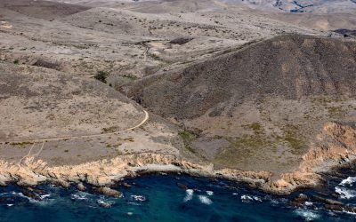
Harmony Headlands, Point Estero
Harmony Headlands State Park preserves an undeveloped parcel of Pacific coastline between Point Estero to the south and Natalie’s Cove to the north, about 7 miles (11 km) west-northwest of Cayucos and 3 miles (5 km) south-southeast of Harmony, California.
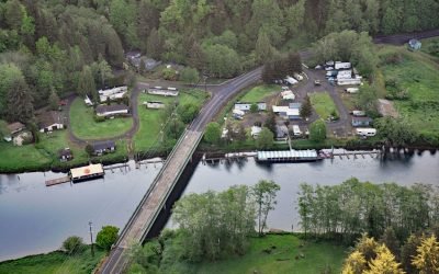
Taylors Landing, Alsea River
Taylors Landing is a small community near the head of the tide on the Alsea River in the Coast Range, about 17.4 miles (28 km) west of Alsea and 6.4 miles (10 km) east-southeast of Waldport, Oregon.
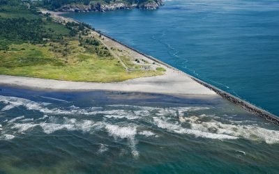
Peacock Spit, Columbia River Bar
Peacock Spit is the northern portion of a mostly submerged sand bar at the mouth of the Columbia River, about 12 miles (19 km) northwest of Astoria and 2.5 miles (4 km) south of Ilwaco, Washington.

Princeton Glacier, Nassau Fjord
Princeton Glacier is on the east side of the Kenai Peninsula, about 37 miles (60 km) south-southeast of Whittier and 38 miles (61 km) east-northeast of Seward, Alaska.
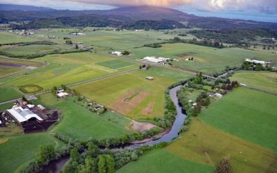
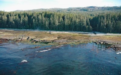
Trask River, Tillamook Bay
Trask River is in northwestern Oregon, draining a mountainous timber-producing area of the Coast Range into Tillamook Bay, about 57 miles (92 km) west of Portland and 52 miles (84 km) south of Astoria, Oregon.
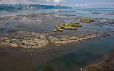
Douglas River Tidal Flats, Kamishak Bay
Douglas River starts at the terminus of an unnamed glacier on the northwest flank of Fourpeaked Mountain in the Aleutian Range on the Alaska Peninsula, and flows north for 28 miles (45 km) to Kamishak Bay, about 108 miles (174 km) northeast of King Salmon and 89 miles (144 km) southwest of Homer, Alaska.
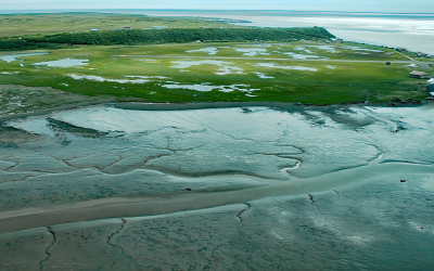
Clark’s Point, Nushagak Bay
Clark’s Point is the site of a historic community and salmon cannery located on the eastern shore of Nushagak Bay at the mouth of Clark Slough, about 57 miles (92 km) west-northwest of Naknek and 14 miles (23 km) south-southwest of Dillingham, Alaska.

North Dawes Glacier, Endicott Arm
North Dawes Glacier starts from the Stikine Icefield at an elevation of about 5,200 feet (1,585 m) on the western flank of Sheppard Peak and flows generally southwest for 15 miles (24 km) to a proglacial lake at an elevation of 1000 feet (305 m) which is 2 miles (3.2 km) long and drained by a stream 1.3 miles (2.1 km) long at the head of an inlet extending north from Endicott Arm, about 74 miles (119 km) southeast of Juneau and 51 miles (82 km) north of Petersburg, Alaska.

Salmon Creek, Sonoma Coast State Park
Salmon Creek starts at an elevation of 570 feet (174 m) and flows generally southwest for 19 miles (31 km) draining a watershed of 22,487 acres (9,100 ha) between the Northern Coast Ranges and the Pacific Ocean at Salmon Creek Beach in Sonoma Coast State Park, about 20 miles (32 km) southwest of Santa Rosa and 2 miles (3.2 km) northwest of Bodega Bay, California.
Michigan Creek, Pacific Rim National Park Reserve
Michigan Creek starts at an elevation of 1400 feet (427 m) and flows generally south for 4 miles (6.4 km) through the coast mountains on Vancouver Island and enters the Pacific Ocean in the Pacific Rim National Park Reserve 1 mile (1.6 km) east of the Pachena Point Light Station, about 81 miles (130 km) west-northwest of Victoria and 8.5 miles (14 km) southeast of Bamfield, British Columbia.
About the background graphic
This ‘warming stripe’ graphic is a visual representation of the change in global temperature from 1850 (top) to 2019 (bottom). Each stripe represents the average global temperature for one year. The average temperature from 1971-2000 is set as the boundary between blue and red. The colour scale goes from -0.7°C to +0.7°C. The data are from the UK Met Office HadCRUT4.6 dataset.
Click here for more information about the #warmingstripes.