Shipwrecks
Recent Articles
More Articles

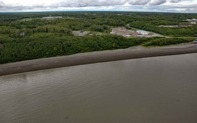
USS Milwaukee, Samoa Beach
The USS Milwaukee was a U.S. Navy cruiser that in 1917 was overcome by wind and waves close to shore and was beached at the community of Samoa on the northern peninsula of Humboldt Bay, about 7 miles (11 km) southwest of Arcata and 1.5 miles (2.4 km) west of Eureka, California.
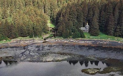
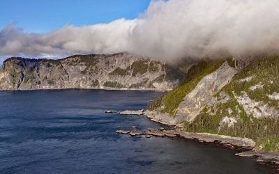
Monks Lagoon, Spruce Island
Monks Lagoon is on Icon Bay, a bight about 1 mile (1.6 km) across, on the southeastern shore of Spruce Island, about 6.6 miles (10.6 km) north of Kodiak and 5.7 miles (9 km) south-southeast of Ouzinkie, Alaska.
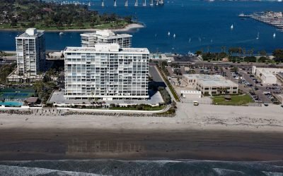
SS Monte Carlo, Coronado Shores
The shipwreck of the SS Monte Carlo is occasionally exposed by shifting sands during the winter on Coronado Shores, a wide sandy beach also known as South Beach, on Coronado Island about 4.5 miles (7.3 km) east of Point Loma and 3.4 miles (5.5 km) south of San Diego, California.
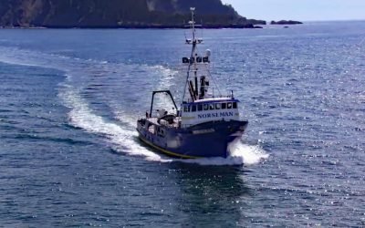
FV Norseman, Princess Royal Channel
The fishing vessel Norseman sank in June 1978 in Princess Royal Channel, approximately 11 miles (18 km) southeast of Butedale and 115 miles (185 km) southeast of Prince Rupert, British Columbia.
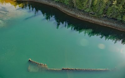
McLean Arm Bay, Prince of Wales Island
McLean Arm Bay is a narrow inlet that extends 6.5 miles (10.5 km) west from Clarence Strait, on the southeast coast of Prince of Wales Island, about 40 miles (65 km) southwest of Ketchikan and 40 miles (65 km) southeast of Hydaburg, Alaska.

Minter, Henderson Bay
Minter is a community on the northwestern shore of Henderson Bay, at the head of Carr Inlet in South Puget Sound, about 24 miles (39 km) southwest of Seattle and 5.5 miles (9 km) northwest of Gig Harbor, Washington.
Nikiski Bay, Cook Inlet
Nikiski Bay, formerly known as Nikishka Bay, is a bight in Upper Cook Inlet that extends southwest for 4 miles (6.5 km) from Boulder Point along the southeast shore of Gompertz Channel, 1 mile (1.6 km) north of the community of Nikiski and about 14 miles (22.6 km) north of Kenai, Alaska.
Star of Bengal, China Cove
Star of Bengal is a shipwreck near China Cove, a small embayment about 1.7 miles (2.7 km) wide on the southeastern coast of Coronation Island, situated between Chatham and Sumner Straits, 93 miles (150 km) south-southeast of Sitka and 106 miles (171 km) northwest of Ketchikan, Alaska.
Uyak Bay, Kodiak Island
Uyak Bay extends south-southeast for 40 miles (65 km) from Shelikof Strait on the northwest coast of Kodiak Island, about 59 miles (95 km) west-southwest of Kodiak, Alaska.
Egg Island, Sedanka Pass
Egg Island is about 0.7 miles (1.1 km) wide, located 2 miles (3.2 km) northeast across Sedanka Pass from Cape Sedanka on Sedanka Island and 1.4 miles (2.3 km) southeast of Old Man Rocks in the Fox Islands of the Aleutian Archipelago, about 22 miles (35 km) southwest of Akutan and 20 miles (32 km) east-southeast of Dutch Harbor, Alaska.
About the background graphic
This ‘warming stripe’ graphic is a visual representation of the change in global temperature from 1850 (top) to 2019 (bottom). Each stripe represents the average global temperature for one year. The average temperature from 1971-2000 is set as the boundary between blue and red. The colour scale goes from -0.7°C to +0.7°C. The data are from the UK Met Office HadCRUT4.6 dataset.
Click here for more information about the #warmingstripes.