Shipwrecks
Recent Articles
More Articles
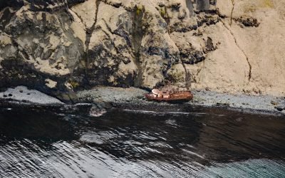
FV Lisa Jo, Akun Bay
FV Lisa Jo is a shipwreck at the entrance to Akun Bay on the western coast of Akun Island between Round Head to the south and Billings Head to the north, about 94 miles (151 km) southwest of False Pass and 13 miles (21 km) northeast of the village of Akutan, Alaska.
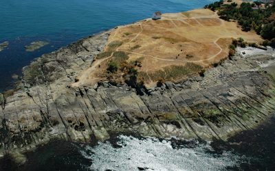
East Point, Saturna Island
East Point is the end of a long peninsula at the easternmost tip of Saturna Island in the Gulf Islands National Park Reserve, about 35 miles (56 km) south of Vancouver and 18 miles (29 km) northeast of Sidney, British Columbia.
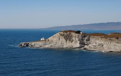
Point Conception, Gaviota Coast
Point Conception is located on the Gaviota Coast, at the western end of the Santa Barbara Channel, about 45 miles (72 km) west of Santa Barbara and 13 miles (21 km) south of Lompoc, California.
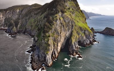
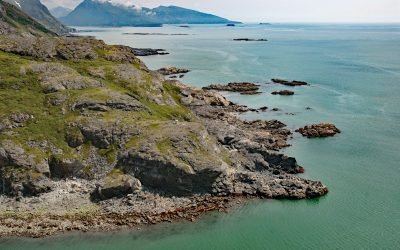
Helm Point, Coronation Island
Helm Point is a prominent headland at the southern tip of Coronation Island in the Alexander Archipelago of Southeast Alaska, between Chatham and Sumner Straits, about 94 miles (151 km) south-southeast of Sitka and 86 miles (138 km) southwest of Wrangell, Alaska.
SS Farallon, Black Reef
Black Reef is on the west shore of Cook Inlet about 0.5 miles (0.8 km) offshore between North Head and Knoll Head on a peninsula between Iliamna Bay and Iniskin Bay, and the site of the SS Farallon shipwreck, about 130 miles (209 km) northeast of King Salmon and 71 miles (114 km) west of Homer, Alaska.km) west of Homer, Alaska.
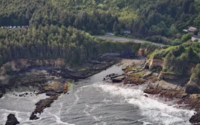
Boiler Bay Intertidal Research Reserve
Boiler Bay Intertidal Research Reserve is a rocky embayment 0.6 miles (1 km) wide between Government Point to the south and Rabbit Rock to the north, about 9 miles (14.5 km) south of Lincoln City and 1.6 miles (2.6 km) north of Depoe Bay, Oregon.
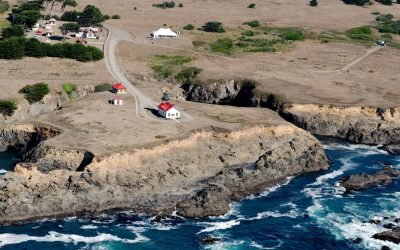
Point Cabrillo, Mendocino Coast
Point Cabrillo is a sandstone headland marked with a lighthouse on the Mendocino Coast between Point Arena and Cape Mendocino, about 6.7 miles (11 km) south of Fort Bragg and 1.3 miles (2 km) southwest of Caspar, California.
Ocean Bay, Sitkalidak Island
Ocean Bay is on the southeast shore of Sitkalidak Island in the Kodiak Archipelago, about 56 miles (90 km) southwest of Kodiak and 9 miles (15 km) southeast of the village of Old Harbor, Alaska.
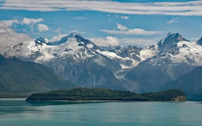
Cenotaph Island, Lituya Bay
Cenotaph Island is approximately in the middle of Lituya Bay, a fjord formed primarily by the Crillon and Lituya glaciers in Glacier Bay National Park and Preserve, about 117 miles (189 km) west-northwest of Juneau and 97 miles (156 km) southeast of Yakutat, Alaska.
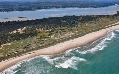
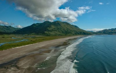
Camp Castaway, North Spit Coos Bay
Camp Castaway is a historical site on North Spit of Coos Bay, a sandy, vegetated peninsula separating the estuary of the Coos River from the Pacific Ocean, about 3.8 miles (6 km) west of North Bend and 1 mile (1.6 km) north of Charleston, Oregon.
About the background graphic
This ‘warming stripe’ graphic is a visual representation of the change in global temperature from 1850 (top) to 2019 (bottom). Each stripe represents the average global temperature for one year. The average temperature from 1971-2000 is set as the boundary between blue and red. The colour scale goes from -0.7°C to +0.7°C. The data are from the UK Met Office HadCRUT4.6 dataset.
Click here for more information about the #warmingstripes.