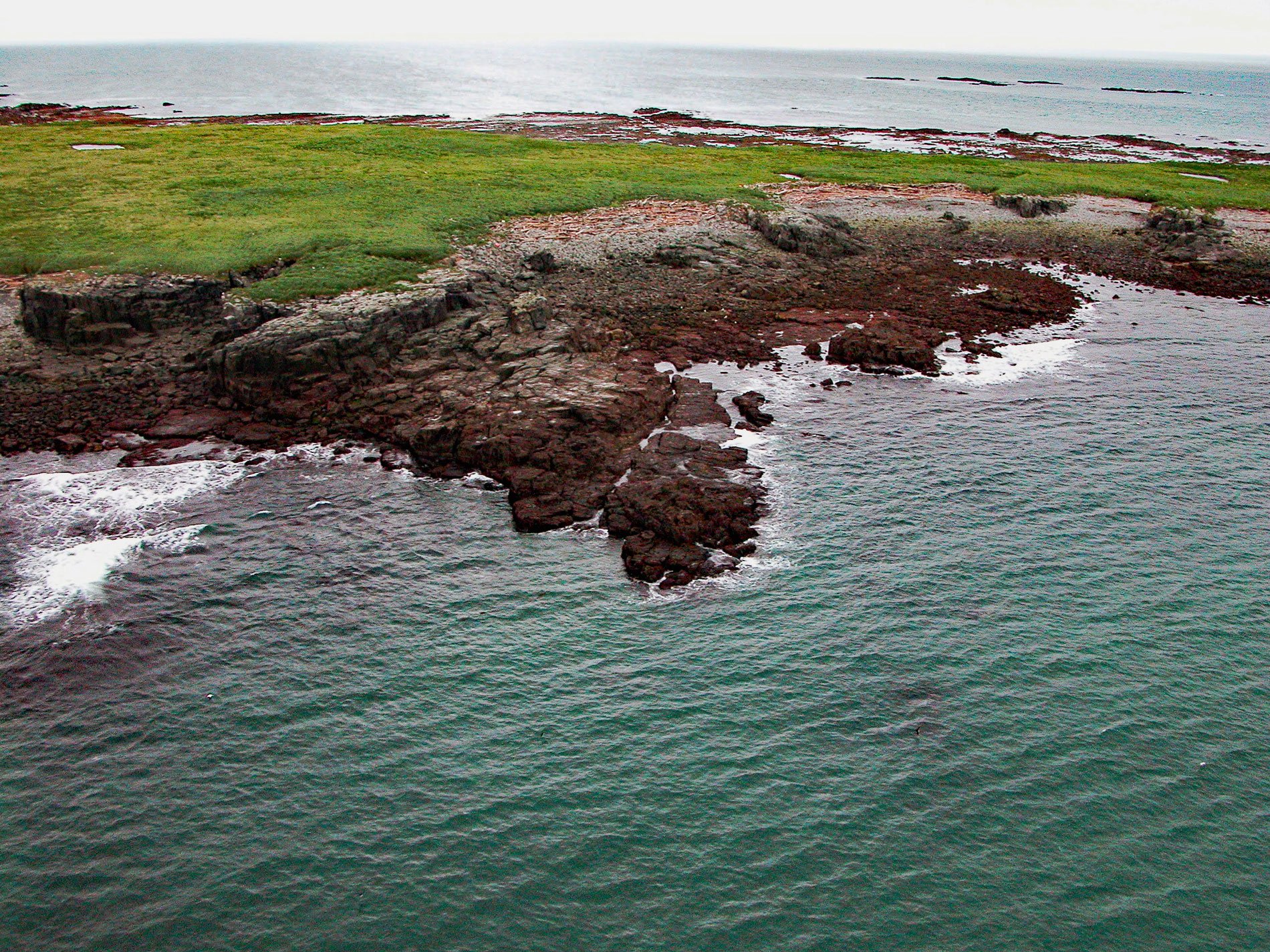
Shaw Island is located in Katmai National Park and Preserve, 2.5 miles (4 km) north of the Alaska Peninsula near the entrance to Kamishak Bay on the western shore of Cook Inlet, about 119 miles (192 km) east-northeast of King Salmon and 79 miles (127 km) southwest of Homer, Alaska. The island was named ‘Shaw’s Island’ in 1794 by Captain George Vancouver. The Alutiiq Sugpiat name ‘Shunakhtuli’ was published in 1847 on Russian Hydrographic charts. Shaw Island is flat and grass-covered and is surrounded by extensive rocky ledges that are exposed or awash at low tide. The bedrock is composed of quartz monzonite that formed during the Late Cretaceous and the ledges were formed by wave erosion.
Following the Alaska Purchase in 1867, the Alaska Commercial Company took over the fur trade from the Russian-American Company and continued organizing sea otter hunting parties by provisioning Aleut hunters and providing boats to transport them and their kayaks to lucrative hunting areas such as Kamishak Bay even though sea otters were regionally in rapid decline. The nearest trading station was at Douglas on Shelikof Strait. Each spring, hunters from several villages on both sides of the Alaska Peninsula migrated to the area to hunt for the Alaska Commercial Company. Many seasonal camps were established along the shore from Augustine Island in the north to Cape Douglas in the south and hunters were also known to occupy nearby islands, including Shaw Island. Schooners traveled around the Cook Inlet area to pick up furs and deliver them to the Douglas trading station. Poor hunting returns and epidemics led to the depopulation of the Katmai region, and the Douglas Station was closed in 1901.
The Exxon Valdez oil spill occurred in Prince William Sound on March 24, 1989, and 10.8 million US gallons (257,000 bbl or 37,000 tonnes) of crude oil flowed into the Gulf of Alaska and was then carried west by the Alaska Coastal Current to Cook Inlet and Shelikof Strait. Storms mixed the oil with water and transformed the crude oil into a water-in-oil emulsion called mousse with significantly greater volume. Rafts of this oil mousse were stranded sporadically along the Gulf of Alaska coastlines of the Kenai Peninsula, the Kodiak Archipelago, and the Alaska Peninsula. In the aftermath of the oil spill, Gulf of Alaska shorelines were surveyed for stranded oil, and cleanup was carried out in the most heavily oiled areas. In 1992, oil was found on Cape Douglas and Shaw Island but was rapidly degraded by subsequent winter storms. Read more here and here. Explore more of Shaw Island and Cook Inlet here:

