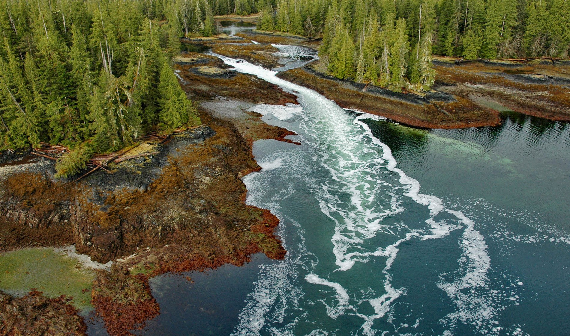
A skookumchuck is a tidal rapid that occurs at the mouth of an unnamed embayment that nearly bisects Brownson Island which is located on the west shore of Ernest Sound and separated from Etolin Island by Canoe Passage, about 47 miles (75 km) north-northwest of Ketchikan and 36 miles (58 km) south of Wrangell, Alaska. The narrow passages and large range of tides in Southeast Alaska create very strong currents and in some cases a ‘skookumchuck’ meaning strong water in the Chinook jargon. Canoe Passage was first described by Lieutenant Commander Albert S. Snow of the U.S. Navy in 1886. Brownson Island was named in 1891 by the U.S. Coast and Geodetic Survey for Lieutenant Commander Willard H. Brownson, a highly decorated U.S. Naval officer of the late 19th century. The island is formed by sedimentary rocks that developed during the Cretaceous and Jurassic and consist of marine greywacke and mudstone partially metamorphosed by two small igneous intrusions that formed plutons of granodiorite and tonalite during the Cretaceous.
This part of Southeast Alaska is the traditional territory or kwaan of the Shtax’héen Tlingit, formed by the unification of several smaller clans under the hereditary lineage of Chief Shakes. They controlled a large area that extended from Cape Fanshaw on Frederick Sound in the north to Union Bay on the Cleveland Peninsula in the south and included the mouth of the Stikine River, for which they are named, and extending well upriver providing access to interior trade with the Tahltan people. The lands of the Tahltan people extended over much of the interior Stikine Plateau, including the entirety of the inland Stikine basin, and adjoined Tlingit lands near the confluence of the Stikine and Iskut rivers. In summer, Tlingit would travel up the river to dry salmon and berries in the dry interior climate. During winter, the Tahltan had exclusive use of this section, which they utilized for hunting and trapping. The Stikine River was a critical component of the Shtax’héen Tlingit’s rise to power in the region and they monopolized trading between the Tahltan Athabascans and the Russian and Hudson’s Bay Company fur traders at Wrangell.
Ernest Sound has a tidal range of up to 23 feet (7 m), which forces large volumes of seawater through the many surrounding inlets and embayments. As the tide rushes out, water surges through these narrows with current speeds that can exceed 16 knots (30 kph) creating turbulent rapids and whirlpools. These areas of high currents often have dense concentrations of filter-feeding organisms like mussels and sea anemones. Mussels are well known for their ability to survive in hydrodynamically stressful environments. The blue mussel withstands these forces by tethering itself to the substrate with a byssal complex composed of 20 to 60 collagenous threads that radiate from a central stem. In cyclic tidal conditions with opposite directions of ebb and flood currents, the radial spread of fiber placement allows the mussel to dynamically align most of its fibers in the direction of applied force. Individual threads are secreted by a gland in the foot and individual threads are both strong and extensible, and have a mechanical toughness that exceeds that of mammal tendons and other collagenous fibers. Read more here and here. Explore more of this skookumchuck and Brownson Island here:

