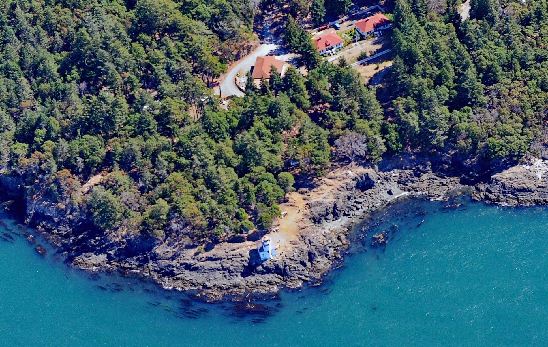
Lime Kiln Light was established in 1919 on Lime Kiln Point, a day-use park of 36 acres (15 ha) overlooking Deadman Bay to the south and Haro Strait to the west on the west coast of San Juan Island, about 12 miles (19 km) northeast of Victoria and 6.4 miles (10 km) west-southwest of Friday Harbor, Washington. The San Juan Islands were first visited by Europeans in 1794 when Spanish explorer Francisco de Eliza sailed here and named the archipelago Isla y Archipiélago de San Juan to honor his patron sponsor, Juan Vicente de Güemes Padilla Horcasitas y Aguayo, 2nd Count of Revillagigedo. Lime Kiln Point is named for the historic lime kilns that were used here for the calcination of limestone which was mined nearby to produce quicklime for use in building mortars. The limestone is a minor constituent of the mostly metavolcanic rocks that form the point including pillow basalt, breccia, tuff, and chert.
The San Juan Islands has an archaeological record of human habitation dating back at least 14,000 years. These prehistorical people became the Lummi, Saanich, and Songhees tribes, which together with the Sooke, Semiahmoo, and Samish tribes are now often called collectively the Northern Straits Coast Salish people. Coast Salish families undertook a seasonal rotation of activities on San Juan Island. In spring, women harvested and prepared camas bulbs, an important food that they cultivated, and worked to maintain crops of other meadow plants. Men hunted deer and repaired fishing nets and made hooks for fishing halibut, rockfish, and lingcod. In early summer, families moved to fish camps to take advantage of the salmon runs that occurred especially along the southwest coast of San Juan Island. Traditional family sites were used for reef-net fishing, and the large catches were then wind-dried or smoked for winter consumption. By late autumn, families returned to winter villages either on the islands or the mainland. The 18th and 19th centuries brought traders and explorers to the islands first from Russia, Spain, and England, and later from the United States.
In the 1860s, acetylene lights were placed on Lime Kiln Point. These lights were updated five years later with an octagonal concrete tower that still stands rising 38 feet (12 m) from the fog signal building and two light keeper’s houses. The lighthouse was built on solid rock, about 20 feet (6 m) above high water. The tower’s helical-bar lantern room, which was fabricated by Wisconsin Iron and Wire Works of Milwaukee, has a diameter of just over 7 feet (2.1 m) and is encircled by a concrete deck and gallery. A fourth-order Fresnel lens was added to the tower in 1919. The U.S. Coast Guard automated the light in 1962 and in 1998 the drum lens was replaced with a modern optic, flashing a white light every 10 seconds. Situated on the rocky shoreline at a height of 55 feet (17 m), the beacon is visible for 15 nautical miles (27 km) to guide ships through Haro Strait. Read more here and here. Explore more Lime Kiln Light here:

