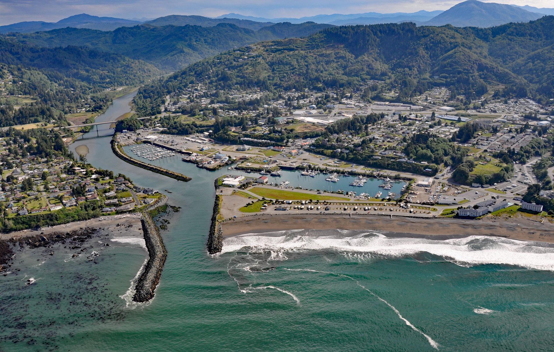
Brookings is a community at the mouth of the Chetco River, which flows from the Southern Oregon Coast Range to the Pacific Ocean, about 21 miles (34 km) north-northwest of Crescent City, California and 26 miles (42 km) south-southeast of Gold Beach, Oregon. It was named after John E. Brookings, president of the Brookings Lumber and Box Company, which founded and built the town in 1908. The Chetco River starts at an elevation of 3,588 feet (1,094 m) on the eastern flank of Chetco Peak and flows north around Vulcan Peak and then generally southwest for 56 miles (90 km), draining a watershed of 225,280 acres (91,168 ha). The mountainous terrain of the Chetco River watershed was created approximately 130 million years ago when the Klamath terrane collided with North American creating the Klamath Mountains. The collision also caused the subduction of sedimentary rocks and the subsequent formation of large plutons that rose to the surface and solidified as granite which is visible around Vulcan and Chetco Peaks. The eroded watershed now exposes some of the oldest rocks in Oregon including metasedimentary and sedimentary rocks, ophiolitic rocks, volcanic rocks, and intrusive plutonic rocks.
The archaeological record suggests that the earliest humans arrived in the Chetco River watershed about 3,000 to 1,000 years ago and are likely the ancestors of the historical Chetco people. The name Chetco comes from the Athabascan word meaning ‘close to the mouth of the Chetco River’. The Chetco were hunter-gatherers with a diet based on hunting deer and elk, gathering acorns and mussels, and fishing. An ancient aboriginal trail parallels the coast in Oregon that was probably a seasonal migration route used to access food. It was this trail that was followed in 1828 by a group of 18 Euro-American men and nearly 300 horses led by Jedediah Smith, after being ordered out of Mexican Alta California, in the hopes of reaching the Hudson’s Bay Company Fort Vancouver on the Columbia River. They crossed the river and camped near a Chetco village with 10 or 12 lodges, although all the residents had fled. Smith noted that these people caught elk in pits dug to 10-12 feet (3-4 m) deep. The pits were completely covered, and some of the group fell into the pits with their horses and had considerable difficulty getting out. There were at least nine separate villages along the river but between 1853 and 1855, many of the Chetco people were killed by settler militias and the military and their villages destroyed in skirmishes known as the nearby Rogue River Wars. The surviving members of the tribe were forcibly removed to the Siletz Reservation. In 1873, the U.S. Coast Survey made a hydrographic chart of the river mouth and recorded one village.
In 1906, the Brookings Lumber and Box Company hired William J. Ward, a graduate in civil engineering and forestry, to survey the southern Oregon Coast for its lumber potential. After timber cruising the Chetco and Pistol River areas for several years, he recommended that the Brookings company begin extensive lumbering operations and secure a townsite at the Chetco River for a mill and shipping center. In 1908, Brookings was founded as a company town for the Brookings Lumber & Box Company. John E. Brookings was president and chief executive officer, and his cousin, Robert S. Brookings provided major financial support. Robert Brookings lived in the east and devoted much of his time to semi-diplomatic missions and support of the arts and later founded the Brookings Institution. In 1942, World War II came to Brookings when Mount Emily became the first site in the continental United States to suffer aerial bombardment in wartime. Incendiary bombs were dropped by a Japanese seaplane launched from a submarine. The same submarine had previously shelled Fort Stevens near Astoria. The pilot of the seaplane was Nobuo Fujita who dropped two bombs, one on Wheeler Ridge on Mount Emily, and the location of the other bomb is unknown. The Wheeler Ridge bomb started a small fire that U.S. Forest Service rangers were able to extinguish. Fujita flew a second bombing sortie three weeks later using the Cape Blanco Light as a beacon. After 90 minutes of flying east from Cape Blanco, he dropped his bombs and reported seeing flames, but the bombing and fire were unnoticed. Read more here and here. Explore more of the Chetco River and Brookings here:

