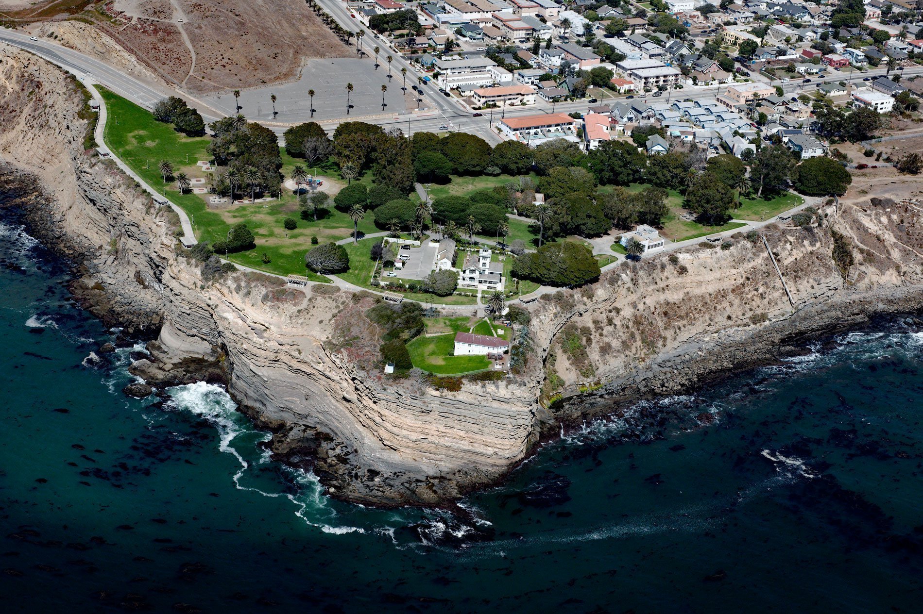
Point Fermin is the site of a historic lighthouse at the southernmost tip of the Palos Verdes Peninsula in the city of San Pedro, about 25 miles (40 km) southeast of Santa Monica and 7 miles (11 km) southwest of Long Beach, California. The point is named after Father Fermín de Lasuén who in 1792, met British explorer George Vancouver at the Carmel Mission near Monterey. When Vancouver sailed into San Pedro Bay the following year, he named Point Fermin and Point Lasuen in honor of the Franciscan Father. The point is formed by sea cliffs consisting of Point Fermin Sandstone that developed during the Miocene as a submarine fan in the Monterey Formation. The Monterey Formation is the major source-rock for oil and is considered to hold 84 percent of the known oil reserves in the San Joaquin Basin, a total of 12.2 billion barrels. Monterey Formation oil was discovered at the Orcutt Oil Field in the Santa Maria Basin of Santa Barbara County in 1901. This was followed by other Monterey discoveries nearby, including the Cat Canyon Oil Field and Lompoc Oil Field. Major Monterey production was also discovered in offshore oil fields, such as the South Ellwood Oil Field in the Santa Barbara Channel, and the Point Arguello Field in the Santa Maria Basin. Each of these early Monterey discoveries depended on natural fractures in the rock formation but increasingly steam injection and hydraulic fracturing methods are being used.
The Palos Verdes Peninsula is the traditional territory of the Tongva people and the site of a historical village called Chowigna that was inhabited for at least 7,100 years and first described by the Cabrillo Expedition in 1542. The Tongva were a semi-nomadic coastal hunter-gatherer tribe that, at the time, populated a territory covering almost 2,560,000 acres (1,035,995 ha) including the offshore islands of Santa Catalina and San Clemente, part of Orange County, and most of present-day Los Angeles County. These lands in turn provided resources for a population of nearly 5,000 people. The Tongva traveled among other tribes on foot and also by canoes, called ti’ats, which could hold 15 people and were crafted out of large wooden planks. The canoes allowed them to access sea resources such as fish, shellfish, and sea mammals and to offer these resources in trade with their inland neighbors. The peninsula was part of a Spanish land grant of 75,000 acres (30,351 ha) called Rancho San Pedro given to Juan José Domínguez in 1784. Following the Mexican War of Independence in 1821, a portion of the Rancho San Pedro land grant was contested, but in 1846, a Mexican land grant called Rancho de los Palos Verdes of 31,629 acres (12,800 ha) was given by Governor Pío Pico to José Loreto and Juan Capistrano Sepulveda. By 1882, the land had been partitioned into 17 parcels and ownership had passed from the Sepulveda family through various mortgage holders to Jotham Bixby of Rancho Los Cerritos, who leased the land to Japanese farmers. After the turn of the century most of Bixby’s land was sold to a consortium of New York investors headed by Frank A. Vanderlip who created the Palos Verdes Project and began marketing land on the peninsula for small horse ranches and residential communities.
The Point Fermin Lighthouse was designed by Paul J. Pelz and built in 1874 to mark the harbor at San Pedro. The harbor served the rapidly growing Los Angeles area that in 1869 was connected to the bay by the Los Angeles and San Pedro Railroad. The redwood and fir needed for the project were delivered by ship. The ornate Victorian lighthouse is similar in design to the original Port Hueneme Lighthouse and the Hereford Inlet Lighthouse in New Jersey that combined the light tower and residence in one structure. Between 1927 and 1941, the light was electrified and managed by the City of Los Angeles. Point Fermin Lighthouse remained active until December 9, 1941, two days after the attack on Pearl Harbor, when most lights on the west coast were extinguished to avoid aiding Japanese submarines. The lighthouse was saved from demolition in 1972 and refurbished in 1974, and a new lantern room and gallery were built by local preservationists. In 1972, the light was added to the National Register of Historic Places. In 2002, the lighthouse was restored, retrofitted, and rehabilitated for public access with funds from the City of Los Angeles, the Port of Los Angeles, and the State of California. The lighthouse was opened to the public on November 1, 2003, under the management of the Department of Recreation and Parks for the City of Los Angeles. Volunteers from the Point Fermin Lighthouse Society serve as tour guides and help to keep the lighthouse open to the public. Read more here and here. Explore more of Point Fermin and San Pedro here:

