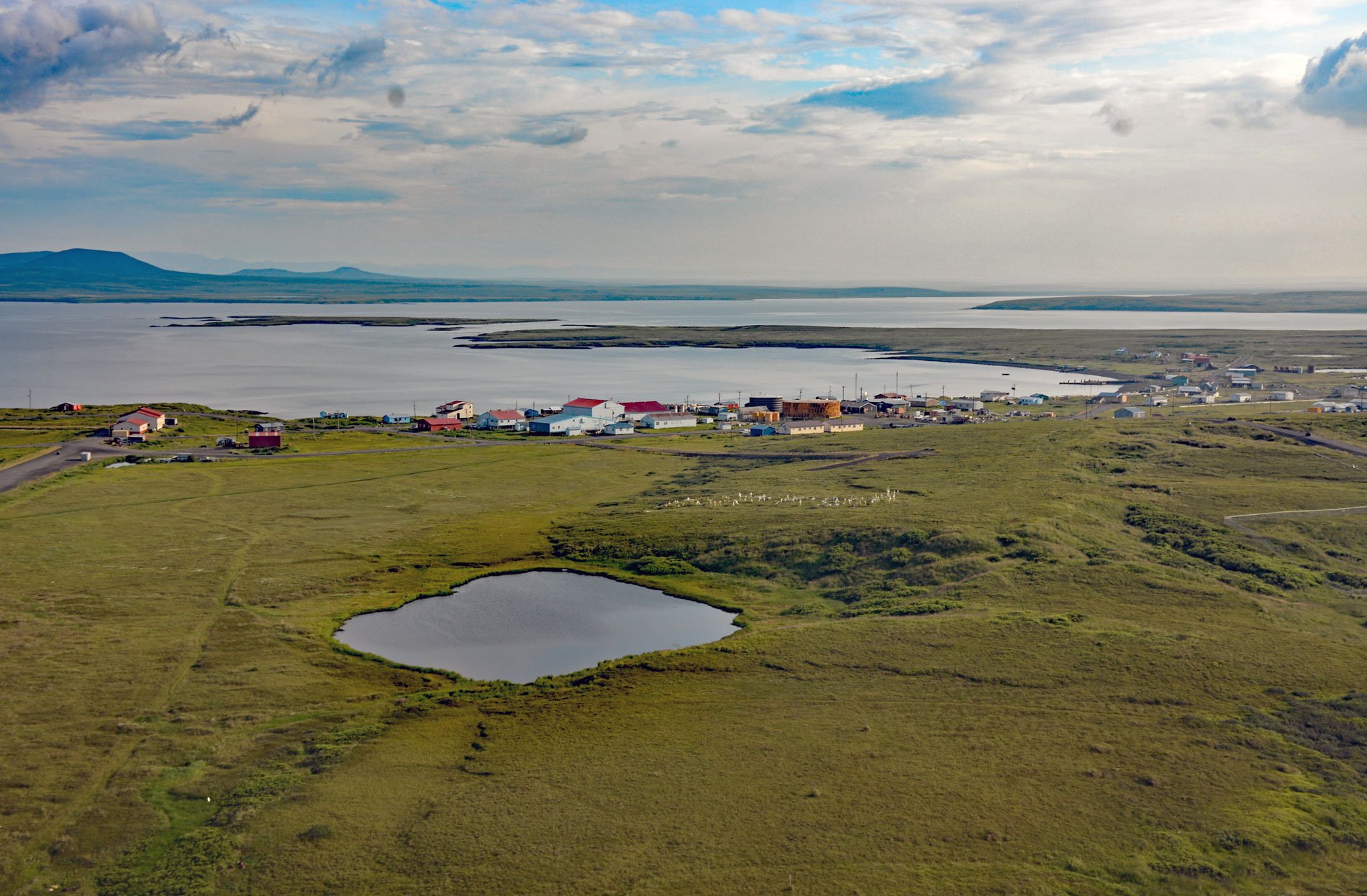
Saint Michael is a community situated on the eastern coast of Saint Michael Island, on Saint Michael Bay which is on the southern coast of Norton Sound, about 47 miles (76 km) southwest of Unalakleet and 8 miles (13 km) east-southeast of Stebbins, Alaska. The community was founded as a fortified trading post called Mikhailivoski, or Saint Michael Redoubt, in 1833 near the historical Yup’ik village of Tachik by the Russian-American Company on the orders of Ferdinand von Wrangel, who was then Governor of the Russian America colony. The post was used in the following decades as a logistics base that provided a deep-water harbor for exploration of southwestern Alaska and the Alaskan interior via the Yukon and other rivers. The deep-water harbor is formed by volcanic rocks of Jurassic age, sedimentary rocks of Cretaceous age, and basalt flows and cones of Quaternary age. The latter are known as the St. Michael volcanic field which includes an area contains 55 cones and craters, low broad shield volcanoes, and maars considered part of the Bering Sea Volcanic Province that likely erupted sometime within the last 3,000 years.
Redoubt St. Michael served as the major supply and fur depot for the vast region of the Yukon-Kuskokwim River delta under the Russian-American Company, and following the Alaska Purchase of 1867, under the Alaska Commercial Company. The trading post also led to adjustments in subsistence and settlement patterns among several Native groups. For example, the village of Stebbins was founded by a group of Yup’ik from Nelson Island who relocated to be closer to trading opportunities. But the traditional seasonal cycles of subsistence activity were disrupted to allow for trapping, fur processing, and transportation of hides to the trading post. The Alaska Commercial Company purchased the steamer Yukon in 1869 and began regular river service. In 1880, the first prospectors from San Francisco arrived at St. Michael aboard the SS Dora followed by many more. When news of the Klondike gold discoveries spread in 1897, hordes of people headed north and by some estimates there were over 10,000 fortune hunters at St. Michael waiting for transportation to the gold fields. The all-water route from Seattle or San Francisco along the Yukon River to the Klondike and Fortymile gold districts proved to be the easiest although the longest route to the interior. The island of St. Michael, 80 miles (130 km) from the entrance to the Yukon and Kuskokwim Rivers, was the closest deep-water port where travelers and supplies were transferred from ocean vessels to shallow draft sternwheelers. The increased activity because of the gold rush convinced the U.S. Government to establish a military post to maintain order, and in 1897, the U.S. War Department declared St. Michael Island and all the lands within 100 miles (160 km) a military reservation.
Fort St. Michael became the western terminus for the Washington-Alaska Military Cable and Telegraph System constructed by the U.S. Signal Corp beginning in 1900. The communication system linked military garrisons in Alaska with each other and Washington, D.C. The land cable stretched from Fort Egbert in the village of Eagle near the United States-Canada border to St. Michael, and an underwater cable crossed Norton Sound to connect Fort Davis near Nome. In 1903, both underwater and overland cables that connected St. Michael were replaced by radio communication. In 1913, the western headquarters of the system was transferred from St. Michael to Fort Gibbon and the radio operator at St. Michael was removed. Ten years later, the Alaska Railroad from Seward to Fairbanks was completed. Seasonal river steamboats along the Yukon could not compete with the year-round railroad service, and in 1925, the fort was closed. In 1930, the U.S. Customs House was closed, and ships gradually stopped using the harbor. Today, St. Michael is a predominantly a Yup’ik native village and only a few historical buildings from the gold rush remain, including a waterfront warehouse, the armory, jail, and parts of the railroad, as well as the remains of several steamboats along the shore of the bay. Read more here and here. Explore more of St. Michael and Norton Sound here:

