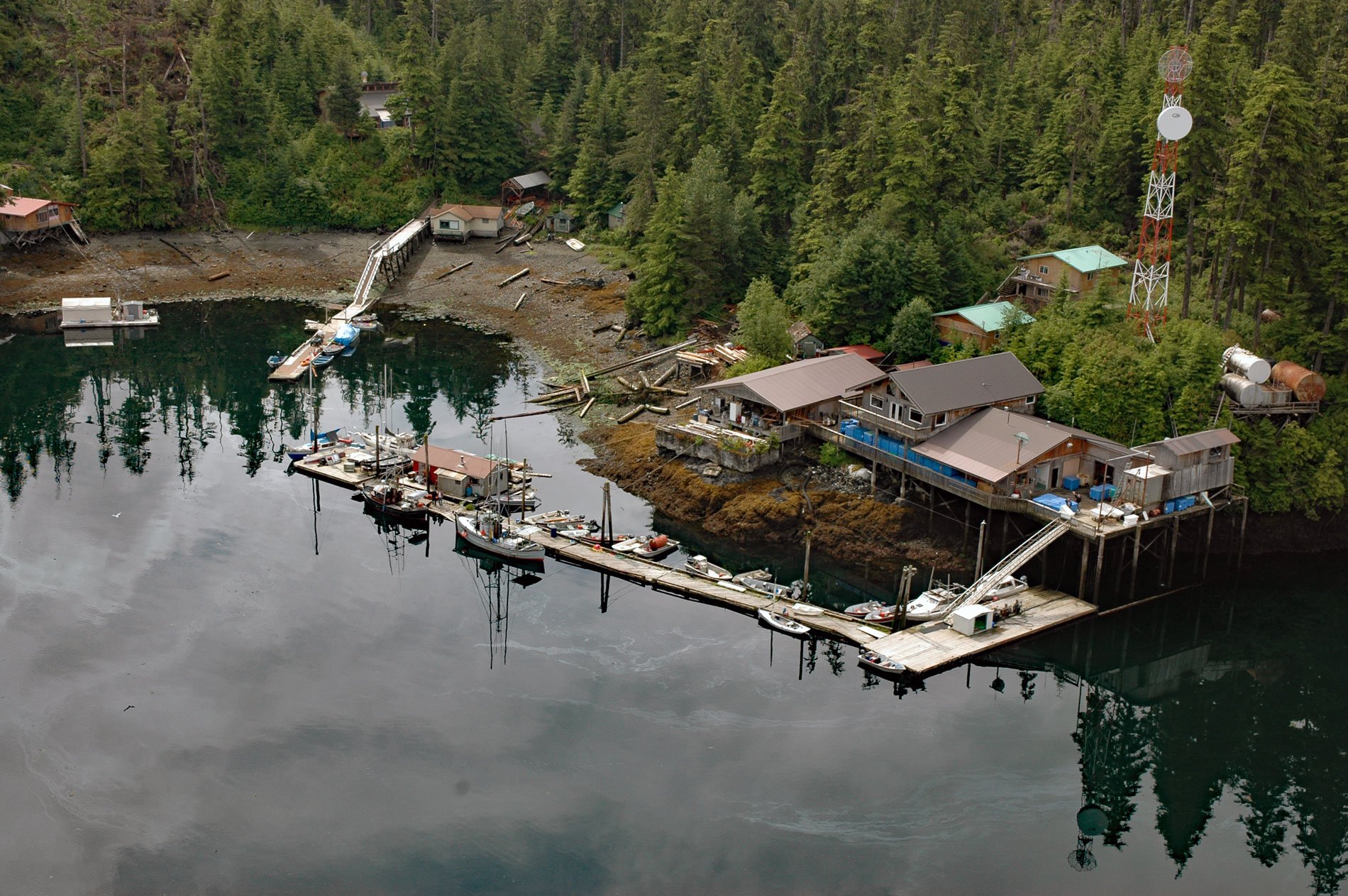
Port Protection is a community situated on Wooden Wheel Cove, at the northern tip of Prince of Wales Island in Tongass National Forest, about 140 miles (225 km) south-southwest of Juneau and 48 miles (77 km) west-northwest of Wrangell, Alaska. The community is named after an embayment called Port Protection that extends south for 4 miles (6.4 km) from Sumner Strait in the Alexander Archipelago of Southeast Alaska. The bay is formed by rocks of the Descon Formation, a part of the Alexander Terrane that consists of sandstone and turbidites that were metamorphosed into beds of greywacke, shale, chert, and limestone. Some of the limestone at Port Protection contains fossils from the Silurian, a geological period spanning from 443.8 to 419.2 million years ago. Tlingit people that historically inhabited the northern region of Prince of Wales Island were known as the Henya or Henyakwan and had exclusive use of the resources from all the islands between Prince of Wales Island, which they called Taan meaning ‘sea lion’, and the Pacific Ocean. In 1793, Captain George Vancouver gave the name ‘Prince of Wales Archipelago’ to all the islands of the southern Alexander Archipelago. The name is after George IV, Prince of Wales, who would later become King George IV. At the time of Vancouver’s visit, although not reported in his journals, a Tlingit fish camp was well established at the northern tip of Prince of Wales Island and used for trade and subsistence fishing.
In the early 1900s a fish buyer named ‘Wooden Wheel’ Johnson was attracted by the protected anchorage and moored a scow in the cove with a store and fuel dock. This enabled salmon trollers to stop when transiting between Juneau and Ketchikan via Keku Strait. In the 1930s, the U.S. Forest Service opened some of the area along the waterfront for homesites within the Tongass National Forest. In 1946, Laurel ‘Buckshot’ Woolery opened the B.S. Trading Post to replace Johnson’s scow. In 1950, residents petitioned for additional homesites along the shore of Port Protection. In 1955, the townsite of Point Baker, about 2.2 miles (3.5 km) north of Port Protection, was removed from the Tongass National Forest. In 1973, Woolery closed the trading post, and it was replaced by the Wooden Wheel Trading Post in 1983 that today operates a general store and fuel dock. State land sales have enabled the area to be permanently settled with a year-round population of about 36 residents. The community is accessible only by float planes and boats, and residents use small skiffs for local travel. There is a boardwalk that provides access to the water for the few homes which do not have a beach front. Port Protection and Point Baker share a common post office and have similar economies and lifestyles. Most residents fish salmon, halibut, shrimp, clams, and hunt deer for personal use.
The relatively shallow head of Port Protection is known locally as the ‘Back Bay‘. In the 1950s, this area helped to support a small commercial Dungeness crab fishery and cannery. The local stocks were depleted after about three years and the commercial operation ceased. The Back Bay crab stocks are harvested by most of the residents of Port Protection and some of the residents from Port Baker. In 1975, a large logging camp was established at Labouchere Bay, adjacent to and immediately south of Port Protection, by Tuxecan Logging Company and hundreds of miles of logging roads were built to extract the timber. Camp residents harvested Dungeness crab from Back Bay until the camp was closed in the late 1990s. Generally, crabs are caught with pots that are individually owned, but residents of the area who do not own pots share the catch by pulling the pots whenever they visit the bay. Most of the individuals who fish the pots distribute any excess crab to neighbors and friends, and historically there were annual crab feeds held in the communities. Back Bay is also an important area for collecting clams and cockles, as well as waterfowl hunting, particularly ducks and geese. Read more here and here. Explore more of Port Protection and Wooden Wheel Cove here:

