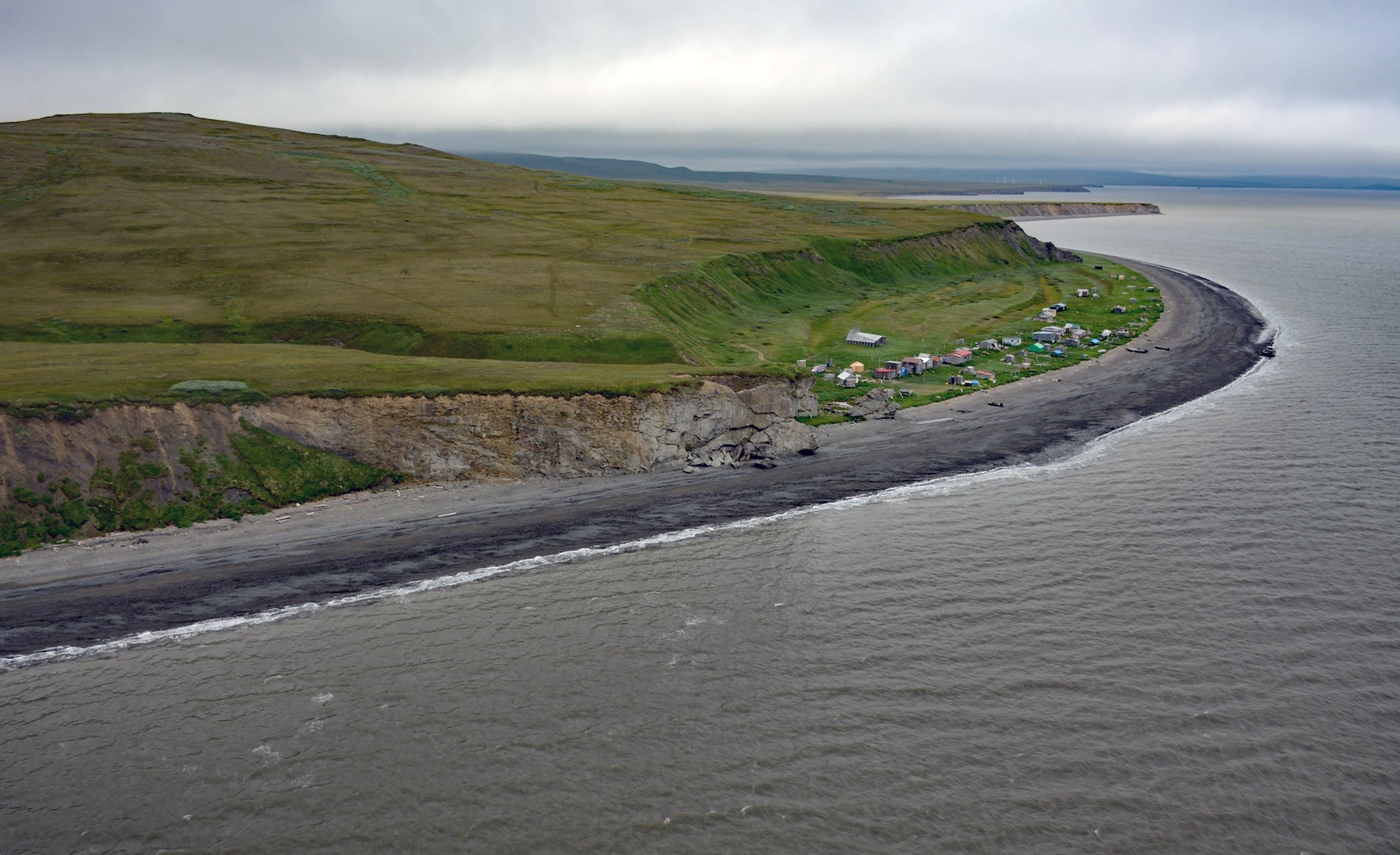
Umkumiut is a seasonally occupied Yup’ik fish camp in Kangirlvar Bay, also known as Toksook Bay, located on the western shore of Nelson Island in the Bering Sea, between Atrnak Point to the north and Chinigyak Cape to the south, about 118 miles (190 km) west-southwest of Bethel and 3.8 miles (6 km) southwest of Toksook Bay, Alaska. Nelson Island was named after Edward W. Nelson, who in 1877 joined the U.S. Army Signal Corps and was stationed at Saint Michael but also explored much of the Bering Sea making detailed studies of the flora and fauna as the naturalist on board U.S. Revenue Cutter Thomas Corwin. The western shores of Nelson Island face the Bering Sea and are characterized by high, rugged cliffs of volcanic and sedimentary rocks. Pack ice normally begins to form in this part of the Bering Sea in mid-November and break-up generally occurs in early May. Snowfall is not heavy, but strong winds cause drifting in protected sites, and exposed areas are often swept nearly free of snow. There are four communities on Nelson Island at Tununak, Toksook Bay, Nightmute, and Mertarvik which is a new development built for the village of Newtok that is relocating due to riverbank erosion. None of these communities are linked by road, and air and water transportation are the primary means of access.
For most Yup’ik households on Nelson Island, the Bering Sea remains the primary source of food. Most of their protein comes from herring, salmon, and seals. Occasionally Steller sea lions, walrus, and beluga are hunted. The fish camp at Umkumiut is used mostly by residents of Nightmute and Toksook Bay. Families move to the fish camp prior to ice breakup for spring seal hunting and stay until August for herring and salmon fishing and drying, although a few hunters used the camp throughout the year. The people also utilize inland resources such as waterfowl, freshwater fish, and edible plants from the varied habitats of the island and the vast wetlands of the adjacent Yukon-Kuskokwim Delta. Imported canned goods, flour, sugar, and even some fresh vegetables and frozen foods are gradually supplanting the traditional diet. As this process continues, dependence upon local plants declines, accompanying an inevitable loss of information about their uses as food sources. Knowledge of traditional herbal remedies is also declining as modern medicines spread. A series of beach ridges at Umkumiut provide high ground for an assortment of dwellings. The last traditional semi- subterranean family dwelling was abandoned in the mid 1960s, and today there are tents and yurts, but most buildings are of frame construction, usually with plywood exteriors.
Umkumiut has recently emerged as an important center of Yup’ik cultural activity. Each summer, the village hosts a culture camp sponsored by the Calista Elders Council for youths from surrounding villages to teach them about Yup’ik ways of thought and life. The camps provide an opportunity for students to learn subsistence hunting, fishing, cultural skills, history, and values as well respect for wildlife and habitat and how to protect these resources. The culture camp emphasizes that a traditional subsistence lifestyle involves more than food and nutrition. It is integral to the Yup’ik culture, society, and economy and is manifested both materially and spiritually. The future of a subsistence lifestyle for Alaska Native peoples in general will require continual access to the resources present in vast areas of ocean and tracts of undeveloped lands. Training the youth of today in traditional Yup’ik ways will help to ensure access and retention of these essential cultural links to the ocean and land and encourage participation in the planning and decision-making processes used by state and federal agencies. Read more here and here. Explore more of Umkumiut and Nelson Island here:

