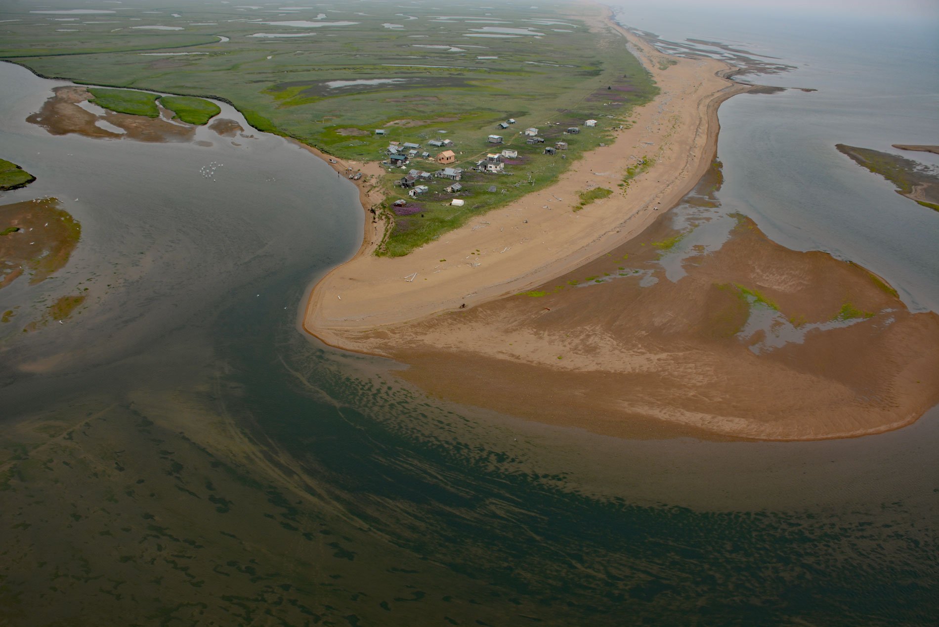
Moses Point is a fish camp, used mostly by residents of Elim, situated at the mouth of the Kwiniuk River on the northern shore of Norton Bay, about 100 miles (160 km) east of Nome and 31 miles (50 km) southwest of Koyuk, Alaska. The name Moses Point also refers to a sand spit that forms the southern shore of Kwiniuk Inlet located about 9 miles (15 km) east of the fish camp. The fish camp is on the Iditarod Trail which brought thousands of people north following the discovery of gold around Nome beginning in 1898. The fish camp became a waypoint on the route and was named after a Unalit Yup’ik man who had been given the name of Moses by gold seekers. Kwiniuk River starts at an elevation of 1,370 feet (418 m) in the Kwiktalik Mountains and flows generally northeast for 30 miles (48 km) draining a watershed of 86,488 acres (35,000 ha) in the southern Darby Mountains and then turns southeast and continues for another 10 miles (16 km) to Devils Slough. The tidal slough is an abandoned meander channel of the river that connects to Norton Sound at the fish camp. The active channel of the Kwiniuk River and its terraces, overbank areas, and flood plains are covered with stratified deposits of sorted gravel, sand, and silt. Lowland areas east and west of the Kwiniuk River and north of the fish camp contain thick deposits of silt and peat with permafrost and ice wedges concentrated in marshy topographic depressions. The coastal beaches, spits, and bars represent unconsolidated deposits of Quaternary age consisting of sand and gravel.
The eastern area of Norton Sound represents a cultural juncture of Iñupiat, Yup’ik, and Athabascan peoples. Archaeological sites at Cape Denbigh and Shaktoolik indicate that between 1100 and 1400 AD, the area was inhabited by the prehistoric Nukleet people. Between 1400 and 1800 AD, the region was occupied by late prehistoric and early historical Yupiit. In 1778, Captain James Cook was the first European to explore the area and communicated with Unalit Yup’ik people. In 1838, the Russian-American Company established a trading post at present-day Saint Michael. With the construction of the post and the advent of commercial whaling in the Bering Strait in 1848, Norton Sound became a hub for trade among the Inupiat, Yupiit, Athabascans, Russians, and Euro-Americans. A smallpox epidemic subsequently swept through the region and decimated the local Yup’ik population between 1838 and 1844. The few remaining survivors moved south and Malemiut Inupiat people moved in from the north, presumably taking advantage of new hunting, fishing, and trading opportunities, and their descendants inhabit the area to this day. In 1884, Johan A. Jacobsen documented a village at the mouth of the Kwiniuk River that he transcribed as ‘Kjuwagonak’. The village of Elim was founded during the Nome Gold Rush in the early 1900s, and since then, the Moses Point area has been a traditional subsistence fish camp, mainly for the five species of Pacific salmon and Pacific herring.
Between 1940 and 1941, the U.S. Department of the Interior, Office of Indian Affairs, authorized the Civil Aeronautics Administration to build an airfield and radio station at Moses Point, as one of the many emergency landing strips constructed to support the lend-lease operation with Russia. The airstrip was taken over by the U.S. Army in 1942, and a garrison was constructed that encompassed the airstrip and over 1500 acres (607 ha) of land that included Quonset huts, frame buildings, a small hospital, and an access road. After the war, the Army reportedly demolished and buried some of the garrison buildings in place and returned the airfield to civilian control. The Civil Aeronautics Administration, which became the Federal Aviation Administration in 1958, maintained the landing strip, instrumentation, and buildings until the mid-1980s when the land was transferred to Elim Native Corporation. In 1999, a new airport was built at Elim and the Moses Point facility was reduced to a radio station located on the barrier beach at the mouth of the Kwiniuk River. These activities resulted in hazardous waste along the access road, garrison buildings, and Kwiniuk River including six sites where drums were buried and contaminated soil was identified. Since 2006, these have been removed and the site remediated under the Formerly Used Defense Sites program funded by U.S. Department of Defense. Read more here and here. Explore more of Moses Point and Kwiniuk River here:

